Country:
Region:
City:
Latitude and Longitude:
Time Zone:
Postal Code:
IP information under different IP Channel
ip-api
Country
Region
City
ASN
Time Zone
ISP
Blacklist
Proxy
Latitude
Longitude
Postal
Route
Luminati
Country
ASN
Time Zone
America/Lima
ISP
CONVERGIA
Latitude
Longitude
Postal
IPinfo
Country
Region
City
ASN
Time Zone
ISP
Blacklist
Proxy
Latitude
Longitude
Postal
Route
db-ip
Country
Region
City
ASN
Time Zone
ISP
Blacklist
Proxy
Latitude
Longitude
Postal
Route
ipdata
Country
Region
City
ASN
Time Zone
ISP
Blacklist
Proxy
Latitude
Longitude
Postal
Route
Popular places and events near this IP address
Villa El Salvador
District in Lima, Peru
Distance: Approx. 2803 meters
Latitude and longitude: -12.05,-77
Villa El Salvador is an urban, largely residential coastal district on the outskirts of Lima, Peru. It borders the district of Chorrillos on the east; the Pacific Ocean on the southwest; Lurín on the southeast; Villa María del Triunfo on the east and San Juan de Miraflores on the north.
Colegio Franklin Delano Roosevelt, The American School of Lima
School in Lima, Peru
Distance: Approx. 3844 meters
Latitude and longitude: -12.078,-76.972
Colegio Franklin Delano Roosevelt is a K–12 school in Lima, Peru, founded by a group of American families in the mid-1940s, with the intent of providing an American Education. While its first campus was in the San Isidro District, it eventually moved to the current location in Camacho, La Molina. There are approximately 1,590 students.

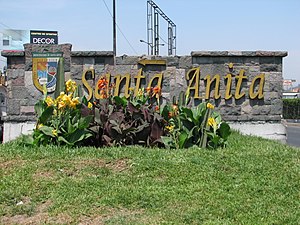
Santa Anita District
District in Lima, Peru
Distance: Approx. 1826 meters
Latitude and longitude: -12.04305556,-76.95833333
Santa Anita is a district of the Lima Province in Peru. It is part of city of Lima. Officially established as a district on October 25, 1989, from parts of Ate and El Agustino separated by the Rio Surco, a ditch which went all the way to Santiago de Surco.

Cementerio Presbítero Matías Maestro
Cemetery in Lima, Peru
Distance: Approx. 3593 meters
Latitude and longitude: -12.041,-77.008
Presbyter Matías Maestro Cemetery (Spanish: Cementerio Presbítero Matías Maestro), formerly the General Cemetery of Lima (Spanish: Cementerio General de Lima), is a cemetery, museum and historical monument located in the Barrios Altos neighbourhood of Lima District, in Lima, Peru. Inaugurated on May 31, 1808, it was the first pantheon in the city since burials were previously held in the city's churches. It was named in honour of its designer, Spanish priest Matías Maestro.
University of San Martín de Porres
Private nonprofit university in Lima, Peru
Distance: Approx. 590 meters
Latitude and longitude: -12.0454,-76.97
The University of San Martin de Porres (USMP) is a private nonprofit university located in the city of Lima, Peru. It was founded by the Dominican Order of the Catholic Church in 1962.
Women's University of the Sacred Heart
University in Lima, Peru
Distance: Approx. 3288 meters
Latitude and longitude: -12.0717,-76.9658
The Women's University of the Sacred Heart (UNIFÉ) is a private university for women, located in the city of Lima, Peru. It was founded and sponsored by the Congregation of Sisters of the Sacred Heart of Jesus of the Catholic Church on December 24, 1962. Its headquarters are in the district of La Molina.

El Ángel metro station
Lima metro station
Distance: Approx. 3779 meters
Latitude and longitude: -12.04605556,-77.00972222
El Ángel is a Lima and Callao Metro station on Line 1. The station is located between Miguel Grau and Presbítero Maestro. It was opened on 3 January 2012 as part of the extension of the line from Miguel Grau to Bayóvar.

Presbítero Maestro metro station
Lima metro station
Distance: Approx. 3983 meters
Latitude and longitude: -12.04172222,-77.01163889
Presbítero Maestro is a Lima and Callao Metro station on Line 1. The station is located between El Ángel and Caja de Agua. It was opened on 3 January 2012 as part of the extension of the line from Miguel Grau to Bayóvar.

El Ángel Cemetery
Cemetery in Lima, Peru
Distance: Approx. 3353 meters
Latitude and longitude: -12.04555556,-77.00583333
El Ángel Cemetery is a cemetery located on the 17th block of Jirón Áncash, in Barrios Altos, between the districts of Lima and El Agustino, in the city of Lima, Peru. It was inaugurated by President Manuel Prado Ugarteche on June 27, 1959, due to the need of the city of Lima to have a new funerary space, since the capacity of the Presbítero Matías Maestro Cemetery had reached its maximum in 1955. It is owned and managed by the Charity of Lima.

Church of the Holy Christ of Wonders
Church in Lima, Peru
Distance: Approx. 4042 meters
Latitude and longitude: -12.045,-77.0122
The Church of the Holy Christ of Wonders (Spanish: Iglesia del Santo Cristo de las Maravillas) is a Catholic church located at the junction of Jirón Áncash and Sebastián Lorente Avenue. Located in the neighbourhood of Barrios Altos. It is part of the historic centre of Lima, Peru.

La Atarjea Water Treatment Plant
Water treatment plant in Lima, Peru
Distance: Approx. 558 meters
Latitude and longitude: -12.0387,-76.9762
La Atarjea is a water treatment plant located in El Agustino, a district of Lima, Peru. Originally a spring, it serves the headquarters of SEDAPAL, the city's water treatment company that also services Callao.

Colegio Sagrados Corazones Recoleta
School in Lima, Peru
Distance: Approx. 3818 meters
Latitude and longitude: -12.075,-76.961
The Colegio de los Sagrados Corazones Recoleta is a private Catholic school in La Molina District, Lima, Peru. Founded in 1893 by a French mission of the Congregation of the Sacred Hearts of Jesus and Mary as a all-boys school in central Lima, it is currently a mixed-sex school.
Weather in this IP's area
scattered clouds
21 Celsius
20 Celsius
21 Celsius
21 Celsius
1013 hPa
64 %
1013 hPa
984 hPa
10000 meters
6.17 m/s
180 degree
40 %
05:32:40
18:12:23