Country:
Region:
City:
Latitude and Longitude:
Time Zone:
Postal Code:
IP information under different IP Channel
ip-api
Country
Region
City
ASN
Time Zone
ISP
Blacklist
Proxy
Latitude
Longitude
Postal
Route
Luminati
Country
Region
e
City
sanjose
ASN
Time Zone
America/Argentina/Cordoba
ISP
Internet Services S.A.
Latitude
Longitude
Postal
IPinfo
Country
Region
City
ASN
Time Zone
ISP
Blacklist
Proxy
Latitude
Longitude
Postal
Route
db-ip
Country
Region
City
ASN
Time Zone
ISP
Blacklist
Proxy
Latitude
Longitude
Postal
Route
ipdata
Country
Region
City
ASN
Time Zone
ISP
Blacklist
Proxy
Latitude
Longitude
Postal
Route
Popular places and events near this IP address

Colón, Entre Ríos
City in Entre Ríos, Argentina
Distance: Approx. 8210 meters
Latitude and longitude: -32.21666667,-58.13333333
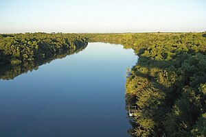
Colón is a city in the province of Entre Ríos, Argentina. It is located in the east of the province, on the western shore of the Uruguay River, and has about 23,000 inhabitants (2010 census [INDEC]). It lies opposite Paysandú, Uruguay, to which it is linked across the river by the General Artigas Bridge.
San José, Entre Ríos
City in Entre Ríos, Argentina
Distance: Approx. 446 meters
Latitude and longitude: -32.2,-58.21666667
San José (also called Villa San José) is a city in the center-east of the province of Entre Ríos, Argentina, located some 10 km northwest from Colón, near the Uruguay River. It has about 16,000 inhabitants as per the 2010 census [INDEC].

Colón Department, Entre Ríos
Department in Entre Ríos, Argentina
Distance: Approx. 7519 meters
Latitude and longitude: -32.22416667,-58.14444444
The Colón Department (in Spanish, Departamento Colón) is an administrative subdivision (departamento) of the province of Entre Ríos, Argentina. It is located in the center-east of the province, beside the Uruguay River. The department has 52,718 inhabitants as per the 2001 census [INDEC].
Queguay Grande River
River in Uruguay
Distance: Approx. 9509 meters
Latitude and longitude: -32.13916667,-58.14166667
The Queguay Grande River is a river of Uruguay.

Pueblo Liebig
Municipality and village in Entre Ríos, Argentina
Distance: Approx. 5367 meters
Latitude and longitude: -32.15305556,-58.19111111
Pueblo Liebig is a village and municipality in Entre Ríos Province in north-eastern Argentina. This small town seduces tourists with its quiet pace, its recreational activities and a rich history.
Weather in this IP's area
clear sky
20 Celsius
19 Celsius
20 Celsius
20 Celsius
1013 hPa
66 %
1013 hPa
1011 hPa
10000 meters
4.93 m/s
13.14 m/s
48 degree
05:48:08
19:25:26
