200.112.214.158 - IP Lookup: Free IP Address Lookup, Postal Code Lookup, IP Location Lookup, IP ASN, Public IP
Country:
 Colombia
Region:
City:
Location:
Time Zone:
Postal Code:
ISP:
ASN:
language:
User-Agent:
Proxy IP:
Blacklist:
IP information under different IP Channel
ip-api
Country
Region
City
ASN
Time Zone
ISP
Blacklist
Proxy
Latitude
Longitude
Postal
Route
db-ip
Country
Region
City
ASN
Time Zone
ISP
Blacklist
Proxy
Latitude
Longitude
Postal
Route
IPinfo
Country
Region
City
ASN
Time Zone
ISP
Blacklist
Proxy
Latitude
Longitude
Postal
Route
IP2Location
200.112.214.158Country
coRegion
atlantico
City
soledad
Time Zone
America/Bogota
ISP
Language
User-Agent
Latitude
Longitude
Postal
ipdata
Country
Region
City
ASN
Time Zone
ISP
Blacklist
Proxy
Latitude
Longitude
Postal
Route
Popular places and events near this IP address

Ernesto Cortissoz International Airport
Airport serving Barranquilla, Colombia
Distance: Approx. 3665 meters
Latitude and longitude: 10.88944444,-74.78055556
Ernesto Cortissoz International Airport (Spanish: Aeropuerto Internacional Ernesto Cortissoz) (IATA: BAQ, ICAO: SKBQ) is an international airport serving the area of Barranquilla, the capital city of the Atlántico department in Colombia. The airport is located in the suburban municipality of Soledad. It owes its name to one of the pioneers of Colombian aviation, Ernesto Cortissoz.

Atlántico Department
Department of Colombia
Distance: Approx. 7513 meters
Latitude and longitude: 10.98333333,-74.78333333
Atlántico (Spanish pronunciation: [aðˈlantiko], English: Atlantic) is a department of Colombia, located in northern Colombia with the Caribbean Sea to its north, the Bolívar Department to its west and south separated by the Canal del Dique, and the Magdalena Department to its east separated by the Magdalena River. Despite being the third smallest in the country, the department is among the most densely populated, with a population of 2,535,517. The department's capital and most-populous city is Barranquilla with a population of 1,327,209.

Barranquilla Carnival
Colombian folklore festival
Distance: Approx. 6141 meters
Latitude and longitude: 10.96388889,-74.79638889
The Barranquilla Carnival (Spanish: Carnaval de Barranquilla) is one of Colombia's most important folkloric celebrations, and one of the biggest carnivals in the world. The carnival has traditions that date back to the 19th century. Four days before Lent, Barranquilla decks itself out to receive national and foreign tourists to join together with the city's inhabitants to enjoy four days of intense festivities.

Estadio Metropolitano Roberto Meléndez
Football stadium in Barranquilla, Colombia
Distance: Approx. 4059 meters
Latitude and longitude: 10.92686111,-74.80072222
Estadio Metropolitano Roberto Meléndez, commonly known as Estadio Metropolitano, or colloquially, El Metro, is a multi-use all-seater football stadium in Barranquilla, Colombia. It is the home stadium of local football team Atlético Junior. It was built with a capacity of 46,788 for the Colombian World Cup bid in 1986.

Galapa, Colombia
Municipality and town in Caribbean, Colombia
Distance: Approx. 7515 meters
Latitude and longitude: 10.91666667,-74.83333333
Galapa is a municipality and town in the Colombian department of Atlántico. It forms the southwestern part of the Metropolitan area of Barranquilla.

Malambo, Atlántico
Municipality and city in Caribbean, Colombia
Distance: Approx. 7780 meters
Latitude and longitude: 10.85,-74.75
Malambo is a municipality and city in the Colombian department of Atlántico. Malambo forms the southernmost part of the Metropolitan area of Barranquilla.
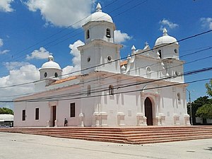
Soledad, Atlántico
Place in Caribbean, Colombia
Distance: Approx. 1607 meters
Latitude and longitude: 10.91666667,-74.75
Soledad (Spanish pronunciation: [soleˈðað]) is a municipality in the Colombian department of Atlántico, part of the Metropolitan area of Barranquilla. It is 6th in population in Colombia and 3rd in the Caribbean region, after Barranquilla and Cartagena. It is also the city with the highest population growth in Colombia and in 2005 was 455,734 and 2019 683,486.

Pumarejo bridge
Bridge in Barranquilla and Salamanca Island Road Park, Colombia
Distance: Approx. 3668 meters
Latitude and longitude: 10.9503,-74.7562
The Pumarejo bridge (Spanish: Puente Pumarejo) is a bridge over the Río Magdalena in Barranquilla and the Salamanca Island Road Park in Sitionuevo, Colombia, which has connected the city with the east of the country since December 20th 2019. It replaces the old Puente Pumarejo, which fulfilled this task between 1974 and 2019, but for which a bridge with a clearance below of only 16 meters (52 ft) was chosen for cost reasons, which soon criticized as an obstacle for shipping on the Río Magdalena has been. The two lanes no longer did justice to the increased traffic.

Metropolitan area of Barranquilla
Metropolitan area in Atlántico, Colombia
Distance: Approx. 6141 meters
Latitude and longitude: 10.96388889,-74.79638889
The Barranquilla metropolitan area (Spanish: Área metropolitana de Barranquilla) is a metropolitan area in Atlántico, Colombia, centered on the city of Barranquilla. The city of Barranquilla serves as a major trade center for Colombia, housing the largest port in the country. With an estimated population of 1.2 million, every major company in the country keeps at least one major depot or distribution center in the urban areas, and most international brands utilize the port while having their logistic operating bases in the region.

St. Joseph College, Barranquilla
Private primary and secondary school in Carerra & Calle , Barranquilla, Atlántico, Colombia
Distance: Approx. 5537 meters
Latitude and longitude: 10.96111111,-74.79055556
Colegio San Jose, Barranquilla, (Spanish: Colegio San Jose), is a private Catholic primary and secondary school, located in the San Jose section of Barranquilla, Atlántico, Colombia. The co-educational school was founded by the Society of Jesus in 1918 and currently covers kindergarten through baccalaureate.
Estadio Moderno Julio Torres
Distance: Approx. 5403 meters
Latitude and longitude: 10.9634168,-74.7830892
Estadio Moderno Julio Torres is a multi-use stadium in Barranquilla, Colombia. The stadium was given national monument status in July 2006. The stadium was named as the host for the Women's football tournament at the 2018 Central American and Caribbean Games.

Laureano Gómez bridge
Bridge in Barranquilla, Colombia
Distance: Approx. 3845 meters
Latitude and longitude: 10.95083333,-74.7525
The Laureano Gómez bridge (Spanish: Puente Laureano Gómez), popularly known as Pumarejo bridge (Spanish: Puente Pumarejo) after its promoter Alberto Pumarejo, is a bridge in Colombia, built over the Magdalena River to connect the Salamanca Island Road Park and the city of Barranquilla. The bridge was designed by Riccardo Morandi and built by an Italian-Colombian group between 1970 and 1974. The entire bridge is based on piles that go down to 30 meters (98 ft) below the water level and is 1,500 meters (4,900 ft) long and 12.5 meters (41 ft) wide, with a main span of 140 meters (460 ft), and is built of concrete.
Weather in this IP's area
few clouds
26 Celsius
26 Celsius
26 Celsius
26 Celsius
1008 hPa
73 %
1008 hPa
1004 hPa
10000 meters
4.63 m/s
30 degree
20 %