200.108.62.29 - IP Lookup: Free IP Address Lookup, Postal Code Lookup, IP Location Lookup, IP ASN, Public IP
Country:
 Panama
Region:
City:
Location:
Time Zone:
Postal Code:
ISP:
ASN:
language:
User-Agent:
Proxy IP:
Blacklist:
IP information under different IP Channel
ip-api
Country
Region
City
ASN
Time Zone
ISP
Blacklist
Proxy
Latitude
Longitude
Postal
Route
db-ip
Country
Region
City
ASN
Time Zone
ISP
Blacklist
Proxy
Latitude
Longitude
Postal
Route
IPinfo
Country
Region
City
ASN
Time Zone
ISP
Blacklist
Proxy
Latitude
Longitude
Postal
Route
IP2Location
200.108.62.29Country
paRegion
chiriqui
City
puerto armuelles
Time Zone
America/Panama
ISP
Language
User-Agent
Latitude
Longitude
Postal
ipdata
Country
Region
City
ASN
Time Zone
ISP
Blacklist
Proxy
Latitude
Longitude
Postal
Route
Popular places and events near this IP address

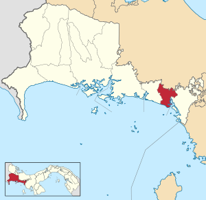
Barú District, Chiriquí
District in Chiriquí Province, Panama
Distance: Approx. 5 meters
Latitude and longitude: 8.28333333,-82.86666667
Barú District is a district (distrito) of Chiriquí Province in Panama. The population according to the 2000 census was 60,551. The district covers a total area of 589 km².

Puerto Armuelles
City and corregimiento in Chiriquí, Panama
Distance: Approx. 5 meters
Latitude and longitude: 8.28333333,-82.86666667
Puerto Armuelles is a city and corregimiento on Panama's Pacific coast in western Chiriquí Province adjacent to Costa Rica. It is the seat of the Barú District and the second-largest city in Chiriqui province with a population of nearly 25,000. Puerto Armuelles has two different types of deep-water ports, one for bananas, and one for oil.

Finca Corredor
Place in Chiriquí, Panama
Distance: Approx. 7649 meters
Latitude and longitude: 8.35,-82.85
Finca Corredor is a town in the Chiriquí province of Panama.
Remedios District
District in Chiriquí Province, Panama
Distance: Approx. 5859 meters
Latitude and longitude: 8.23333333,-82.85
Remedios District (Spanish pronunciation: [reˈmeðjos]) is a district (distrito) of Chiriquí Province in Panama. The population according to the 2000 census was 3,489. The district covers a total area of 168 km2.
Weather in this IP's area
broken clouds
26 Celsius
26 Celsius
26 Celsius
26 Celsius
1010 hPa
84 %
1010 hPa
1006 hPa
10000 meters
2.24 m/s
3.58 m/s
260 degree
67 %