Country:
 Colombia
Region:
City:
Latitude and Longitude:
Time Zone:
Postal Code:
IP information under different IP Channel
ip-api
Country
Region
City
ASN
Time Zone
ISP
Blacklist
Proxy
Latitude
Longitude
Postal
Route
IPinfo
Country
Region
City
ASN
Time Zone
ISP
Blacklist
Proxy
Latitude
Longitude
Postal
Route
MaxMind
Country
Region
City
ASN
Time Zone
ISP
Blacklist
Proxy
Latitude
Longitude
Postal
Route
Luminati
Country
COASN
Time Zone
America/Bogota
ISP
Suramericana de Seguros S.A.
Latitude
Longitude
Postal
db-ip
Country
Region
City
ASN
Time Zone
ISP
Blacklist
Proxy
Latitude
Longitude
Postal
Route
ipdata
Country
Region
City
ASN
Time Zone
ISP
Blacklist
Proxy
Latitude
Longitude
Postal
Route
Popular places and events near this IP address

Atanasio Girardot Sports Complex
Sports venue in Medellín, Colombia
Distance: Approx. 1022 meters
Latitude and longitude: 6.2568,-75.59017222
Atanasio Girardot Sports Complex (officially Unidad Deportiva Atanasio Girardot) is a sports complex located in Medellín, Colombia. The complex includes Estadio Atanasio Girardot, Medellín Sports Coliseum, Luis Alberto Villegas Stadium, and Alfonso Galvis Duque Stadium.
Estadio La Raza
Distance: Approx. 937 meters
Latitude and longitude: 6.258708,-75.590111
Estadio La Raza is the main tennis court in Medellín, Colombia. Built in 1958, it currently holds 10,000 spectators.

The Metropolitan Area of the Aburrá Valley
Socially and economically organized region in Colombia
Distance: Approx. 1298 meters
Latitude and longitude: 6.25,-75.6
The Metropolitan Area of the Aburrá Valley (Spanish: Área Metropolitana del Valle de Aburrá) is the second most important and populated metropolitan area in Colombia. The region is made up of ten municipalities, Medellín being the most important, largest and the capital city of the Antioquia Department.

Coliseo Iván de Bedout
Sports arena in Medellín, Colombia
Distance: Approx. 1274 meters
Latitude and longitude: 6.2562,-75.5879
Coliseo Iván de Bedout is an indoor sporting arena that is located in Medellín, Colombia. The arena is mainly used to host basketball and futsal games. The arena's seating capacity for basketball and futsal games is 6,000.

Medellín Sports Coliseum
Sport coliseum in Colombia
Distance: Approx. 1022 meters
Latitude and longitude: 6.2568,-75.59017222
Medellín Sports Coliseum (known in Spanish simply as the Coliseums (Spanish: Los Coliseos) or the Sport Coliseums (Spanish: Los Coliseos Deportivos), is a complex of five sports arenas located in Medellín, Colombia: the Guillermo Gaviria Correa Coliseum for Martial Arts, the Jorge Valderrama Coliseum for Handball, the Jorge Hugo Giraldo Coliseum for Gymnastics, the Iván de Beodut Coliseum for Basketball, and the Yesid Santos Coliseum for Volleyball. It is part of the larger Atanasio Girardot Sports Complex. The five gymnasiums were designed by Giancarlo Mazzanti and Plan B Architects.

Estadio Atanasio Girardot
Stadium in Medellín, Colombia
Distance: Approx. 1022 meters
Latitude and longitude: 6.2568,-75.59017222
Estadio Atanasio Girardot (Atanasio Girardot Stadium), commonly referred to as El Atanasio, is a multi-purpose stadium in Medellín, Colombia. Located in the Laureles comuna of Medellin, the stadium is currently used mostly for football matches by Atlético Nacional and Independiente Medellín, the most popular clubs in the Antioquia Department. On occasion, the stadium has held Colombia national team matches too.

San Javier Library
Library park in Medellín, Colombia
Distance: Approx. 782 meters
Latitude and longitude: 6.2552,-75.6012
Father José Luis Arroyave Restrepo Library, most commonly known as San Javier Library (Spanish: Parque Biblioteca San Javier) for its location in the San Javier commune, is one of ten library parks in Medellín, Colombia. The library was designed by architect Javier Vera.

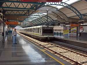
Estadio station
Medellín metro station
Distance: Approx. 1413 meters
Latitude and longitude: 6.25333333,-75.58833333
Estadio is the fourth station on line B of the Medellín Metro from the center going west. It is an elevated station named after the nearby Atanasio Girardot Sports Complex, which is the main area for sports activities in the Medellin Metropolitan Area. The sports complex hosted the 2010 South American Games and is where the two biggest football clubs in Medellín play, Atlético Nacional and Independiente Medellín.
Floresta station
Medellín metro station
Distance: Approx. 325 meters
Latitude and longitude: 6.25861111,-75.59777778
Floresta is the fifth station on line B of the Medellín Metro from the center going west. At its entrance is the mosaic Our Virgin Lady of Sorrows. The station communicates with part of the Atanasio Girardot Sports Complex, the Ethnographic Museum of Miguel Ángel Builes, and the Medellin headquarters of Sukyo Mahikari, among others.
Santa Lucía station (Medellín)
Medellín metro station
Distance: Approx. 734 meters
Latitude and longitude: 6.25805556,-75.60375
Santa Lucía is the sixth station on line B of the Medellín Metro from the center going west. It is named after the Santa Lucía neighborhood where it is located. The station was opened on 28 February 1996 as part of the inaugural section of line B, from San Javier to San Antonio.
St. Ignatius Loyola College, Medellín
Private primary and secondary school in Calle , Medellín, Antioquia, Colombia
Distance: Approx. 1431 meters
Latitude and longitude: 6.255,-75.58694444
St. Ignatius Loyola School (Spanish: San Ignacio de Loyola) is a private Catholic primary and secondary school, located in the La Plazuela area of Medellín, Antioquia, Colombia. The school was founded by the Society of Jesus in 1885, initially as a boys' school, and now offers a co-educational environment for students from kindergarten through 12th grade.

Luis Amigó Catholic University
Private Catholic university in Medellín, Colombia
Distance: Approx. 1611 meters
Latitude and longitude: 6.2594,-75.5837
Luis Amigó Catholic University (Spanish: Universidad Católica Luis Amigó) is a private Catholic university located in Medellín, the second-largest city of Colombia. The university also has offices in Apartadó, Bogotá, Cali, Manizales, and Montería.
Weather in this IP's area
overcast clouds
24 Celsius
25 Celsius
23 Celsius
25 Celsius
1010 hPa
81 %
1010 hPa
852 hPa
10000 meters
4.02 m/s
170 degree
100 %
05:48:13
17:45:38