Country:
Region:
City:
Latitude and Longitude:
Time Zone:
Postal Code:
IP information under different IP Channel
ip-api
Country
Region
City
ASN
Time Zone
ISP
Blacklist
Proxy
Latitude
Longitude
Postal
Route
Luminati
Country
Region
mex
City
temoaya
ASN
Time Zone
America/Mexico_City
ISP
Bicentel SA de CV
Latitude
Longitude
Postal
IPinfo
Country
Region
City
ASN
Time Zone
ISP
Blacklist
Proxy
Latitude
Longitude
Postal
Route
db-ip
Country
Region
City
ASN
Time Zone
ISP
Blacklist
Proxy
Latitude
Longitude
Postal
Route
ipdata
Country
Region
City
ASN
Time Zone
ISP
Blacklist
Proxy
Latitude
Longitude
Postal
Route
Popular places and events near this IP address

State of Mexico
State of central Mexico
Distance: Approx. 9157 meters
Latitude and longitude: 19.35,-99.63333333
The State of Mexico (Spanish: Estado de México, pronounced [esˈtaðo ðe ˈmexiko] ), officially just Mexico (Spanish: México), is one of the 32 federal entities of Mexico. Commonly known as Edomex (from Estado de México) to distinguish it from the name of the whole country, it is the most populous, as well as the second most densely populated, state in the country. Located in south-central Mexico, the state is divided into 125 municipalities.

Toluca International Airport
International airport in Toluca, Mexico
Distance: Approx. 7932 meters
Latitude and longitude: 19.33694444,-99.56583333
Toluca International Airport (Spanish: Aeropuerto Internacional de Toluca); officially Aeropuerto Internacional Licenciado Adolfo López Mateos (Licenciado Adolfo López Mateos International Airport) (IATA: TLC, ICAO: MMTO) is an international airport in Toluca, State of Mexico, Mexico. It handles both national and international air traffic for the Metropolitan area of Toluca and serves as a secondary airport for Greater Mexico City, alongside Felipe Angeles Airport. Historically serving as a hub for Volaris, Interjet, and Republicair, the airport is operated by Administradora Mexiquense del Aeropuerto Internacional de Toluca and is named after President Adolfo López Mateos.
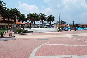
Temoaya
Municipality in State of Mexico, Mexico
Distance: Approx. 7126 meters
Latitude and longitude: 19.46861111,-99.59333333
Temoaya is a municipality in the State of Mexico, Mexico. It's municipal seat is the town of Temoaya which is the sixth largest town in the municipality. It is located 18 kilometres (11 mi) from Toluca and 85 kilometres (53 mi) from Mexico City.
Xonacatlán
Municipality in Mexico, Mexico
Distance: Approx. 4105 meters
Latitude and longitude: 19.4,-99.53333333
Xonacatlán (Spanish pronunciation: [xonakaˈtlan]) is one of 125 municipalities in Mexico State in Mexico. The municipality covers an area of 32.87 km². As of 2005, the municipality had a total population of 45,274.

Toluca (meteorite)
Group of meteorites found in Mexico
Distance: Approx. 4838 meters
Latitude and longitude: 19.45,-99.58333333
Toluca is a group of iron meteorites found in Jiquipilco, Mexico near Toluca.
San Francisco Xonacatlán
Town in the State of Mexico
Distance: Approx. 4145 meters
Latitude and longitude: 19.402222,-99.5325
San Francisco Xonacatlán is a town in the State of Mexico. Colonia San Francisco Xonacatlán de Vicencio is located in the municipality of Xonacatlán. Its area code is 719; its postal code is 52060.

Circuito Centro Dinámico Pegaso
Motorsport venue in Mexico
Distance: Approx. 4799 meters
Latitude and longitude: 19.36722222,-99.55666667
Circuito Centro Dinámico Pegaso is a motorsport venue located in Toluca, Mexico. In 2016, the circuit met all FIA requirements and obtained homologation to host a round of the NACAM Formula 4 Championship, thus becoming an international track endorsed by FIA in the State of Mexico.
Weather in this IP's area
broken clouds
12 Celsius
10 Celsius
11 Celsius
12 Celsius
1021 hPa
35 %
1021 hPa
758 hPa
10000 meters
2.82 m/s
3.83 m/s
47 degree
60 %
06:46:07
17:59:43
