Country:
Region:
City:
Latitude and Longitude:
Time Zone:
Postal Code:
IP information under different IP Channel
ip-api
Country
Region
City
ASN
Time Zone
ISP
Blacklist
Proxy
Latitude
Longitude
Postal
Route
Luminati
Country
Region
s
City
sancristobal
ASN
Time Zone
America/Argentina/Cordoba
ISP
Internet Services S.A.
Latitude
Longitude
Postal
IPinfo
Country
Region
City
ASN
Time Zone
ISP
Blacklist
Proxy
Latitude
Longitude
Postal
Route
db-ip
Country
Region
City
ASN
Time Zone
ISP
Blacklist
Proxy
Latitude
Longitude
Postal
Route
ipdata
Country
Region
City
ASN
Time Zone
ISP
Blacklist
Proxy
Latitude
Longitude
Postal
Route
Popular places and events near this IP address
San Cristóbal, Santa Fe
City in Santa Fe, Argentina
Distance: Approx. 529 meters
Latitude and longitude: -30.31666667,-61.23333333
San Cristóbal is a city in the center-north of the province of Santa Fe, Argentina, 179 km north-northwest from the provincial capital. It had about 14,000 inhabitants at the 2010 census [INDEC] and it is the head town of the San Cristóbal Department. The town was founded in 1890 and the attained the status of comuna (commune) on 1894-01-21.

San Cristóbal Department
Department in Santa Fe, Argentina
Distance: Approx. 529 meters
Latitude and longitude: -30.31666667,-61.23333333
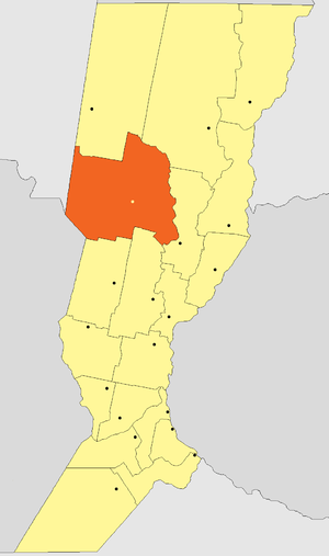
The San Cristóbal Department (in Spanish, Departamento San Cristóbal) is an administrative subdivision (departamento) of the province of Santa Fe, Argentina. It is located in the center-northwest of the province, limiting with the departments of Nueve de Julio and Vera in the north, San Justo in the east, and Las Colonias and Castellanos in the south; to the west it shares a short border with the province of Córdoba and a longer one with Santiago del Estero. The department is the third largest in the province and has about 65,000 inhabitants.
Weather in this IP's area
clear sky
21 Celsius
20 Celsius
21 Celsius
21 Celsius
1010 hPa
52 %
1010 hPa
1001 hPa
10000 meters
5.69 m/s
14.59 m/s
43 degree
06:02:51
19:35:04