2.59.254.59 - IP Lookup: Free IP Address Lookup, Postal Code Lookup, IP Location Lookup, IP ASN, Public IP
Country:
Region:
City:
Location:
Time Zone:
Postal Code:
ISP:
ASN:
language:
User-Agent:
Proxy IP:
Blacklist:
IP information under different IP Channel
ip-api
Country
Region
City
ASN
Time Zone
ISP
Blacklist
Proxy
Latitude
Longitude
Postal
Route
db-ip
Country
Region
City
ASN
Time Zone
ISP
Blacklist
Proxy
Latitude
Longitude
Postal
Route
IPinfo
Country
Region
City
ASN
Time Zone
ISP
Blacklist
Proxy
Latitude
Longitude
Postal
Route
IP2Location
2.59.254.59Country
Region
utrecht
City
woerden
Time Zone
Europe/Amsterdam
ISP
Language
User-Agent
Latitude
Longitude
Postal
ipdata
Country
Region
City
ASN
Time Zone
ISP
Blacklist
Proxy
Latitude
Longitude
Postal
Route
Popular places and events near this IP address

Woerden
City and Municipality in Utrecht, Netherlands
Distance: Approx. 186 meters
Latitude and longitude: 52.08333333,4.88333333
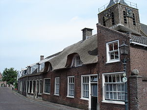
Woerden (Dutch pronunciation: [ˈʋuːrdə(n)] ) is a city and a municipality in central Netherlands. Due to its central location between Amsterdam, Rotterdam, The Hague, and Utrecht, and the fact that it has rail and road connections to those cities, it is a popular town for commuters who work in those cities.
Kamerik
Town in Utrecht, Netherlands
Distance: Approx. 2948 meters
Latitude and longitude: 52.11083333,4.89277778
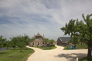
Kamerik is a village in the Dutch province of Utrecht. It is a part of the municipality of Woerden and is situated about 3 km north of Woerden. In 2010 the village of Kamerik (including Kanis) had 3808 inhabitants.

Linschoten (village)
Village in Utrecht, Netherlands
Distance: Approx. 3265 meters
Latitude and longitude: 52.06277778,4.91444444
Linschoten (Dutch pronunciation: [ˈlɪnsxoːtə(n)]) is a village in the Dutch province of Utrecht. It is a part of the municipality of Montfoort, and lies about 3 km southeast of Woerden.

Rietveld, Woerden
Hamlet in Utrecht, Netherlands
Distance: Approx. 2264 meters
Latitude and longitude: 52.08972222,4.85111111
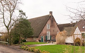
Rietveld is a hamlet in the Dutch province of Utrecht. It is a part of the municipality of Woerden, and lies about 3 km west of Woerden. Rietveld was a separate municipality between 1817 and 1964, when it became part of Woerden.

Geestdorp
Hamlet in Utrecht, Netherlands
Distance: Approx. 1986 meters
Latitude and longitude: 52.09722222,4.90444444
Geestdorp is a hamlet in the Dutch province of Utrecht. It is a part of the municipality of Woerden, and lies about 2 km northeast of the city centre. The hamlet was first mentioned in 1272 as Ghersdorp, and means "settlement near grassland".

Breeveld
Hamlet in Utrecht, Netherlands
Distance: Approx. 2339 meters
Latitude and longitude: 52.09722222,4.91111111
Breeveld is a hamlet in the Dutch province of Utrecht. It is a part of the municipality of Woerden, and lies about 4 km northeast of the city centre. The hamlet was first mentioned in 1217 as Bretevelt, and means "wide field".

Barwoutswaarder
Neighbourhood and hamlet in Woerden, Utrecht, Netherlands
Distance: Approx. 1375 meters
Latitude and longitude: 52.0825,4.86361111
Barwoutswaarder is a neighbourhood of Woerden and a hamlet in the municipality of Woerden in the Dutch province of Utrecht. It is located to the west of the city of Woerden. Nowadays it's part of the urban area of Woerden and a neighbourhood and industrial zone.
's-Gravesloot
Distance: Approx. 1149 meters
Latitude and longitude: 52.095,4.87916667
's-Gravesloot is a former hamlet and municipality in the Dutch province of Utrecht. It was located between Kamerik and Woerden. 's-Gravesloot was a heerlijkheid (manor) owned by the province of Utrecht until 1751, when it was sold to a private owner.

Wulverhorst
Distance: Approx. 2389 meters
Latitude and longitude: 52.06416667,4.89166667
Wulverhorst is a former municipality in the Dutch province of Utrecht. It was located south of Woerden. Wulverhorst was a separate municipality between 1818 and 1857, when it was merged with Linschoten.

Woerden railway station
Railway station in the Netherlands
Distance: Approx. 668 meters
Latitude and longitude: 52.08472222,4.89305556
Woerden railway station (Dutch: Station Woerden) is the railway station of Woerden, Netherlands. The railway station was opened on 21 May 1855 on the Utrecht–Rotterdam railway. In 1911 a new building was built in Jugendstil.
Kalsbeek College
High school in Woerden, Netherlands
Distance: Approx. 1155 meters
Latitude and longitude: 52.0917,4.8704
Kalsbeek College is a secondary school in the village of Woerden, Netherlands. The school is split between two sites and teaches all forms of Dutch secondary education. The Schilderspark site is on Jozef Israëlslaan and the Bredius site on Van kempensingel.

De Windhond
Windmill in Woerden, Netherlands
Distance: Approx. 93 meters
Latitude and longitude: 52.084167,4.883331
De Windhond is a windmill in the city of Woerden, Netherlands. The mill was built in 1755 on an artificial hill of 9.3 metres (31 ft) in height that was part of the defensive enclosure (stadswal) of the ancient city. The mill itself is 5.7 metres (19 ft) high.
Weather in this IP's area
broken clouds
9 Celsius
7 Celsius
8 Celsius
10 Celsius
986 hPa
87 %
986 hPa
986 hPa
10000 meters
4.02 m/s
8.05 m/s
173 degree
71 %


