2.59.25.71 - IP Lookup: Free IP Address Lookup, Postal Code Lookup, IP Location Lookup, IP ASN, Public IP
Country:
Region:
City:
Location:
Time Zone:
Postal Code:
IP information under different IP Channel
ip-api
Country
Region
City
ASN
Time Zone
ISP
Blacklist
Proxy
Latitude
Longitude
Postal
Route
Luminati
Country
ASN
Time Zone
Europe/London
ISP
Precedence Technologies Ltd
Latitude
Longitude
Postal
IPinfo
Country
Region
City
ASN
Time Zone
ISP
Blacklist
Proxy
Latitude
Longitude
Postal
Route
IP2Location
2.59.25.71Country
Region
england
City
cambridge
Time Zone
Europe/London
ISP
Language
User-Agent
Latitude
Longitude
Postal
db-ip
Country
Region
City
ASN
Time Zone
ISP
Blacklist
Proxy
Latitude
Longitude
Postal
Route
ipdata
Country
Region
City
ASN
Time Zone
ISP
Blacklist
Proxy
Latitude
Longitude
Postal
Route
Popular places and events near this IP address

WWT Slimbridge
Wetland nature reserve in Gloucestershire
Distance: Approx. 2856 meters
Latitude and longitude: 51.741471,-2.405979
WWT Slimbridge is a wetland wildlife reserve near Slimbridge in Gloucestershire, England. It is midway between Bristol and Gloucester on the eastern side of the estuary of the River Severn. The reserve, set up by the artist and naturalist Sir Peter Scott, opened in November 1946.
Cambridge, Gloucestershire
Human settlement in England
Distance: Approx. 186 meters
Latitude and longitude: 51.732,-2.365
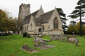
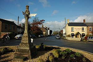
Cambridge ( KAM-brij) is a hamlet in the district of Stroud, in the county of Gloucestershire, England. It lies on the A38 road between Bristol and Gloucester. It is about 3 miles (5 km) from Dursley and about 11 miles (18 km) from Gloucester.

Cam, Gloucestershire
Human settlement in England
Distance: Approx. 3588 meters
Latitude and longitude: 51.70111111,-2.36416667
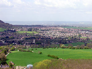
Cam is a large village and civil parish in Gloucestershire, England, situated on the edge of the Cotswolds and contiguous with the town of Dursley, north of Bristol and south of Gloucester. The Cotswold Way runs less than a mile from the village. Cam had 8,160 residents with 3,575 households in the 2011 census.
Cam and Dursley railway station
Railway station in Gloucestershire, England
Distance: Approx. 1784 meters
Latitude and longitude: 51.718,-2.359
Cam and Dursley railway station is a railway station serving the large village of Cam and the market town of Dursley in Gloucestershire, England. It is located on the main Bristol-Birmingham line, between Yate and Gloucester, at a site close to where Coaley Junction railway station was situated from 1856 to 1965.

River Cam, Gloucestershire
River in Gloucestershire, England
Distance: Approx. 1486 meters
Latitude and longitude: 51.7438,-2.38
The River Cam is a small river in Gloucestershire, England. It flows for 12 miles (20 km) north-westwards from the Cotswold Edge, across the Vale of Berkeley, into the Gloucester and Sharpness Canal. The river rises on the Cotswold escarpment above the village of Uley, and flows through Dursley, Cam and Cambridge to the Gloucester and Sharpness Canal as a feeder to that waterway.

Slimbridge
Human settlement in England
Distance: Approx. 977 meters
Latitude and longitude: 51.728,-2.378
Slimbridge is a village and civil parish near Dursley in Gloucestershire, England. It is best known as the home of the Wildfowl and Wetlands Trust's Slimbridge Reserve which was started by Sir Peter Scott.

Coaley
Village in Gloucestershire, England
Distance: Approx. 3346 meters
Latitude and longitude: 51.7118,-2.3328
Coaley is a village in the English county of Gloucestershire roughly 4 miles from the town of Dursley, and 5 miles from the town of Stroud. The village drops from the edge of the Cotswold Hills, overlooked by Frocester Hill and Coaley Peak picnic site, towards the River Cam at Cam and Cambridge and the Severn Estuary beyond. It has a population of around 770.
Slimbridge A.F.C.
Association football club in England
Distance: Approx. 1078 meters
Latitude and longitude: 51.72375556,-2.36934167
Slimbridge Association Football Club is an English football club representing the village of Slimbridge, near Dursley, Gloucestershire (although its ground is in nearby Cambridge). The first team currently plays in the Southern League, the reserve team in the Hellenic League Division Two West, and the Under-18 Youth team in the Cheltenham Under-18 Floodlit Youth League.

Eastington, Stroud
Human settlement in England
Distance: Approx. 3142 meters
Latitude and longitude: 51.746,-2.326
Eastington is a village and civil parish in Gloucestershire, England. It lies 4 miles west of Stroud and 9 miles south of Gloucester at the entrance to the Stroud Valley. It is west of the town of Stonehouse and south of Junction 13 of the M5 motorway and the A38 and A419 roads.

Alkerton, Gloucestershire
Village in Gloucestershire, England
Distance: Approx. 3013 meters
Latitude and longitude: 51.747,-2.329
Alkerton was a village in Gloucestershire, England. It was located along the M5 motorway just east of the River Severn. It was part of the parish of Eastington, and adjoined the village of Eastington at Eastington Cross.

Frocester railway station
Former railway station in England
Distance: Approx. 3405 meters
Latitude and longitude: 51.7272,-2.3183
Frocester railway station served the village of Frocester in Gloucestershire, England. The station was on the Bristol and Gloucester Railway, originally a broad gauge line overseen by Isambard Kingdom Brunel, but later taken over by the Midland Railway and converted to standard gauge. Frocester was a small station designed by Brunel, with short platforms, a small signalbox and a large stone goods shed.
Frampton Pools
Distance: Approx. 3494 meters
Latitude and longitude: 51.764283,-2.358584
Frampton Pools (grid reference SO753073) is a 59.84-hectare (147.9-acre) biological Site of Special Scientific Interest in Gloucestershire, notified in 1974. The pools are on the edge of the village of Frampton on Severn. The site is in the Severn Vale and consists of a number of lakes created as a result of gravel extraction.
Weather in this IP's area
overcast clouds
3 Celsius
-0 Celsius
2 Celsius
4 Celsius
1039 hPa
90 %
1039 hPa
1027 hPa
10000 meters
3.08 m/s
5.58 m/s
176 degree
100 %


