Country:
Region:
City:
Latitude and Longitude:
Time Zone:
Postal Code:
IP information under different IP Channel
ip-api
Country
Region
City
ASN
Time Zone
ISP
Blacklist
Proxy
Latitude
Longitude
Postal
Route
Luminati
Country
ASN
Time Zone
Europe/Paris
ISP
K-NET SARL
Latitude
Longitude
Postal
IPinfo
Country
Region
City
ASN
Time Zone
ISP
Blacklist
Proxy
Latitude
Longitude
Postal
Route
db-ip
Country
Region
City
ASN
Time Zone
ISP
Blacklist
Proxy
Latitude
Longitude
Postal
Route
ipdata
Country
Region
City
ASN
Time Zone
ISP
Blacklist
Proxy
Latitude
Longitude
Postal
Route
Popular places and events near this IP address

Benerville-sur-Mer
Commune in Normandy, France
Distance: Approx. 1178 meters
Latitude and longitude: 49.3431,0.0372
Benerville-sur-Mer is a commune in the Calvados department and Normandy region of north-western France.

Blonville-sur-Mer
Commune in Normandy, France
Distance: Approx. 649 meters
Latitude and longitude: 49.3392,0.0314
Blonville-sur-Mer (French pronunciation: [blɔ̃vil syʁ mɛʁ] , literally Blonville on Sea) is a commune in the Calvados department in the Normandy region in northwestern France. It is a seaside resort on the Côte Fleurie with a long sandy beach.

Tourgéville
Commune in Normandy, France
Distance: Approx. 3450 meters
Latitude and longitude: 49.3247,0.065
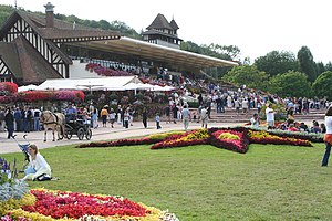
Tourgéville (French pronunciation: [tuʁʒevil] ) is a commune in the Calvados department in the Normandy region in northwestern France. The Deauville-Clairefontaine Racecourse is located on the territory of the commune.

Vauville, Calvados
Commune in Normandy, France
Distance: Approx. 3652 meters
Latitude and longitude: 49.3128,0.0536
Vauville (French pronunciation: [vovil] ) is a commune in the Calvados department in the Normandy region in northwestern France.

Villers-sur-Mer
Commune in Normandy, France
Distance: Approx. 2765 meters
Latitude and longitude: 49.3214,-0.005
Villers-sur-Mer (French pronunciation: [vilɛʁ syʁ mɛʁ] ) is a commune in the Calvados department in Normandy, northwestern France, with a population of 2,644 as of 2017.

Villers-sur-Mer station
Distance: Approx. 2670 meters
Latitude and longitude: 49.31611111,0.00972222
Villers-sur-Mer is the railway station for the town of Villers-sur-Mer. The station is built in Ouest architecture and is on the Côte Fleurie branchline from Trouville-Deauville and to Dives-Cabourg. The line from Trouville-Deauville to Villers-sur-Mer and Houlgate opened in 1884.

Deauville-La Touques Racecourse
Horse race track in France
Distance: Approx. 4504 meters
Latitude and longitude: 49.35388889,0.08
Hippodrome Deauville-La Touques is a race track for thoroughbred horse racing located in Deauville in the Calvados département, in the Normandy région of France. Originally called Hippodrome de la Touques, it was named for the Touques River that separates the city of Deauville from Trouville-sur-Mer. It was constructed in 1862 by Charles Auguste Louis Joseph, duc de Morny, the half brother of Napoleon III. The countryside around Deauville is the main horse breeding region in France and home to numerous stud farms.

Deauville-Clairefontaine Racecourse
Horse race track in France
Distance: Approx. 2634 meters
Latitude and longitude: 49.34611111,0.05694444
Deauville-Clairefontaine Racecourse is a horse race track located in Tourgéville near Deauville in the Calvados département in the Normandy région of France. The 40-acre (16 ha) facility hosts harness racing, thoroughbred flat racing, steeplechase and hurdle races. The countryside around Deauville is the main horse breeding region in France and home to numerous stud farms.

Côte Fleurie
Coastline in France
Distance: Approx. 2937 meters
Latitude and longitude: 49.31666667,0
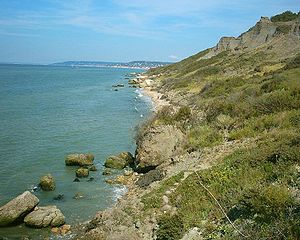
The Côte Fleurie (French pronunciation: [kot flœ.ʁi]) (or Flowery Coast) stretches for approximately 40 km (25 mi) between Merville-Franceville-Plage, at the mouth of the Orne river, opposite Ouistreham to the west and Honfleur on the Seine estuary in the east. It forms part of the eastern Basse-Normandie (Lower Normandy) coast on the English Channel to the north of the Pays d'Auge in the Calvados department. The coast between the towns of Trouville and Honfleur, although part of the Côte Fleurie, is named Côte de Grace.

Hotel Barrière Le Normandy Deauville
Hotel in Deauville, France
Distance: Approx. 4239 meters
Latitude and longitude: 49.36,0.070853
The Hotel Barrière Le Normandy Deauville is a grand hotel of the Groupe Lucien Barrière in Deauville, Normandy. It was built as the Hôtel Normandy in 1912.
Open de France Dames
Women's professional golf tournament
Distance: Approx. 4014 meters
Latitude and longitude: 49.34001,0.0778
The Open de France Dames is a women's professional golf tournament in France on the Ladies European Tour. It has been played annually since 1987, with four exceptions: 1990, 1991, 1992, and 1998. Since the 2011 edition, Lacoste has been the title sponsor of the event.
Mont Canisy battery
WW2 German fortification in Calvados, Normandy, France
Distance: Approx. 1293 meters
Latitude and longitude: 49.34083333,0.04
The Mont Canisy battery was a World War II German artillery battery constructed close to the French village of Benerville-sur-Mer in the Calvados department in the Lower Normandy region. Located on the highest ground in Normandy (110 m (360 ft) high), the vantage point overlooks the Côte Fleurie. The bunker complex was constructed between 1941 and 1944 to protect the River Seine estuary and the port of Le Havre.
Weather in this IP's area
mist
11 Celsius
11 Celsius
10 Celsius
11 Celsius
1026 hPa
100 %
1026 hPa
1026 hPa
2200 meters
1.03 m/s
100 %
08:01:25
17:26:12
