Country:
Region:
City:
Latitude and Longitude:
Time Zone:
Postal Code:
IP information under different IP Channel
ip-api
Country
Region
City
ASN
Time Zone
ISP
Blacklist
Proxy
Latitude
Longitude
Postal
Route
Luminati
Country
ASN
Time Zone
Europe/Amsterdam
ISP
Eranium B.V.
Latitude
Longitude
Postal
IPinfo
Country
Region
City
ASN
Time Zone
ISP
Blacklist
Proxy
Latitude
Longitude
Postal
Route
db-ip
Country
Region
City
ASN
Time Zone
ISP
Blacklist
Proxy
Latitude
Longitude
Postal
Route
ipdata
Country
Region
City
ASN
Time Zone
ISP
Blacklist
Proxy
Latitude
Longitude
Postal
Route
Popular places and events near this IP address
Government of Amsterdam
Municipality in the Netherlands, containing the cities of Amsterdam and Weesp
Distance: Approx. 131 meters
Latitude and longitude: 52.36666667,4.88333333
The Government of Amsterdam consists of several territorial and functional forms of local and regional government. The principal form of government is the municipality of Amsterdam, Netherlands. The municipality's territory covers the city of Amsterdam as well as a number of small towns.

Metz & Co
Former Dutch department store
Distance: Approx. 105 meters
Latitude and longitude: 52.36611111,4.88666667
Metz & Co was a department store in Amsterdam, The Netherlands, whose roots went back to 1740. It closed down in 2013. The store was founded by Mozes Samuels in the Jodenbreestraat, he sold his company to his three sons in 1794.
De Krijtberg
Church in AV Amsterdam, Netherlands
Distance: Approx. 257 meters
Latitude and longitude: 52.36777778,4.88805556
De Krijtberg Kerk is a Roman Catholic church in Amsterdam, located at the Singel. The church was designed by Alfred Tepe and was opened in 1883. The exuberant interior was made by Friedrich Wilhelm Mengelberg.

Canals of Amsterdam
17th-century canals in the Netherlands; UNESCO World Heritage Site
Distance: Approx. 229 meters
Latitude and longitude: 52.365,4.88777778
Amsterdam, capital of the Netherlands, has more than 100 kilometers (62 mi) of grachten (canals), about 90 islands and 1,500 bridges. The three main canals (Herengracht, Prinsengracht and Keizersgracht), dug in the 17th century during the Dutch Golden Age, form concentric belts around the city, known as the Grachtengordel. Alongside the main canals are 1550 monumental buildings.

Keizersgracht 453
Distance: Approx. 92 meters
Latitude and longitude: 52.3664,4.8865
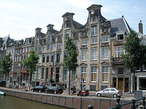
Keizersgracht 453 is a canal house with a neck gable on the northeastern side of the Keizersgracht between Leidsegracht and Leidsestraat. It is a national monument of "very high value" (zeer hoge waarde) and "national distinction" (nationale kenmerkendheid) according to the Dutch Cultural Heritage agency.
Auberge (restaurant)
Former Michelin-starred restaurant in Amsterdam, Netherlands.
Distance: Approx. 260 meters
Latitude and longitude: 52.36416667,4.88361111
Auberge was a restaurant in Amsterdam, Netherlands. It was a fine dining restaurant that was awarded one Michelin star in 1980 and 1981. Head chef of Auberge was John Halvemaan.

Huis Marseille, Museum for Photography
Photography museum in Amsterdam, Netherlands
Distance: Approx. 150 meters
Latitude and longitude: 52.36764,4.88487
Huis Marseille, Museum for Photography is the oldest photography museum in Amsterdam, opened in 1999. Huis Marseille was the first photography museum in the Netherlands when it opened in 1999; the Nederlands Fotomuseum in Rotterdam, the Fotomuseum Den Haag in The Hague, and FOAM in a nearby building have opened since. The museum is housed in a residence built around 1665 for a French merchant, and contains 13 exhibition spaces and a restored room in Louis XIV style; the building was restored and the museum extended into the adjacent building in 2007–2013.

Cromhouthuizen
Group of canal houses in Amsterdam
Distance: Approx. 262 meters
Latitude and longitude: 52.36855,4.8863
Cromhouthuizen (English: Cromhout Houses) consists of four consecutive canal houses on Herengracht in Amsterdam, Netherlands. The houses are located between Huidenstraat and the canal Herengracht, with house numbers 362–364, 366, 368, and 370. The houses were designed by Amsterdam architect Philips Vingboons in the style of Dutch Classicism.

Morsink Icon Gallery
Art gallery, Russian and Greek Icons, UNESCO World Heritage Site in Amsterdam, Netherlands
Distance: Approx. 114 meters
Latitude and longitude: 52.36713133,4.88417268
Morsink Icon Gallery (previously called Jan Morsink Ikonen) is an international gallery in Amsterdam specializing in Russian and Greek icons dating from the fifteenth to the nineteenth century.

Leidsegracht
Canal in Amsterdam
Distance: Approx. 106 meters
Latitude and longitude: 52.366389,4.883611
The Leidsegracht (Dutch pronunciation: [ˈlɛitsəˌɣrɑxt]) is a canal in Amsterdam, Netherlands. It is a cross-canal in Amsterdam-Center that connects Herengracht, Keizersgracht, Prinsengracht and Lijnbaansgracht and flows into the Singelgracht at Marnixstraat.

Murder of Peter R. de Vries
Murder of crime reporter Peter R. de Vries
Distance: Approx. 263 meters
Latitude and longitude: 52.36396187,4.884625
In the evening of 6 July 2021, Dutch investigative journalist and crime reporter Peter R. de Vries was shot in the head after leaving the television studio of RTL Boulevard in Amsterdam where he had appeared as a guest. Several bullets were fired at him in the Lange Leidsedwarsstraat, near the Leidseplein, while he was walking to his car. De Vries was taken to the VU University Medical Center in critical condition.
Boekman Foundation
Cultural research foundation
Distance: Approx. 208 meters
Latitude and longitude: 52.3675,4.8875
The Boekman Foundation Institute for arts, culture and related policy (Dutch: Boekmanstichting Kenniscentrum voor kunst, cultuur en beleid) is a research institute for Dutch arts and culture policy and practice. It was named after the Amsterdam SDAP politician and alderman Emanuel Boekman (1889–1940), who promoted public support for art and culture in his PhD thesis of 1939. The Boekman Foundation was established in 1963 by Dutch cultural philosopher Jan Kassies (nl) and compiles and analyses statistical and other data on art and culture in the Netherlands for policy purposes.
Weather in this IP's area
light intensity drizzle
9 Celsius
6 Celsius
9 Celsius
11 Celsius
1015 hPa
85 %
1015 hPa
1014 hPa
10000 meters
7.2 m/s
220 degree
75 %
08:04:06
16:46:44

