2.58.49.99 - IP Lookup: Free IP Address Lookup, Postal Code Lookup, IP Location Lookup, IP ASN, Public IP
Country:
Region:
City:
Location:
Time Zone:
Postal Code:
ISP:
ASN:
language:
User-Agent:
Proxy IP:
Blacklist:
IP information under different IP Channel
ip-api
Country
Region
City
ASN
Time Zone
ISP
Blacklist
Proxy
Latitude
Longitude
Postal
Route
db-ip
Country
Region
City
ASN
Time Zone
ISP
Blacklist
Proxy
Latitude
Longitude
Postal
Route
IPinfo
Country
Region
City
ASN
Time Zone
ISP
Blacklist
Proxy
Latitude
Longitude
Postal
Route
IP2Location
2.58.49.99Country
Region
grad zagreb
City
dubrava
Time Zone
Europe/Zagreb
ISP
Language
User-Agent
Latitude
Longitude
Postal
ipdata
Country
Region
City
ASN
Time Zone
ISP
Blacklist
Proxy
Latitude
Longitude
Postal
Route
Popular places and events near this IP address
Dubrava, Zagreb
Distance: Approx. 1278 meters
Latitude and longitude: 45.82611111,16.05111111
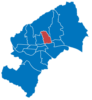
Dubrava is a large urban area in east Zagreb, Croatia. It is located in the northeastern part of the city and divided by the Dubrava Avenue into two administrative areas: Gornja Dubrava (Upper Dubrava), population 61,841 (2011) Donja Dubrava (Lower Dubrava), population 36,363 The name comes from a Slavic toponym for oak forests.

Stadion Maksimir
Multi-use stadium in Zagreb, Croatia
Distance: Approx. 3894 meters
Latitude and longitude: 45.81888889,16.01805556
Maksimir Stadium (Croatian: Stadion Maksimir, pronounced [ˈstâdioːn mǎksimiːr]) is a multi-use stadium in Zagreb, Croatia. Named after the surrounding neighbourhood of Maksimir, it is one of the largest stadiums in the country with a current seating capacity of 25,912 and a maximum possible capacity of 35,423. It is the home stadium of Croatian club Dinamo Zagreb and has been used since 1990 by the Croatia national football team for the majority of international competitions.

Maksimir
City district of Zagreb, Croatia
Distance: Approx. 3397 meters
Latitude and longitude: 45.83215556,16.01985833
Maksimir (pronounced [mǎksimiːr]) is one of the districts of Zagreb, Croatia, population 48,902 (2011 census). Maksimir stadium and Maksimir Park are located in it. It was named for Bishop Maksimilijan Vrhovac.

Gornja Dubrava
City district of Zagreb, Croatia
Distance: Approx. 1040 meters
Latitude and longitude: 45.841125,16.05566111
Gornja Dubrava (pronounced [ɡôːrɲaː dǔbraʋa], "Upper Dubrava") is one of the districts of Zagreb, Croatia. It is located in the northeastern part of the city and has 61,841 inhabitants (2011 census).

Donja Dubrava, Zagreb
City district of Zagreb, Croatia
Distance: Approx. 1264 meters
Latitude and longitude: 45.82621389,16.05121944
Donja Dubrava (Croatian pronunciation: [dôːɲaː dǔbraʋa], "Lower Dubrava") is one of the districts of Zagreb, Croatia. It is located in the northeastern part of the city and in 2011 had 36,363 inhabitants.

Zagreb Zoo
Zoo in Zagreb, Croatia
Distance: Approx. 3448 meters
Latitude and longitude: 45.82277778,16.02194444
Zagreb Zoo (Croatian: Zoološki vrt Grada Zagreba) is a 7-hectare (17-acre) zoo located within Maksimir Park in Zagreb, Croatia, and is across the street from Zagreb's Maksimir Stadium. It is one of three zoo parks in the country. Zagreb Zoo is a member of both the European and the World Association of Zoos and Aquariums and is a participant in the European Endangered Species Programme.

Stadion ŠRC Sesvete
Football stadium in Sesvete, Croatia
Distance: Approx. 3419 meters
Latitude and longitude: 45.83638889,16.1075
Stadion SRC Sesvete is a football stadium in Sesvete, Croatia. It serves as home stadium for football club NK Sesvete. The stadium has an all seater capacity of 3,500 spectators.
Gojko Šušak Avenue
Distance: Approx. 2469 meters
Latitude and longitude: 45.83833333,16.0325
Gojko Šušak Avenue (Croatian: Avenija Gojka Šuška) is an avenue in northeastern Zagreb, Croatia. It serves as part of the boundary between city districts Maksimir and Gornja Dubrava. Spanning between Štefanovec Road and Dubrava Avenue, the avenue has four lanes and a parking lot along its western side.

Clinical Hospital Dubrava
Hospital in Zagreb, Croatia
Distance: Approx. 2220 meters
Latitude and longitude: 45.83444444,16.035
Clinical Hospital Dubrava (Croatian: Klinička bolnica Dubrava) is a public teaching hospital in Zagreb, Croatia.

Maksimir Park
Urban protected area in Zagreb
Distance: Approx. 3366 meters
Latitude and longitude: 45.82972222,16.02055556
Maksimir Park is the oldest public park in Zagreb, Croatia. It forms part of the city's cultural heritage and is a habitat for many different plant and animal species.
Borongaj
Distance: Approx. 3685 meters
Latitude and longitude: 45.81277778,16.02666667
Borongaj is a neighborhood in the Peščenica – Žitnjak district of Zagreb, Croatia. It is situated south of the main railway along Branimir Avenue and east of Donje Svetice Road. It is the location of the former Borongaj Airfield.

2020 Zagreb earthquake
Distance: Approx. 3182 meters
Latitude and longitude: 45.85,16.03
At approximately 6:24 AM CET on the morning of 22 March 2020, an earthquake of magnitude 5.3 Mw, 5.5 ML, hit Zagreb, Croatia, with an epicenter 7 kilometres (4.3 mi) north of the city centre. The maximum felt intensity was VII–VIII (Very strong to Damaging) on the Medvedev–Sponheuer–Karnik scale. The earthquake was followed by numerous aftershocks, the strongest of which with a magnitude of 5.0.
Weather in this IP's area
overcast clouds
-0 Celsius
-0 Celsius
-1 Celsius
-0 Celsius
1026 hPa
83 %
1026 hPa
1006 hPa
6000 meters
1.03 m/s
100 %
