2.58.255.224 - IP Lookup: Free IP Address Lookup, Postal Code Lookup, IP Location Lookup, IP ASN, Public IP
Country:
Region:
City:
Location:
Time Zone:
Postal Code:
ISP:
ASN:
language:
User-Agent:
Proxy IP:
Blacklist:
IP information under different IP Channel
ip-api
Country
Region
City
ASN
Time Zone
ISP
Blacklist
Proxy
Latitude
Longitude
Postal
Route
db-ip
Country
Region
City
ASN
Time Zone
ISP
Blacklist
Proxy
Latitude
Longitude
Postal
Route
IPinfo
Country
Region
City
ASN
Time Zone
ISP
Blacklist
Proxy
Latitude
Longitude
Postal
Route
IP2Location
2.58.255.224Country
Region
england
City
washington
Time Zone
Europe/London
ISP
Language
User-Agent
Latitude
Longitude
Postal
ipdata
Country
Region
City
ASN
Time Zone
ISP
Blacklist
Proxy
Latitude
Longitude
Postal
Route
Popular places and events near this IP address

Washington, West Sussex
Village and parish in West Sussex, England
Distance: Approx. 214 meters
Latitude and longitude: 50.90298,-0.40634
Washington is a village and civil parish in the Horsham District of West Sussex, England. It is located five miles (eight kilometres) west of Steyning and three miles (five kilometres) east of Storrington on the A24 between Horsham and Worthing. The parish covers an area of 1,276 hectares (3,150 acres).

Windlesham House School
Preparatory school in Pulborough, West Sussex, England
Distance: Approx. 1866 meters
Latitude and longitude: 50.88994,-0.41848
Windlesham House School is an independent boarding and day school for boys and girls aged 4 to 13 on the South Downs, in Pulborough, West Sussex, England. It was founded in 1837 by Charles Robert Malden and was the first boys' preparatory school in the United Kingdom. In 1967 it became the first IAPS co-educational school.

Chanctonbury Ring
Hill fort in West Sussex, England
Distance: Approx. 1985 meters
Latitude and longitude: 50.89626,-0.38177
Chanctonbury Ring is a prehistoric hill fort atop Chanctonbury Hill on the South Downs, on the border of the civil parishes of Washington and Wiston in the English county of West Sussex. A ridgeway, now part of the South Downs Way, runs along the hill. It forms part of an ensemble of associated historical features created over a span of more than 2,000 years, including round barrows dating from the Bronze Age to the Saxon periods and dykes dating from the Iron Age and Roman periods.

Chanctonbury Hill
Distance: Approx. 2162 meters
Latitude and longitude: 50.895,-0.38
Chanctonbury Hill is an 82.7-hectare (204-acre) biological Site of Special Scientific Interest west of Steyning in West Sussex. Part of it is Chanctonbury Ring, an early Iron Age hillfort which contains two Romano-Celtic temples and which is a Scheduled Monument. This site on the steep slope of the South Downs is mainly woodland with some areas of chalk grassland.

Sullington
Village in West Sussex, England
Distance: Approx. 2279 meters
Latitude and longitude: 50.90685,-0.43882
Sullington is a village and former civil parish, now in the parish of Storrington and Sullington, in the Horsham district of West Sussex, England. The village lies on the A283 road west of the A24 road, 20 miles (32 km) south of Horsham. In 1961 the parish had a population of 1354.

Buncton
Human settlement in England
Distance: Approx. 2558 meters
Latitude and longitude: 50.91332,-0.37259
Buncton () is a small village in the Horsham District of West Sussex, England, part of the civil parish of Wiston 0.5 miles (0.80 km) north. It lies to the east of the A24 road, 11 miles (18 km) as the crow flies, about 18 miles (29 km) by road south of Horsham and 6 miles (9.7 km) north west of Shoreham by Sea. Buncton existed as a settlement at the time of the Domesday survey in 1086, when it was called Bongetune.
Heath Common
Village in West Sussex, England
Distance: Approx. 2479 meters
Latitude and longitude: 50.9249,-0.42203
Heath Common is a settlement in the Horsham District of West Sussex, England. It lies on the Storrington to Ashington road 1.5 miles (2.4 km) east of Storrington.

Wiston, West Sussex
Village in West Sussex, England
Distance: Approx. 2601 meters
Latitude and longitude: 50.91613,-0.37401
Wiston is a scattered village and civil parish in the Horsham District of West Sussex, England. It lies on the A283 road 2.8 miles (4.5 km) northwest of Steyning. The parish covers an area of 1,360 hectares (3,400 acres).

Rock Mill, Washington
Windmill in Washington, West Sussex, UK
Distance: Approx. 1028 meters
Latitude and longitude: 50.9117,-0.3966
Rock Mill is a Grade II listed smock mill at Washington, West Sussex, England, which has been converted to residential use.

Storrington (electoral division)
Distance: Approx. 2720 meters
Latitude and longitude: 50.91039,-0.44426
Storrington is an electoral division of West Sussex in the United Kingdom and returns one member to West Sussex County Council.

All Saints Church, Buncton
Church in West Sussex , United Kingdom
Distance: Approx. 2557 meters
Latitude and longitude: 50.9133,-0.3726
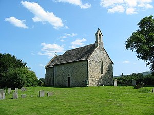
All Saints Church is an Anglican church in the hamlet of Buncton in the district of Horsham, one of seven local government districts in the English county of West Sussex. Built in the 11th or 12th century as a small chapel of ease to a nearby parish church, and hardly changed or restored since, the stone chapel stands behind a "delightful ... wooded ravine" beneath the South Downs and has been called "a real piece of hidden Sussex".

The Sanctuary (community)
Distance: Approx. 1679 meters
Latitude and longitude: 50.91729722,-0.42013333
The Sanctuary, near Storrington in West Sussex, England, was a utopian community which was founded in 1923 and lasted about a decade.
Weather in this IP's area
few clouds
8 Celsius
3 Celsius
8 Celsius
9 Celsius
984 hPa
80 %
984 hPa
981 hPa
10000 meters
11.83 m/s
210 degree
20 %