2.57.207.169 - IP Lookup: Free IP Address Lookup, Postal Code Lookup, IP Location Lookup, IP ASN, Public IP
Country:
Region:
City:
Location:
Time Zone:
Postal Code:
IP information under different IP Channel
ip-api
Country
Region
City
ASN
Time Zone
ISP
Blacklist
Proxy
Latitude
Longitude
Postal
Route
Luminati
Country
Region
26
City
kalush
ASN
Time Zone
Europe/Kyiv
ISP
Kaluska informatsiyna merezha LLC
Latitude
Longitude
Postal
IPinfo
Country
Region
City
ASN
Time Zone
ISP
Blacklist
Proxy
Latitude
Longitude
Postal
Route
IP2Location
2.57.207.169Country
Region
ivano-frankivska oblast
City
kalush
Time Zone
Europe/Kiev
ISP
Language
User-Agent
Latitude
Longitude
Postal
db-ip
Country
Region
City
ASN
Time Zone
ISP
Blacklist
Proxy
Latitude
Longitude
Postal
Route
ipdata
Country
Region
City
ASN
Time Zone
ISP
Blacklist
Proxy
Latitude
Longitude
Postal
Route
Popular places and events near this IP address

Kalush, Ukraine
Urban locality in Ivano-Frankivsk Oblast, Ukraine
Distance: Approx. 3722 meters
Latitude and longitude: 49.04416667,24.35972222
Kalush (Ukrainian: Калуш, IPA: [ˈkɑlʊʃ] ) is a city set in the foothills of the Carpathian Mountains, in Ivano-Frankivsk Oblast (province) of western Ukraine. It is the administrative centre of Kalush Raion (district) and hosts the administration of Kalush urban hromada, one of the hromadas of Ukraine. Its estimated population was 65,088 (2022 estimate).
Ugartsthal
Distance: Approx. 6304 meters
Latitude and longitude: 49.03222222,24.2925
Ugartsthal, a former German colony in the Kingdom of Galicia and Lodomeria which is today part of the village Sivka-Kaluska in Kalush Raion (Ivano-Frankivsk Oblast, Ukraine), is located 7 km (4 mi) west of Kalush.

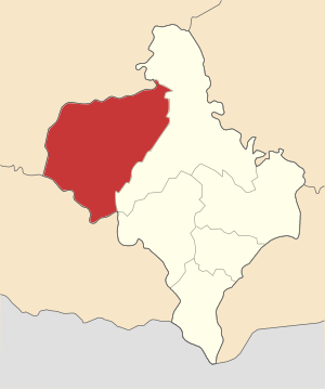
Kalush Raion
Subdivision of Ivano-Frankivsk Oblast, Ukraine
Distance: Approx. 5548 meters
Latitude and longitude: 49.06083333,24.3875
Kalush Raion (Ukrainian: Калуський район, romanized: Kalus'kyj rajon) is a raion (district) of Ivano-Frankivsk Oblast (province). The city of Kalush is the administrative center of the raion. Population: 279,867 (2022 estimate).
Staryi Uhryniv
Village in Ivano-Frankivsk Oblast, Ukraine
Distance: Approx. 7448 meters
Latitude and longitude: 48.945,24.37138889
Staryi Uhryniv (Ukrainian: Старий Угринів, Polish: Uhrynów Stary) is a village in Kalush Raion, Ivano-Frankivsk Oblast, western Ukraine. The local government is administered by Serednouhrynivska village council. It belongs to Novytsia rural hromada, one of the hromadas of Ukraine.
Mostyshche
Village in Ukraine
Distance: Approx. 6872 meters
Latitude and longitude: 49.07027778,24.3425
Mostyshche is a village at Kalush district, Ivano-Frankivsk region, Ukraine.

Novytsia
Village in Ivano-Frankivsk Oblast, Ukraine
Distance: Approx. 6532 meters
Latitude and longitude: 48.96,24.33138889
Novytsia (Ukrainian: Новиця; Polish: Nowica) is a village in Ivano-Frankivsk Oblast, Ukraine, in Kalush Raion. It is the administrative centre of Novytsia rural hromada. Its population is 3,733 (as of 2023).

Church of the Entry into Jerusalem, Staryi Uhryniv
Church in Ivano-Frankivsk Oblast, Ukraine
Distance: Approx. 7141 meters
Latitude and longitude: 48.94777778,24.37027778
Church of the Entry into Jerusalem (Ukrainian: Церква В'їзду Господа в Єрусалим) is a Greek Catholic parish church (UGCC) in Staryi Uhryniv of the Novytsia rural hromada, Kalush Raion, Ivano-Frankivsk Oblast, Ukraine and an architectural monument of local importance. In a former wooden church on the site, Stepan Bandera was baptized.
Weather in this IP's area
overcast clouds
-0 Celsius
-2 Celsius
-0 Celsius
-0 Celsius
1039 hPa
83 %
1039 hPa
1004 hPa
10000 meters
1.39 m/s
1.42 m/s
89 degree
100 %