Country:
 Poland
Region:
City:
Latitude and Longitude:
Time Zone:
Postal Code:
IP information under different IP Channel
ip-api
Country
Region
City
ASN
Time Zone
ISP
Blacklist
Proxy
Latitude
Longitude
Postal
Route
IPinfo
Country
Region
City
ASN
Time Zone
ISP
Blacklist
Proxy
Latitude
Longitude
Postal
Route
MaxMind
Country
Region
City
ASN
Time Zone
ISP
Blacklist
Proxy
Latitude
Longitude
Postal
Route
Luminati
Country
PLRegion
24
City
czestochowa
ASN
Time Zone
Europe/Warsaw
ISP
Beyond.pl sp. z o.o.
Latitude
Longitude
Postal
db-ip
Country
Region
City
ASN
Time Zone
ISP
Blacklist
Proxy
Latitude
Longitude
Postal
Route
ipdata
Country
Region
City
ASN
Time Zone
ISP
Blacklist
Proxy
Latitude
Longitude
Postal
Route
Popular places and events near this IP address

Częstochowa
City in southern Poland
Distance: Approx. 864 meters
Latitude and longitude: 50.8,19.11666667
Częstochowa ( CHEN-stə-KOH-və, Polish: [t͡ʂɛ̃stɔˈxɔva] ) is a city in southern Poland on the Warta River with 214,342 inhabitants, making it the thirteenth-largest city in Poland. It is situated in the Silesian Voivodeship. However, Częstochowa is historically part of the Lesser Poland region, not of Silesia, and before 1795, it belonged to the Kraków Voivodeship.

Częstochowa County
County in Silesian Voivodeship, Poland
Distance: Approx. 864 meters
Latitude and longitude: 50.8,19.11666667
Częstochowa County (Polish: powiat częstochowski) is a unit of territorial administration and local government (powiat) in Silesian Voivodeship, southern Poland. It came into being on January 1, 1999, as a result of the Polish local government reforms passed in 1998. Its administrative seat is the city of Częstochowa, although the city is not part of the county (it constitutes a separate city county).

Roman Catholic Archdiocese of Częstochowa
Roman Catholic archdiocese in Poland
Distance: Approx. 1119 meters
Latitude and longitude: 50.8088,19.1272
The Archdiocese of Częstochowa (Latin: Archidioecesis Czestochoviensis) is a Latin Church archdiocese of the Catholic Church located in the city of Częstochowa in Poland.

Częstochowa Ghetto
Nazi ghetto in occupied Poland
Distance: Approx. 1529 meters
Latitude and longitude: 50.8125,19.1273
The Częstochowa Ghetto was a World War II ghetto set up by Nazi Germany for the purpose of persecution and exploitation of local Jews in the city of Częstochowa during the German occupation of Poland. The approximate number of people confined to the ghetto was around 40,000 at the beginning and in late 1942 at its peak, immediately before mass deportations, 48,000. Most ghetto inmates were delivered by the Holocaust trains to Treblinka extermination camp, where they were murdered.
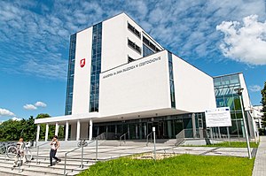
Jan Długosz University
Public university in Częstochowa, Poland
Distance: Approx. 1569 meters
Latitude and longitude: 50.810281,19.115851
Jan Dlugosz University in Czestochowa (JDU) is a Polish public university in Czestochowa, established in 1971 as the Higher Teacher Education School in Czestochowa. Since 2004, it has been named after Jan Dlugosz.

Częstochowa massacre
Distance: Approx. 864 meters
Latitude and longitude: 50.8,19.11666667
The Częstochowa massacre, also known as the Bloody Monday, was committed by the German Wehrmacht forces beginning on the 4th day of World War II in the Polish city of Częstochowa, between 4 and 6 September 1939. The shootings, beatings and plunder continued for three days in more than a dozen separate locations around the city. Approximately 1,140 Polish civilians (150 of whom were ethnically Jewish), were murdered.

Orthodox Church of the Icon of Our Lady of Częstochowa
Eastern Orthodox church in Poland
Distance: Approx. 1479 meters
Latitude and longitude: 50.80833333,19.11416667
The Orthodox Church of the Icon of Our Lady of Częstochowa (Polish: Cerkiew Częstochowskiej Ikony Matki Bożej w Częstochowie) is an Eastern Orthodox church in Częstochowa, Poland that honors the Icon of Our Lady of Częstochowa, one of the country's national symbols. Construction of the building commenced in 1994 according to a design by Michał Bałasz of Białystok. As of 2009, the church is mostly complete.

Hala Sportowa Częstochowa
Distance: Approx. 1745 meters
Latitude and longitude: 50.80444444,19.15194444
Hala Sportowa Częstochowa is a sport, show and fair arena in Częstochowa, Poland. In sport it is primarily used for volleyball, and also concerts. The arena was officially opened on September 29, 2012, during the SuperCup 2012 volleyball match – PGE Skra Bełchatów vs Asseco Resovia Rzeszów.
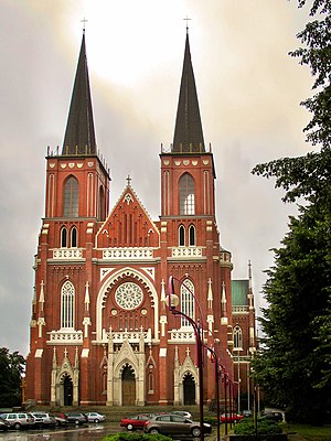
Częstochowa Cathedral
Church in Częstochowa, Poland
Distance: Approx. 1130 meters
Latitude and longitude: 50.8089,19.1272
The Cathedral Basilica of the Holy Family (Polish: Bazylika Archikatedralna Sanktuarium Świętej Rodziny ) also called Częstochowa Cathedral is a religious building that is affiliated with the Catholic Church and was built in the neo-Gothic style, it is a three-nave church following the Roman or Latin rite and is located on the street Krakowska in the city of Częstochowa in Poland. It is one of the largest of its kind in Europe, built on an old cemetery in the years 1825-1898. It was built between 1901 and 1927 and designed by Konstanty Wojciechowski.

Częstochowa railway station
Railway station in Częstochowa, Poland
Distance: Approx. 1292 meters
Latitude and longitude: 50.808728,19.119292
Częstochowa railway station is one of two major railway stations in Częstochowa, Silesian Voivodeship, Poland, the other station being Częstochowa Stradom. Since 2015 it has been operating as a “P” (premium) category station in the PKP classification. In 2018, the station served approximately 10,000 passengers a day.
Minor Seminary in Częstochowa
School in Częstochowa, , Silesian, Poland
Distance: Approx. 836 meters
Latitude and longitude: 50.80555556,19.12361111
Minor Seminary in Częstochowa (Polish: Niższe Seminarium - Liceum Humanistyczne w Częstochowie) is a Roman Catholic minor seminary, a private general education liceum, all male boarding school in Poland for those who are considering a vocation to the priesthood. It is operated by the Archdiocese of Częstochowa. The school is located in the town of Częstochowa.

Częstochowa Stradom railway station
Railway station in Silesia, Poland
Distance: Approx. 1669 meters
Latitude and longitude: 50.7976414,19.1051466
Częstochowa Stradom railway station is one of two major railway stations in Częstochowa, Silesian Voivodeship, Poland, the other station being the Częstochowa railway station. As of 2022, it is served by Polregio (local and InterRegio services) and PKP Intercity (EIP, InterCity, and TLK services).
Weather in this IP's area
overcast clouds
5 Celsius
3 Celsius
5 Celsius
7 Celsius
1026 hPa
64 %
1026 hPa
996 hPa
10000 meters
3 m/s
5.96 m/s
129 degree
95 %
07:13:18
17:43:10