2.147.0.111 - IP Lookup: Free IP Address Lookup, Postal Code Lookup, IP Location Lookup, IP ASN, Public IP
Country:
 Iran
IranRegion:
City:
Location:
Time Zone:
Postal Code:
ISP:
ASN:
language:
User-Agent:
Proxy IP:
Blacklist:
IP information under different IP Channel
ip-api
Country
Region
City
ASN
Time Zone
ISP
Blacklist
Proxy
Latitude
Longitude
Postal
Route
db-ip
Country
Region
City
ASN
Time Zone
ISP
Blacklist
Proxy
Latitude
Longitude
Postal
Route
IPinfo
Country
Region
City
ASN
Time Zone
ISP
Blacklist
Proxy
Latitude
Longitude
Postal
Route
IP2Location
2.147.0.111Country
irRegion
mazandaran
City
tonekabon
Time Zone
Asia/Tehran
ISP
Language
User-Agent
Latitude
Longitude
Postal
ipdata
Country
Region
City
ASN
Time Zone
ISP
Blacklist
Proxy
Latitude
Longitude
Postal
Route
Popular places and events near this IP address
Tonekabon
City in Mazandaran province, Iran
Distance: Approx. 265 meters
Latitude and longitude: 36.81527778,50.87111111
Tonekabon (Persian: تنكابن) is a city in the Central District of Tonekabon County, Mazandaran province, Iran, serving as capital of both the county and the district.

Khorramabad, Mazandaran
City in Mazandaran province, Iran
Distance: Approx. 3800 meters
Latitude and longitude: 36.78222222,50.87138889
Khorramabad (Persian: خرم آباد) is a city in, and the capital of, Khorramabad District of Tonekabon County, Mazandaran province, Iran.
Abdollahabad, Tonekabon
Village in Mazandaran, Iran
Distance: Approx. 453 meters
Latitude and longitude: 36.819,50.87
Abdollahabad (Persian: عبداللهآباد, also Romanized as ʿAbdollahābād) is a village in Tameshkol Rural District, Nashta District, Tonekabon County, Mazandaran Province, Iran. At the 2006 census, its population was 283, in 76 families.
Karat-e Kalleh
Village in Mazandaran, Iran
Distance: Approx. 2369 meters
Latitude and longitude: 36.79611111,50.88222222
Karat-e Kalleh (Persian: كرات كله, also Romanized as Karāt-e Kalleh; also known as Karāt-e Kalleh-ye Bozorg) is a village in Baladeh Rural District, Khorramabad District, Tonekabon County, Mazandaran Province, Iran. At the 2006 census, its population was 215, in 64 families.
Karaf, Tonekabon
Village in Mazandaran, Iran
Distance: Approx. 2102 meters
Latitude and longitude: 36.79916667,50.86388889
Karaf (Persian: كرف) is a village in Baladeh Rural District, Khorramabad District, Tonekabon County, Mazandaran Province, Iran. At the 2006 census, its population was 373, in 99 families.
Palham Dasht
Village in Mazandaran, Iran
Distance: Approx. 3359 meters
Latitude and longitude: 36.78916667,50.89027778
Palham Dasht (Persian: پلهمدشت) is a village in Baladeh Rural District, Khorramabad District, Tonekabon County, Mazandaran Province, Iran. At the 2006 census, its population was 176, in 48 families.
Pas Kalayeh-ye Bozorg
Village in Mazandaran, Iran
Distance: Approx. 1908 meters
Latitude and longitude: 36.80027778,50.88138889
Pas Kalayeh-ye Bozorg (Persian: پسكلايه بزرگ, also Romanized as Pas Kalāyeh-ye Bozorg; also known as Pas Kalāyeh) is a village in Baladeh Rural District, Khorramabad District, Tonekabon County, Mazandaran Province, Iran. At the 2006 census, its population was 1,196, in 330 families.
Chenarbon, Tonekabon
Village in Mazandaran, Iran
Distance: Approx. 2670 meters
Latitude and longitude: 36.815,50.84388889
Chenarbon (Persian: چناربن, also Romanized as Chenārbon) is a village in Goli Jan Rural District, in the Central District of Tonekabon County, Mazandaran Province, Iran. At the 2006 census, its population was 940, in 274 families.
Geraku, Mazandaran
Village in Mazandaran, Iran
Distance: Approx. 3216 meters
Latitude and longitude: 36.81805556,50.83777778
Geraku (Persian: گراكو, also Romanized as Gerākū) is a village in Goli Jan Rural District, in the Central District of Tonekabon County, Mazandaran Province, Iran. At the 2006 census, its population was 743, in 201 families.
Khowban Razgah
Village in Mazandaran, Iran
Distance: Approx. 1976 meters
Latitude and longitude: 36.81222222,50.85222222
Khowban Razgah (Persian: خوبان رزگاه, also Romanized as Khowbān Razgāh) is a village in Goli Jan Rural District, in the Central District of Tonekabon County, Mazandaran Province, Iran. At the 2006 census, its population was 706, in 197 families.
Ammariyeh
Village in Mazandaran province, Iran
Distance: Approx. 3719 meters
Latitude and longitude: 36.79944444,50.83777778
Ammariyeh (Persian: عماريه) is a village in Goli Jan Rural District of the Central District of Tonekabon County, Mazandaran province, Iran.

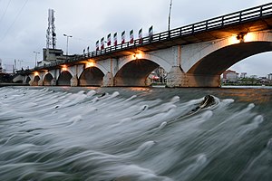
Cheshmeh Kileh River
Distance: Approx. 991 meters
Latitude and longitude: 36.8208,50.8834
The Cheshmeh Kileh River is located in northern Iran. It flows into the Caspian Sea at Tonekabon city. Its headwaters comprise two forested valleys, Do-Hezar ("Two Rivers") valley and Se-Hezar ("Three Rivers") valley, both on the northern slopes of the Alborz mountain range.
Weather in this IP's area
overcast clouds
6 Celsius
5 Celsius
6 Celsius
6 Celsius
1031 hPa
70 %
1031 hPa
1020 hPa
10000 meters
1.76 m/s
1.49 m/s
347 degree
88 %