199.96.155.101 - IP Lookup: Free IP Address Lookup, Postal Code Lookup, IP Location Lookup, IP ASN, Public IP
Country:
Region:
City:
Location:
Time Zone:
Postal Code:
IP information under different IP Channel
ip-api
Country
Region
City
ASN
Time Zone
ISP
Blacklist
Proxy
Latitude
Longitude
Postal
Route
Luminati
Country
Region
oh
City
cleveland
ASN
Time Zone
America/New_York
ISP
GEOSTAR
Latitude
Longitude
Postal
IPinfo
Country
Region
City
ASN
Time Zone
ISP
Blacklist
Proxy
Latitude
Longitude
Postal
Route
IP2Location
199.96.155.101Country
Region
ohio
City
westerville
Time Zone
America/New_York
ISP
Language
User-Agent
Latitude
Longitude
Postal
db-ip
Country
Region
City
ASN
Time Zone
ISP
Blacklist
Proxy
Latitude
Longitude
Postal
Route
ipdata
Country
Region
City
ASN
Time Zone
ISP
Blacklist
Proxy
Latitude
Longitude
Postal
Route
Popular places and events near this IP address

Huber Ridge, Ohio
Census-designated place in Ohio, United States
Distance: Approx. 2201 meters
Latitude and longitude: 40.09111111,-82.91722222
Huber Ridge is a census-designated place (CDP) in Blendon Township, Franklin County, Ohio, United States. The population was 4,940 at the 2020 census.
Westerville, Ohio
City in Ohio, United States
Distance: Approx. 2717 meters
Latitude and longitude: 40.13055556,-82.92277778
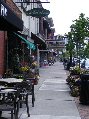
Westerville is a city in Franklin and Delaware counties in the U.S. state of Ohio. A northeastern suburb of Columbus as well as the home of Otterbein University, the population was 39,190 at the 2020 census. Westerville was once known as "The Dry Capital of the World" for its strict laws prohibiting sales of alcohol and for being the home of the Anti-Saloon League, one of the driving forces behind Prohibition at the beginning of the 20th century.
Hoover Dam (Ohio)
Dam in Blendon Township, near Westerville
Distance: Approx. 2170 meters
Latitude and longitude: 40.10805556,-82.88166667
Hoover Dam, in Blendon Township, near Westerville, Ohio, dams the Big Walnut Creek to form the Hoover Memorial Reservoir. This reservoir is a major water source for the city of Columbus, Ohio. It holds 20.8 billion US gallons (79,000,000 m3) of water and has a surface area of 3,272 acres (13.24 km2), or about five square miles.

Inniswood Metro Gardens
Distance: Approx. 2004 meters
Latitude and longitude: 40.12361111,-82.92138889
The Inniswood Metro Gardens (123 acres), is a botanical garden and nature preserve located at 940 South Hempstead Road in Westerville, Ohio. It is open daily from 7 am until 7pm (9pm in the summer) without an admission fee. It is part of the Metro Parks system of Columbus, Ohio.
Westerville North High School
Public, coeducational high school in Westerville, , Ohio, United States
Distance: Approx. 2738 meters
Latitude and longitude: 40.13277778,-82.8975
Westerville North High School is a public high school in Westerville, Ohio in Delaware County, Ohio. It is one of three high schools in the Westerville City School District. The school's current principal is Kurt Yancey.
Westerville City School District
School district in Ohio
Distance: Approx. 2004 meters
Latitude and longitude: 40.12361111,-82.92138889
Westerville City Schools serves Westerville, Minerva Park, Blendon Township, portions of Columbus, and other nearby rural areas. Though the district is situated in northern Franklin County, it also serves much of Genoa Township in southern Delaware County. The district is the 12th largest in Ohio.
Westerville South High School
Public high school in Westerville, , Ohio, United States
Distance: Approx. 1620 meters
Latitude and longitude: 40.11782,-82.92252
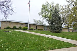
Westerville South High School is a public high school located in Westerville, Ohio, northeast of Columbus, Ohio. Originally Westerville High School, it is the oldest of the three high schools in the Westerville City School District. It serves most of southern Westerville, as well as much of the portion of Columbus served by Westerville City Schools.

Westerville Public Library
Public library in Ohio
Distance: Approx. 2448 meters
Latitude and longitude: 40.122837,-82.929756
The Westerville Public Library is a public library that serves the community of Westerville, Ohio, a suburb of Columbus, Ohio. As a school district library, its geographic boundaries are defined by the Westerville City School District which is located in both Franklin County and Delaware County. All Ohio residents can apply for a Westerville Public Library card.

Central College Presbyterian Church
Historic church in Ohio, United States
Distance: Approx. 1824 meters
Latitude and longitude: 40.09972222,-82.88972222
Central College Presbyterian Church is a historic Presbyterian church building in Westerville, Ohio. The Romanesque style building was started in 1870 and was added to the National Register of Historic Places in 1980.

Presbyterian Parsonage (Westerville, Ohio)
United States historic place
Distance: Approx. 1840 meters
Latitude and longitude: 40.10111111,-82.88833333
The Presbyterian Parsonage is a historic parsonage in the Central College neighborhood of Westerville, Ohio, United States. Constructed in the 1840s, when Central College was a separate community, it has been named a historic site. The parsonage is an aluminum-sided structure, two stories tall with a multi-level gabled roof.

Westerville High School-Vine Street School
United States historic place
Distance: Approx. 2720 meters
Latitude and longitude: 40.127259,-82.928762
The Westerville High School - Vine Street School is a historic school in Westerville, Ohio. It was built in 1896 by the Columbus architecture firm of Yost and Packard. The high school is an example of Romanesque Revival architecture.

Gideon Hart House
Historic house in Ohio, United States
Distance: Approx. 795 meters
Latitude and longitude: 40.10888889,-82.89777778
The Gideon Hart House is the oldest home in Westerville, Ohio, United States. Built in 1820, the home is listed on the National Register of Historic Places. Located at 636 S. Hempstead Road, it was originally built by Gideon Hart on land awarded to his father for service in the Revolutionary War.
Weather in this IP's area
snow
-3 Celsius
-10 Celsius
-5 Celsius
-3 Celsius
1011 hPa
83 %
1011 hPa
978 hPa
2816 meters
8.23 m/s
12.86 m/s
20 degree
100 %

