199.91.254.24 - IP Lookup: Free IP Address Lookup, Postal Code Lookup, IP Location Lookup, IP ASN, Public IP
Country:
Region:
City:
Location:
Time Zone:
Postal Code:
IP information under different IP Channel
ip-api
Country
Region
City
ASN
Time Zone
ISP
Blacklist
Proxy
Latitude
Longitude
Postal
Route
Luminati
Country
Region
on
City
kitchener
ASN
Time Zone
America/Toronto
ISP
MEGAWIRE
Latitude
Longitude
Postal
IPinfo
Country
Region
City
ASN
Time Zone
ISP
Blacklist
Proxy
Latitude
Longitude
Postal
Route
IP2Location
199.91.254.24Country
Region
ontario
City
waterloo
Time Zone
America/Toronto
ISP
Language
User-Agent
Latitude
Longitude
Postal
db-ip
Country
Region
City
ASN
Time Zone
ISP
Blacklist
Proxy
Latitude
Longitude
Postal
Route
ipdata
Country
Region
City
ASN
Time Zone
ISP
Blacklist
Proxy
Latitude
Longitude
Postal
Route
Popular places and events near this IP address

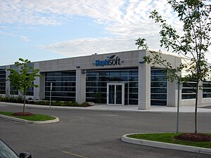
Waterloo Maple
Software company in Canada
Distance: Approx. 1249 meters
Latitude and longitude: 43.506,-80.5478
Waterloo Maple Inc. is a Canadian software company, headquartered in Waterloo, Ontario. It operates under the trade name Maplesoft.

Waterloo (federal electoral district)
Federal electoral district in Ontario, Canada
Distance: Approx. 2477 meters
Latitude and longitude: 43.48,-80.52
Waterloo is a federal electoral district in the Waterloo Region of Ontario, Canada, that has been used in the House of Commons of Canada from since 1968 (from 1973 to 1976, it was known as Waterloo—Cambridge). Between 1997 and 2015, the riding was known as Kitchener—Waterloo.

St. David Catholic Secondary School
Catholic (separate board) school in Waterloo, Ontario, Canada
Distance: Approx. 1730 meters
Latitude and longitude: 43.4843,-80.5294
St. David Catholic Secondary School, established in 1965, is a Roman Catholic high school instructing students from grades 9 to 12. St.

Waterloo Collegiate Institute
Public school in Waterloo, Ontario, Canada
Distance: Approx. 2270 meters
Latitude and longitude: 43.4792,-80.53
Waterloo Collegiate Institute (WCI) is a secondary school in Waterloo, Ontario, Canada. The school is run by the Waterloo Region District School Board. During the 2019–2020 school year, 1,475 students were enrolled at the school.

Conestoga Mall (Waterloo, Ontario)
Shopping mall in Waterloo, Ontario
Distance: Approx. 696 meters
Latitude and longitude: 43.49815833,-80.52700556
Conestoga Mall is a shopping mall located at 550 King Street North in Waterloo, Ontario, Canada. Located at King Street's interchange with the Conestoga Parkway, it is the largest shopping centre in Waterloo, and third-largest in Waterloo Region. The mall is owned and operated by Primaris REIT. Conestoga Mall has over 130 stores and services.
CKMS-FM
Community radio station in Waterloo, Ontario
Distance: Approx. 1944 meters
Latitude and longitude: 43.48333333,-80.54555556
CKMS-FM (branded as Radio Waterloo) is a Canadian community radio station, broadcasting at 102.7 FM in Waterloo, Ontario.

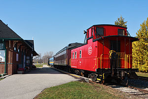
Waterloo Central Railway
Distance: Approx. 2324 meters
Latitude and longitude: 43.5159,-80.552768
The Waterloo Central Railway (WCR) is a non-profit heritage railway owned and operated by the Southern Ontario Locomotive Restoration Society (SOLRS). In May 2007, SOLRS received joint approval from the Region of Waterloo and the City of Waterloo to run trains from Waterloo to St. Jacobs and potentially as far north as Elmira.

Kitchener—Waterloo (provincial electoral district)
Provincial electoral district in Ontario, Canada
Distance: Approx. 2477 meters
Latitude and longitude: 43.48,-80.52
Kitchener—Waterloo was a provincial electoral district in Ontario, Canada, that was represented in the Legislative Assembly of Ontario from 1999 to 2018. Its population in 2006 was 126,742. The riding was created in 1996 from parts of Waterloo North, Kitchener—Wilmot and Kitchener.

St. Jacobs Farmers' Market
Market in Woolwich, Ontario, Canada
Distance: Approx. 2025 meters
Latitude and longitude: 43.5114,-80.5541
St. Jacobs Farmers' Market is a farmers' market and flea market in Woolwich, Ontario, Canada. It is located to the south of King Street North, to the east of Weber Street North, and to the west of the railway tracks.

Northfield station (Waterloo)
Light rail station in Waterloo, Ontario
Distance: Approx. 662 meters
Latitude and longitude: 43.49736,-80.5433
Northfield is a stop on the Region of Waterloo's Ion rapid transit system. It is located on Northfield Drive in Waterloo, between Parkside Drive and the Conestoga Parkway, at the existing railway corridor. It opened on June 21, 2019.

Research and Technology station
Light rail station in Waterloo, Ontario
Distance: Approx. 2137 meters
Latitude and longitude: 43.48136,-80.54527
Research and Technology is a stop on the Region of Waterloo's Ion rapid transit system. It is located on the Waterloo Spur rail line in Waterloo, between Bearinger Road and Columbia Street, near a prominent bend in Wes Graham Way. It opened in 2019, and it serves its namesake, the David Johnston Research and Technology Park, to the west, and the industrial lands along Philip Street to the east (via a pedestrian pathway).

Waterloo (provincial electoral district)
Provincial electoral district in Ontario, Canada
Distance: Approx. 2477 meters
Latitude and longitude: 43.48,-80.52
Waterloo is a provincial electoral district in the Waterloo Region of Ontario, Canada that is represented in the Legislative Assembly of Ontario.
Weather in this IP's area
light snow
-6 Celsius
-13 Celsius
-7 Celsius
-5 Celsius
1019 hPa
89 %
1019 hPa
976 hPa
10000 meters
6.69 m/s
270 degree
100 %