199.8.46.116 - IP Lookup: Free IP Address Lookup, Postal Code Lookup, IP Location Lookup, IP ASN, Public IP
Country:
Region:
City:
Location:
Time Zone:
Postal Code:
IP information under different IP Channel
ip-api
Country
Region
City
ASN
Time Zone
ISP
Blacklist
Proxy
Latitude
Longitude
Postal
Route
Luminati
Country
Region
in
City
northmanchester
ASN
Time Zone
America/Indiana/Indianapolis
ISP
ILIGHT-NET
Latitude
Longitude
Postal
IPinfo
Country
Region
City
ASN
Time Zone
ISP
Blacklist
Proxy
Latitude
Longitude
Postal
Route
IP2Location
199.8.46.116Country
Region
indiana
City
north manchester
Time Zone
America/Indiana/Indianapolis
ISP
Language
User-Agent
Latitude
Longitude
Postal
db-ip
Country
Region
City
ASN
Time Zone
ISP
Blacklist
Proxy
Latitude
Longitude
Postal
Route
ipdata
Country
Region
City
ASN
Time Zone
ISP
Blacklist
Proxy
Latitude
Longitude
Postal
Route
Popular places and events near this IP address

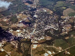
North Manchester, Indiana
Town in Indiana, United States
Distance: Approx. 459 meters
Latitude and longitude: 41.00111111,-85.77611111
North Manchester is a town in Chester Township, Wabash County, in the U.S. state of Indiana. The population was 5,273 at the 2020 census.
Manchester University (Indiana)
Brethren university in North Manchester, Indiana, US
Distance: Approx. 1155 meters
Latitude and longitude: 41.01111111,-85.7625
Manchester University (formerly Manchester College) is a private liberal arts university associated with the Church of the Brethren and two locations, a residential campus in North Manchester, Indiana, and a second location in Fort Wayne, Indiana, which hosts the university's doctorate programs in pharmacy; master's programs in pharmacogenomics, athletic training, and nutrition and nutrigenomics; and an accelerated second degree program in nursing. Total enrollment is approximately 1,200 students.
Manchester High School (Indiana)
Public high school in North Manchester, Wabash County, Indiana, United States
Distance: Approx. 533 meters
Latitude and longitude: 41.009374,-85.772688
Manchester Junior-Senior High School is a public high school located in North Manchester, Indiana.

Lentz House (Hotel Sheller)
United States historic place
Distance: Approx. 602 meters
Latitude and longitude: 41.00027778,-85.76888889
Lentz House (Hotel Sheller) is a historic hotel located at North Manchester, Wabash County, Indiana, USA. It was built in 1881 and is a 2+1⁄2-story, rectangular, Second Empire style brick building. The third story was added in 1896 and attached to the main building is a two-story frame wing built in 1847. It has a mansard roof with dormers and a wraparound porch.: 2 It was listed on the National Register of Historic Places in 1982.

Thomas R. Marshall School
United States historic place
Distance: Approx. 902 meters
Latitude and longitude: 41.00527778,-85.7625
Thomas R. Marshall School, also known as the Town Life Center, is a historic school building located at North Manchester, Wabash County, Indiana. It was built in 1929, and is a two-story, rectangular, Beaux-Arts style multicolored brick building. It has a projecting center entrance bay with a recessed entrance behind a shallow barrel vault.

North Manchester Public Library
United States historic place
Distance: Approx. 580 meters
Latitude and longitude: 40.99944444,-85.77222222
Old North Manchester Public Library is a historic Carnegie library building located at North Manchester, Wabash County, Indiana. It was built in 1912, and is a two-story, rectangular, American Craftsman style dark red brick building over a basement. It has a low-pitched side gable roof of red Spanish tile and wide overhanging eaves.

Noftzger-Adams House
Historic house in Indiana, United States
Distance: Approx. 462 meters
Latitude and longitude: 41.00138889,-85.76972222
Noftzger-Adams House is a historic home located at North Manchester, Wabash County, Indiana. It was built in 1880, and is a two-story, brick dwelling with Second Empire and Gothic Revival style design elements. It sits on a stone block foundation and has a mansard roof with decorative brackets.

North Manchester Covered Bridge
United States historic place
Distance: Approx. 1181 meters
Latitude and longitude: 40.99583333,-85.76527778
North Manchester Covered Bridge is a historic Smith Type 4 Truss covered bridge located at North Manchester, Wabash County, Indiana. It was built in 1872 by the Smith Bridge Company of Toledo, Ohio and crosses the Eel River. It measures 150 feet long and is 18 feet wide.

North Manchester Historic District
Historic district in Indiana, United States
Distance: Approx. 607 meters
Latitude and longitude: 40.99944444,-85.77083333
North Manchester Historic District is a national historic district located at North Manchester, Wabash County, Indiana. It encompasses 159 contributing buildings in the central business district and surrounding residential sections of North Manchester. It developed between about 1870 and 1938, and includes representative examples of Greek Revival, Gothic Revival, Italianate, Queen Anne, and Bungalow / American Craftsman style architecture.

Manchester College Historic District
Historic district in Indiana, United States
Distance: Approx. 1117 meters
Latitude and longitude: 41.01055556,-85.7625
Manchester College Historic District was a national historic district located at North Manchester, Wabash County, Indiana. It encompassed three contributing buildings and one contributing object on the campus of Manchester University. They are the Administration Building, Ikenberry Hall, and Oakwood Hall.

Peabody Memorial Tower
Historic structure in New Manchester, Indiana, U.S.
Distance: Approx. 278 meters
Latitude and longitude: 41.00611111,-85.77583333
Peabody Memorial Tower, also known as the Singing Tower, is a historic structure located at North Manchester, Wabash County, Indiana. It was designed by architect Charles R. Weatherhogg and built in 1937. The structure consists of a cube shaped limestone mausoleum at the base topped by a brick and limestone carillon that reaches 110 feet tall.
Pony Creek (Indiana)
Stream in Indiana, U.S.
Distance: Approx. 1347 meters
Latitude and longitude: 40.9925,-85.77333333
Pony Creek is a stream in the U.S. state of Indiana. According to tradition, Pony Creek was named for pony thieves who operated near the creek.
Weather in this IP's area
scattered clouds
-2 Celsius
-8 Celsius
-3 Celsius
-2 Celsius
1022 hPa
74 %
1022 hPa
992 hPa
10000 meters
6.3 m/s
10.7 m/s
278 degree
32 %