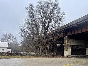
Country:
Region:
City:
Latitude and Longitude:
Time Zone:
Postal Code:
IP information under different IP Channel
ip-api
Country
Region
City
ASN
Time Zone
ISP
Blacklist
Proxy
Latitude
Longitude
Postal
Route
Luminati
Country
Region
ga
City
villarica
ASN
Time Zone
America/New_York
ISP
FOGODC
Latitude
Longitude
Postal
IPinfo
Country
Region
City
ASN
Time Zone
ISP
Blacklist
Proxy
Latitude
Longitude
Postal
Route
db-ip
Country
Region
City
ASN
Time Zone
ISP
Blacklist
Proxy
Latitude
Longitude
Postal
Route
ipdata
Country
Region
City
ASN
Time Zone
ISP
Blacklist
Proxy
Latitude
Longitude
Postal
Route
Popular places and events near this IP address
Bridgeport, Pennsylvania
Borough in Pennsylvania, United States
Distance: Approx. 227 meters
Latitude and longitude: 40.10388889,-75.34305556
Bridgeport is a borough in Montgomery County, Pennsylvania, United States, 18 mi (29 km) north of Philadelphia on the Schuylkill River. Former industries included paper, flour, cotton, woolen mills, steel works, and brickyards. Bridgeport is 6 mi (9.7 km) east of Valley Forge, Pennsylvania.

Norristown, Pennsylvania
Home rule municipality in Pennsylvania, United States
Distance: Approx. 1686 meters
Latitude and longitude: 40.12,-75.34166667
Norristown is a municipality with home rule status and the county seat of Montgomery County, Pennsylvania, United States, in the Philadelphia metropolitan area. Located along the Schuylkill River, approximately 6 miles (9.7 km) from Philadelphia, Norristown had a population of 35,748 as of the 2020 census. It is the fourth-most populous municipality in the county and second-most populous borough in Pennsylvania.

Norristown Transportation Center
Passenger transportation hub in Norristown, Pennsylvania
Distance: Approx. 893 meters
Latitude and longitude: 40.113125,-75.345054
Norristown Transportation Center (soon to be known as Norristown Transit Center) is a two-level multimodal public transportation regional hub located in Norristown, Pennsylvania and operated by SEPTA. It opened in 1989, replacing the older Norristown High Speed Line (Route 100) terminus one block away at Main and Swede Streets, and integrated the former Reading Company's DeKalb Street Norristown railroad station (built 1933) into its structure. A plaque embedded in the sidewalk between the bus lane and Lafayette Street commemorates the location of one of the columns of the dismantled segment of the Philadelphia and Western Railroad (P&W) trestle.

Main Street station (SEPTA)
Distance: Approx. 1360 meters
Latitude and longitude: 40.117,-75.3488
Main Street station is a SEPTA Regional Rail station in Norristown, Pennsylvania, United States. It serves the Manayunk/Norristown Line. It is one of the two stations on the short electrified branch to Elm Street in Norristown.

DeKalb Street station
Rapid transit station in Pennsylvania
Distance: Approx. 901 meters
Latitude and longitude: 40.0989,-75.352
DeKalb Street station, formerly known as King Manor station, is a SEPTA rapid transit station in Bridgeport, Pennsylvania. It serves the Norristown High Speed Line (Route 100) and is located on Ford Street near DeKalb Street (U.S. Route 202), although SEPTA gives the address as Ford Street and Crooked Lane. All trains stop at DeKalb Street.

Bridgeport station (SEPTA)
Rapid transit station in Pennsylvania
Distance: Approx. 256 meters
Latitude and longitude: 40.1049,-75.3482
Bridgeport station is a SEPTA rapid transit station in Bridgeport, Pennsylvania. It serves the Norristown High Speed Line (Route 100). The station is located on Sixth Street near DeKalb Street (US 202), although SEPTA's official website gives the address as being near 5th and Merion Streets.

Barbadoes Island (Pennsylvania)
Distance: Approx. 1348 meters
Latitude and longitude: 40.1135,-75.3566
Barbadoes Island is an island in the Schuylkill River in West Norriton Township, south of Norristown in Montgomery County, Pennsylvania, United States. Southbound U.S. Route 202 and various localized rail lines cross over the eastern tip of the island. It is about 90 acres (36 ha) in size.

St. George Coptic Orthodox Church (Philadelphia)
Church in Pennsylvania, United States
Distance: Approx. 1116 meters
Latitude and longitude: 40.1148,-75.3419
St George Coptic Orthodox Church (Coptic: Ϯⲉⲕ'ⲕⲗⲏⲥⲓⲁ ⳿ⲛⲣⲉⲙ⳿ⲛⲭⲏⲙⲓ ⳿ⲛⲟⲣⲑⲟⲇⲟⲝⲟⲥ ⳿ⲛⲧⲉ ⲫⲏⲉⲑⲟⲩⲁⲃ Ⲅⲉ⳿ⲱⲣⲅⲓⲟⲥ // transliteration: ti.eklyseya en.remenkimi en.orthodoxos ente fi.ethowab Gewargios) is one of the oldest Coptic Orthodox churches established in North America. It is one of over 200 Coptic Orthodox Churches in the US. The church belongs to Coptic Diocese of Pennsylvania, Maryland, Delaware & West Virginia.

Globe Knitting Mills
Former mill in Norristown, Pennsylvania
Distance: Approx. 1332 meters
Latitude and longitude: 40.11111111,-75.33166667
Globe Knitting Mills, also known as the Rambo & Regar Globe Knitting Mills, are two historic textile mill buildings located at Norristown, Montgomery County, Pennsylvania. They were built in 1898, and were referred to as the "Main (Knitting) Building" and the "Oxidizing Building / Dye House." They are constructed of red brick with heavy timber framing and Italianate style design elements. The main building is three stories tall and rectangular in plan.

West Norristown Historic District
Historic district in Pennsylvania, United States
Distance: Approx. 1946 meters
Latitude and longitude: 40.12166667,-75.3525
The West Norristown Historic District is a national historic district that is located in Norristown, Montgomery County, Pennsylvania. It was added to the National Register of Historic Places in 1984.

Central Norristown Historic District
Historic district in Pennsylvania, United States
Distance: Approx. 1494 meters
Latitude and longitude: 40.11777778,-75.33944444
Central Norristown Historic District is a national historic district located in Norristown, Montgomery County, Pennsylvania. It encompasses approximately 1,900 buildings in the central business district and surrounding residential areas of Norristown. Notable buildings include the Montgomery County Courthouse, Philadelphia and Western Railroad Station (1931), Scheidt Brewery, Montgomery County Jail, Y.M.C.A, Odd Fellows Hall, and a variety of workers' housing and imposing dwellings.

Schuylkill River Bridge
Bridge
Distance: Approx. 1735 meters
Latitude and longitude: 40.10305556,-75.325
The Schuylkill River Bridge (also known as the Diamond Run Viaduct) is a bridge that carries the Pennsylvania Turnpike across the Schuylkill River. This section of the Pennsylvania Turnpike, which is located between two major interchanges, became "the most heavily traveled four-lane section of the turnpike" following its opening, according to the Pennsylvania Turnpike Commission.
Weather in this IP's area
scattered clouds
17 Celsius
17 Celsius
16 Celsius
19 Celsius
1018 hPa
82 %
1018 hPa
1015 hPa
10000 meters
6.69 m/s
210 degree
40 %
06:36:56
16:53:09
