199.66.68.87 - IP Lookup: Free IP Address Lookup, Postal Code Lookup, IP Location Lookup, IP ASN, Public IP
Country:
Region:
City:
Location:
Time Zone:
Postal Code:
IP information under different IP Channel
ip-api
Country
Region
City
ASN
Time Zone
ISP
Blacklist
Proxy
Latitude
Longitude
Postal
Route
Luminati
Country
Region
il
City
plainfield
ASN
Time Zone
America/Chicago
ISP
AS-CMN
Latitude
Longitude
Postal
IPinfo
Country
Region
City
ASN
Time Zone
ISP
Blacklist
Proxy
Latitude
Longitude
Postal
Route
IP2Location
199.66.68.87Country
Region
indiana
City
greenwood
Time Zone
America/Indiana/Indianapolis
ISP
Language
User-Agent
Latitude
Longitude
Postal
db-ip
Country
Region
City
ASN
Time Zone
ISP
Blacklist
Proxy
Latitude
Longitude
Postal
Route
ipdata
Country
Region
City
ASN
Time Zone
ISP
Blacklist
Proxy
Latitude
Longitude
Postal
Route
Popular places and events near this IP address

Greenwood, Indiana
City in Indiana, United States
Distance: Approx. 1975 meters
Latitude and longitude: 39.61138889,-86.11805556
Greenwood is a city in Johnson County, Indiana, United States. The population was 63,830 at the 2020 Census. Greenwood is located southeast of central Indianapolis between Indiana State Road 37 and Interstate 65.

New Whiteland, Indiana
Town in Indiana, United States
Distance: Approx. 5022 meters
Latitude and longitude: 39.56166667,-86.09944444
New Whiteland is a town in Pleasant Township, Johnson County, Indiana, United States. The population was 5,550 at the 2020 census.

Greenwood Park Mall
Shopping mall in Indiana, United States
Distance: Approx. 4012 meters
Latitude and longitude: 39.6329,-86.1205
Greenwood Park Mall is a shopping mall located in Greenwood, Indiana. The mall is the hub of the retail and commercial corridor along U.S. Highway 31 on the south side of the Indianapolis Metropolitan Area. As with several other central Indiana shopping centers, Greenwood Park Mall is owned and operated by Simon Property Group.

Pleasant Township, Johnson County, Indiana
Township in Indiana, United States
Distance: Approx. 4289 meters
Latitude and longitude: 39.58444444,-86.08694444
Pleasant Township is one of nine townships in Johnson County, Indiana. As of the 2010 census, its population was 52,957 and it contained 22,355 housing units. Pleasant Township was organized in 1829.
Critchfield, Indiana
Unincorporated community in Indiana, United States
Distance: Approx. 2560 meters
Latitude and longitude: 39.60027778,-86.16333333
Critchfield is an unincorporated community in White River Township, Johnson County, Indiana.
Greenwood Community High School
Public high school in Greenwood, Indiana, United States
Distance: Approx. 1481 meters
Latitude and longitude: 39.60290833,-86.11740278
Greenwood Community High School is a public high school located in Greenwood, Indiana. It is located in a southern suburb of Indianapolis, Indiana.
Indy South Greenwood Airport
Airport in Greenwood, Indiana
Distance: Approx. 5081 meters
Latitude and longitude: 39.6275,-86.08805556
Indy South Greenwood Airport (ICAO: KHFY, FAA LID: HFY) (previously Greenwood Municipal Airport) is a city-owned public-use airport in Greenwood, a city in Johnson County, Indiana, United States. It is 10 miles (16 km) southeast of Downtown Indianapolis. The airport was founded in September 1947 and is primarily used for general aviation.
Frances, Indiana
Unincorporated community in Indiana, U.S.
Distance: Approx. 3141 meters
Latitude and longitude: 39.60583333,-86.16888889
Frances is an unincorporated community in Johnson County, Indiana, in the United States. According to one source, Frances was the name of wife of a railroad man.
Stones Crossing, Indiana
Unincorporated community in Indiana, U.S.
Distance: Approx. 3167 meters
Latitude and longitude: 39.57777778,-86.15916667
Stones Crossing is an unincorporated community in Johnson County, Indiana, in the United States.
Greenwood Christian Academy
Private school in Greenwood, Johnson County, Indiana, United States
Distance: Approx. 1832 meters
Latitude and longitude: 39.584135,-86.122731
Greenwood Christian Academy is a private Christian school with grades PreK through high school located in Greenwood, Indiana. Currently, more than 800 students are enrolled at the school's two campuses.

Greenwood Commercial Historic District
Historic district in Indiana, United States
Distance: Approx. 2684 meters
Latitude and longitude: 39.61388889,-86.10972222
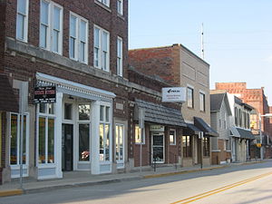
Greenwood Commercial Historic District is a national historic district located at Greenwood, Johnson County, Indiana. The district encompasses 25 contributing buildings in the central business district of Greenwood. It developed between about 1860 and 1935, and includes notable examples of Italianate, Romanesque, and Classical Revival style architecture.

Greenwood Park Mall shooting
Shooting in Greenwood, Indiana
Distance: Approx. 4012 meters
Latitude and longitude: 39.6329,-86.1205
On July 17, 2022, a mass shooting occurred at the Greenwood Park Mall in Greenwood, Indiana, United States. The shooting began at 5:56 p.m. EDT (UTC−04:00) and lasted less than one minute.
Weather in this IP's area
overcast clouds
7 Celsius
3 Celsius
5 Celsius
7 Celsius
1007 hPa
93 %
1007 hPa
978 hPa
10000 meters
5.66 m/s
260 degree
100 %