199.65.240.132 - IP Lookup: Free IP Address Lookup, Postal Code Lookup, IP Location Lookup, IP ASN, Public IP
Country:
 USA
USARegion:
City:
Location:
Time Zone:
Postal Code:
ISP:
ASN:
language:
User-Agent:
Proxy IP:
Blacklist:
IP information under different IP Channel
ip-api
Country
Region
City
ASN
Time Zone
ISP
Blacklist
Proxy
Latitude
Longitude
Postal
Route
db-ip
Country
Region
City
ASN
Time Zone
ISP
Blacklist
Proxy
Latitude
Longitude
Postal
Route
IPinfo
Country
Region
City
ASN
Time Zone
ISP
Blacklist
Proxy
Latitude
Longitude
Postal
Route
IP2Location
199.65.240.132Country
usRegion
new jersey
City
skillman
Time Zone
America/New_York
ISP
Language
User-Agent
Latitude
Longitude
Postal
ipdata
Country
Region
City
ASN
Time Zone
ISP
Blacklist
Proxy
Latitude
Longitude
Postal
Route
Popular places and events near this IP address

Montgomery Township, New Jersey
Township in Somerset County, New Jersey, US
Distance: Approx. 2214 meters
Latitude and longitude: 40.426124,-74.678446
Montgomery Township is a township in southern Somerset County, in the central part of the U.S. state of New Jersey. It is located in the New York Metropolitan Area. As of the 2020 United States census, the township's population was 23,690, an increase of 1,436 (+6.5%) from the 2010 census count of 22,254, which in turn reflected an increase of 4,773 (+27.3%) from the 17,481 counted in the 2000 census.

Montgomery Township School District
School district Somerset County, New Jersey, US
Distance: Approx. 871 meters
Latitude and longitude: 40.417516,-74.702407
The Montgomery Township School District is a comprehensive public school district, consisting of five school facilities, that serves students in pre-kindergarten through twelfth grade from Montgomery Township and Rocky Hill, in Somerset County, in the U.S. state of New Jersey. Montgomery Township had been one of the fastest-growing school districts in New Jersey. In September 1992, the K-12 enrollment was 1,590 compared to 4,924 in September 2005, tripling in just more than a decade.
Blawenburg, New Jersey
Populated place in Somerset County, New Jersey, US
Distance: Approx. 998 meters
Latitude and longitude: 40.402646,-74.698566
Blawenburg is an unincorporated community and census-designated place (CDP) located within Montgomery Township, in Somerset County, in the U.S. state of New Jersey. As of the 2010 United States Census, the CDP's population was 280. It is located at the juncture of two large roads, CR 518 and CR 601.
Montgomery High School (New Jersey)
High school in Somerset County, New Jersey, US
Distance: Approx. 855 meters
Latitude and longitude: 40.417368,-74.702353
Montgomery High School is a four-year comprehensive public high school located in the Skillman section of Montgomery Township, in Somerset County, in the U.S. state of New Jersey, serving students in ninth through twelfth grades as the lone secondary school of the Montgomery Township School District. As of the 2023–24 school year, the school had an enrollment of 1,630 students and 120.2 classroom teachers (on an FTE basis), for a student–teacher ratio of 13.6:1. There were 52 students (3.2% of enrollment) eligible for free lunch and 18 (1.1% of students) eligible for reduced-cost lunch.

Skillman, New Jersey
Populated place in Somerset County, New Jersey, US
Distance: Approx. 2324 meters
Latitude and longitude: 40.428191,-74.712293
Skillman is an unincorporated community and census-designated place (CDP) located within Montgomery Township, in Somerset County, in the U.S. state of New Jersey. As of the 2010 United States Census, the CDP's population was 242. The area is served as United States Postal Service ZIP Code 08558.

North Princeton Developmental Center
Distance: Approx. 965 meters
Latitude and longitude: 40.4197,-74.6927
The North Princeton Developmental Center, formerly known as the New Jersey State Village for Epileptics, was a medical facility within Montgomery Township, Somerset County, New Jersey. The facility was home to a variety of mental health institutions throughout the years. In 2011, the former self-sustaining mental health village was slated for demolition to make space for a proposed county park.

Reformed Dutch Church of Blawenburg
Historic site in Somerset County, New Jersey
Distance: Approx. 434 meters
Latitude and longitude: 40.40833333,-74.69916667
Reformed Dutch Church of Blawenburg, now known as Blawenburg Reformed Church, is a historic church at 424 County Route 518 in the Blawenburg section of Montgomery Township in Somerset County, New Jersey. The Blawenburg Reformed Church Cemetery is located on County Route 601 near CR 518. The church was added to the National Register of Historic Places on July 22, 1985 for its significance in architecture and religion.
Rock Brook
River in the United States
Distance: Approx. 1922 meters
Latitude and longitude: 40.41083333,-74.67333333
Rock Brook is a tributary of Beden Brook in Somerset County, New Jersey in the United States.

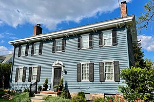
Maplewood (Montgomery Township, New Jersey)
Historic house in New Jersey, United States
Distance: Approx. 1063 meters
Latitude and longitude: 40.41388889,-74.68388889
Maplewood, also known as the David C. Voorhees House or the John A. Voorhees House, was a historic building overlooking Burnt Hill Road at Rock Brook in Montgomery Township, Somerset County, New Jersey. It was added to the National Register of Historic Places on August 24, 2000. for its significance in architecture and health/medicine.
Deaths of John and Joyce Sheridan
Mysterious death of American couple
Distance: Approx. 2778 meters
Latitude and longitude: 40.42156,-74.66606
On September 28, 2014, John Sheridan, a former New Jersey Transportation Commissioner and health care executive, was found dead along with his wife Joyce in their home in Skillman, New Jersey, United States. The bodies were found in the house's master bedroom by firefighters responding to a fire emergency, with both exhibiting stab wounds. The case was initially believed by the Somerset County prosecutor's office to have been a murder-suicide and they wrote a public report to this effect.

Skillman Park
Distance: Approx. 583 meters
Latitude and longitude: 40.415,-74.691
Skillman Park is a public park in Skillman, part of Montgomery, Somerset County, New Jersey. It is operated by the Somerset County Park Commission. The park was opened in 2015.

Stoutsburg Sourland African American Museum
United States historic place
Distance: Approx. 2225 meters
Latitude and longitude: 40.41722222,-74.72111111
The Stoutsburg Sourland African American Museum (SSAAM) is a history museum located in the Skillman section of Montgomery Township, New Jersey, United States. The museum is located at the Mount Zion African Methodist Episcopal Church, an African Methodist Episcopal church constructed in 1899. The church was added to the National Register of Historic Places on June 7, 2021.
Weather in this IP's area
scattered clouds
3 Celsius
-0 Celsius
2 Celsius
4 Celsius
1028 hPa
57 %
1028 hPa
1022 hPa
10000 meters
3.6 m/s
7.72 m/s
280 degree
40 %