199.59.210.62 - IP Lookup: Free IP Address Lookup, Postal Code Lookup, IP Location Lookup, IP ASN, Public IP
Country:
Region:
City:
Location:
Time Zone:
Postal Code:
ISP:
ASN:
language:
User-Agent:
Proxy IP:
Blacklist:
IP information under different IP Channel
ip-api
Country
Region
City
ASN
Time Zone
ISP
Blacklist
Proxy
Latitude
Longitude
Postal
Route
db-ip
Country
Region
City
ASN
Time Zone
ISP
Blacklist
Proxy
Latitude
Longitude
Postal
Route
IPinfo
Country
Region
City
ASN
Time Zone
ISP
Blacklist
Proxy
Latitude
Longitude
Postal
Route
IP2Location
199.59.210.62Country
Region
maryland
City
silver spring
Time Zone
America/New_York
ISP
Language
User-Agent
Latitude
Longitude
Postal
ipdata
Country
Region
City
ASN
Time Zone
ISP
Blacklist
Proxy
Latitude
Longitude
Postal
Route
Popular places and events near this IP address

Fairland, Maryland
Census-designated place in Maryland, United States
Distance: Approx. 3009 meters
Latitude and longitude: 39.08027778,-76.95277778
Fairland is a census-designated place and an unincorporated area in Montgomery County, Maryland, United States. It had a population of 25,396 per the 2020 census.
White Oak, Maryland
Census-designated place in Maryland, United States
Distance: Approx. 2974 meters
Latitude and longitude: 39.039832,-76.993032
White Oak is a census-designated place and unincorporated area in Montgomery County, Maryland, United States. It had a population of 16,347 in 2020. White Oak was known for its Naval Ordnance Laboratory, which was closed in 1994.

Calverton, Maryland
Census-designated place in Maryland, United States
Distance: Approx. 2931 meters
Latitude and longitude: 39.05777778,-76.94888889
Calverton is an unincorporated area and census-designated place located on the boundary between Montgomery and Prince George's counties, Maryland, in the United States. as of the 2020 census, it had a population of 17,316.
General Conference of Seventh-day Adventists
Governing organization of the Seventh-day Adventist Church
Distance: Approx. 1399 meters
Latitude and longitude: 39.06111111,-76.96611111
The General Conference of Seventh-day Adventists is the governing organization of the Seventh-day Adventist Church. Its headquarters is located in Silver Spring, Maryland and oversees the church in directing its various divisions and leadership, as well as doctrinal matters. The General Conference, which is overseen by an executive committee and an elected President of the General Conference, is the administrative head of the global church.

Springbrook High School
Public secondary school in Silver Spring, Maryland, United States
Distance: Approx. 2204 meters
Latitude and longitude: 39.05814167,-77.00541389
Springbrook High School is an American public high school, located in Montgomery County, Maryland, in the Washington, D.C. metropolitan area. It is located within the White Oak census-designated place, and has a Silver Spring mailing address. It is between the Colesville and White Oak communities.
Naval Ordnance Laboratory
Disestablished United States naval laboratory at White Oak, Maryland
Distance: Approx. 3034 meters
Latitude and longitude: 39.03777778,-76.97972222
The Naval Ordnance Laboratory (NOL) was a facility in the White Oak area of Montgomery County, Maryland. The location is now used as the headquarters of the U.S. Food and Drug Administration.
International Religious Liberty Association
Organization
Distance: Approx. 1399 meters
Latitude and longitude: 39.06111111,-76.96611111
The International Religious Liberty Association (IRLA) is a non-sectarian and non-political organization promoting religious freedom. It was originally organized by the Seventh-day Adventist Church leaders in 1893 to campaign for religious freedom for all when the danger of restrictions from blue laws became apparent. Its headquarters are in Silver Spring, Maryland in the United States.

Rachel Carson House (Colesville, Maryland)
Historic house in Maryland, United States
Distance: Approx. 2623 meters
Latitude and longitude: 39.04666667,-77.00055556
The Rachel Carson House is a historic house in Colesville, Maryland, an unincorporated area near Silver Spring, Maryland. Built in 1956, this typical suburban ranch-style house was where writer Rachel Carson wrote her classic work Silent Spring in 1962. The house was designated a National Historic Landmark in 1991 for its association with Carson.
Milimar
Historic house in Maryland, United States
Distance: Approx. 3220 meters
Latitude and longitude: 39.0675,-77.01861111
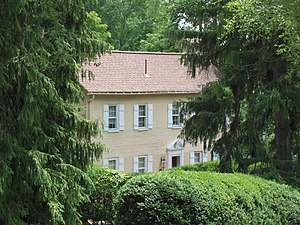
Milimar is a historic home located in Silver Spring, Montgomery County, Maryland, United States. Milimar is a 2+1⁄2-story brick house that is Georgian in style. The house is believed to have been built by Henry Lazenby II, a descendant of a family which came to Maryland at the very beginning of the 18th century.
Sherwood Forest, Montgomery County, Maryland
Unincorporated community in Maryland, U.S.
Distance: Approx. 3078 meters
Latitude and longitude: 39.07861111,-77.0125
Sherwood Forest is an unincorporated community in Montgomery County, Maryland, United States. It is roughly bounded by Randolph Road, Sherwood Forest Drive, Notley Road, the Intercounty Connector, and Northwest Branch Park.

Hypervelocity Wind Tunnel 9
Military unit
Distance: Approx. 2921 meters
Latitude and longitude: 39.04013889,-76.97069444
AEDC Hypervelocity Wind Tunnel 9 is a hypersonic wind tunnel owned by the United States Air Force and operated by National Aerospace Solutions The facility can generate high Mach numbers and high Reynolds for hypersonic ground testing and the validation of computational simulations for the Air Force and Department of Defense.
St. John the Baptist Catholic Church (Silver Spring, Maryland)
Church building in Silver Spring, Maryland, US
Distance: Approx. 1415 meters
Latitude and longitude: 39.058424,-76.995505
Saint John the Baptist Catholic Church is a parish of the Roman Catholic Church in Silver Spring, Maryland, United States. It was established by the Archdiocese of Washington in 1960, and is dedicated to John the Baptist.
Weather in this IP's area
clear sky
-7 Celsius
-14 Celsius
-8 Celsius
-6 Celsius
1028 hPa
62 %
1028 hPa
1015 hPa
10000 meters
7.72 m/s
11.32 m/s
290 degree


