199.58.99.194 - IP Lookup: Free IP Address Lookup, Postal Code Lookup, IP Location Lookup, IP ASN, Public IP
Country:
Region:
City:
Location:
Time Zone:
Postal Code:
IP information under different IP Channel
ip-api
Country
Region
City
ASN
Time Zone
ISP
Blacklist
Proxy
Latitude
Longitude
Postal
Route
Luminati
Country
Region
or
City
albany
ASN
Time Zone
America/Los_Angeles
ISP
ALYRICA
Latitude
Longitude
Postal
IPinfo
Country
Region
City
ASN
Time Zone
ISP
Blacklist
Proxy
Latitude
Longitude
Postal
Route
IP2Location
199.58.99.194Country
Region
oregon
City
albany
Time Zone
America/Los_Angeles
ISP
Language
User-Agent
Latitude
Longitude
Postal
db-ip
Country
Region
City
ASN
Time Zone
ISP
Blacklist
Proxy
Latitude
Longitude
Postal
Route
ipdata
Country
Region
City
ASN
Time Zone
ISP
Blacklist
Proxy
Latitude
Longitude
Postal
Route
Popular places and events near this IP address
Calapooia River
River in Oregon, United States
Distance: Approx. 420 meters
Latitude and longitude: 44.63888889,-123.11
The Calapooia River is an 80-mile (130 km) tributary of the Willamette River in the U.S. state of Oregon. The Calapooia flows generally northwest from its source in the Cascade Range near Tidbits Mountain. In its upper reaches, it passes through parts of the Willamette National Forest.
Albany Parks & Recreation
Distance: Approx. 158 meters
Latitude and longitude: 44.63525278,-123.10684444
The Albany Parks & Recreation is a city agency in Albany, Oregon, United States responsible for maintaining the local city parks as well as organizing cultural events. Its headquarters are at City Hall, 333 Broadalbin Street SW. One goal of the City of Albany is to have all residents live within 2 miles (3 km) of a park.

Thomas and Walter Monteith House
Historic house in Oregon, United States
Distance: Approx. 354 meters
Latitude and longitude: 44.63586111,-123.11027778
Thomas and Walter Monteith House, also known as the Monteith House Museum was the first frame house built in Albany, Oregon, United States. It was built by Walter and Thomas Monteith in 1848–1850. All the house's original boards are hand-hewn due to lack of availability of steam-powered buzzsaws at that time.

Albany station (Oregon)
Distance: Approx. 743 meters
Latitude and longitude: 44.63027778,-123.1025
Albany station is an Amtrak intercity rail station in Albany, Oregon, United States. It is served by the Amtrak Cascades and the Coast Starlight passenger trains, and is the westernmost Amtrak station. Albany station also serves as the hub for local transit.

Ellsworth Street Bridge
Bridge in Albany, Oregon
Distance: Approx. 317 meters
Latitude and longitude: 44.6393,-123.106635
The Ellsworth Street Bridge is a highway bridge that crosses the Willamette River in Albany, Oregon, United States. Built in 1925, the two-lane structure carries U.S. Route 20 eastbound traffic, with the adjacent Lyon Street Bridge carrying westbound traffic. The 1,090-foot-long (330 m) steel truss bridge was designed by Conde McCullough and opened in 1926.
United Presbyterian Church and Rectory (Albany, Oregon)
Historic church in Oregon, United States
Distance: Approx. 450 meters
Latitude and longitude: 44.63341667,-123.10958333
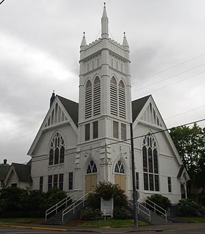
The Albany Presbyterian Church and Rectory, also known as Whitespires, is a historic church building in Albany, Oregon, United States. It was built in 1891 in the Carpenter Gothic style. It was listed on the National Register of Historic Places (NRHP) in 1979.
Albany Monteith Historic District
Historic district in Oregon, United States
Distance: Approx. 551 meters
Latitude and longitude: 44.63194444,-123.10861111
The Albany Monteith Historic District, also known as Monteith Historic District, in Albany, Oregon, United States, was listed on the National Register of Historic Places (NRHP) in 1980. It includes the Alfred Dawson House, which is separately listed on the NRHP. The district was expanded in 2008.

Lyon Street Bridge
Bridge in Albany, Oregon
Distance: Approx. 313 meters
Latitude and longitude: 44.63931,-123.1059
The Lyon Street Bridge is a highway bridge that crosses the Willamette River in Albany, Oregon, United States. Built in 1973, the two-lane structure carries US 20 westbound traffic, with the adjacent Ellsworth Street Bridge carrying eastbound traffic. The bridge connects Albany with North Albany and is a major link between Albany and Corvallis.

Hackleman Historic District
Historic district in Oregon, United States
Distance: Approx. 548 meters
Latitude and longitude: 44.63472222,-123.09944444
The Hackleman Historic District in Albany Oregon, was placed on the list of National Register of Historic Places (NRHP) in 1982. The district contains 228 historic properties within about a 28 city blocks area. The district was named after Abner Hackleman who came to Albany in 1845.
Linn County Courthouse (Oregon)
Distance: Approx. 238 meters
Latitude and longitude: 44.63447,-123.10686
The Linn County Courthouse is located at 300 SW 4th Avenue in Albany, Oregon, United States. In 1851, the Oregon Territorial Legislature passed an act establishing Albany as the county seat. The original county courthouse was erected in Albany in 1853 but was destroyed by fire in 1861.

Methodist Episcopal Church South (Albany, Oregon)
Historic church in Oregon, United States
Distance: Approx. 303 meters
Latitude and longitude: 44.63588889,-123.10216667
Methodist Episcopal Church South (Bethesda Heritage Church) is a historic church at 238 E. 3rd Street in Albany, Oregon. It was built circa 1875 and added to the National Register in 1979.

George Earle Chamberlain House (Albany, Oregon)
Historic house in Oregon, United States
Distance: Approx. 516 meters
Latitude and longitude: 44.632656,-123.102271
The George Earle Chamberlain House is a historic house in Albany, Oregon, United States. Governor George Earle Chamberlain's house was entered on the National Register of Historic Places in 1980.
Weather in this IP's area
moderate rain
7 Celsius
5 Celsius
6 Celsius
7 Celsius
1012 hPa
80 %
1012 hPa
1004 hPa
10000 meters
2.68 m/s
5.36 m/s
199 degree
100 %


