199.47.179.75 - IP Lookup: Free IP Address Lookup, Postal Code Lookup, IP Location Lookup, IP ASN, Public IP
Country:
Region:
City:
Location:
Time Zone:
Postal Code:
ISP:
ASN:
language:
User-Agent:
Proxy IP:
Blacklist:
IP information under different IP Channel
ip-api
Country
Region
City
ASN
Time Zone
ISP
Blacklist
Proxy
Latitude
Longitude
Postal
Route
db-ip
Country
Region
City
ASN
Time Zone
ISP
Blacklist
Proxy
Latitude
Longitude
Postal
Route
IPinfo
Country
Region
City
ASN
Time Zone
ISP
Blacklist
Proxy
Latitude
Longitude
Postal
Route
IP2Location
199.47.179.75Country
Region
california
City
sacramento
Time Zone
America/Los_Angeles
ISP
Language
User-Agent
Latitude
Longitude
Postal
ipdata
Country
Region
City
ASN
Time Zone
ISP
Blacklist
Proxy
Latitude
Longitude
Postal
Route
Popular places and events near this IP address

Area codes 916 and 279
Area codes in Sacramento, California, United States
Distance: Approx. 2043 meters
Latitude and longitude: 38.6,-121.5
Area codes 916 and 279 are California telephone area codes that serve Sacramento, the state capital, and most of its suburbs. Area code 916 was one of the first three original area codes established in California in October 1947. It originally covered most of northeastern California, but area code splits have reduced its coverage to the greater Sacramento area.
Northwestern California University School of Law
Online-only law school in California, USA
Distance: Approx. 1957 meters
Latitude and longitude: 38.60583333,-121.51222222
The Northwestern California University School of Law is an online-only law school registered in Sacramento, California, founded in 1982. It is accredited by the State Bar of California, and is approved to award the Juris Doctor degree upon completion and graduation from the program. Although it is accredited by the Committee of Bar Examiners of the State Bar of California, it is not accredited by the American Bar Association (ABA).

Jedediah Smith Memorial Trail
Paved multi-use pathway
Distance: Approx. 1333 meters
Latitude and longitude: 38.60694444,-121.50166667
The Jedediah Smith Memorial Trail (or American River Bike Trail) is a paved multi-use pathway that runs between the confluence of the Sacramento River with the American River, just north of downtown Sacramento, California, and Beal's Point at Folsom Lake, north of Folsom. The trail is 32 miles (51 km) long, and is used as a major recreational destination, as well as a commuter artery for cyclists. The trail is considered one of the longest paved purpose-built bike trails in the country.
Natomas High School
School in Sacramento, California, United States
Distance: Approx. 1230 meters
Latitude and longitude: 38.62912,-121.49507
Natomas High School is a high school in the Natomas Unified School District located in the Natomas neighborhood of Sacramento. It is located at 3301 Fong Ranch Road. The school mascot is Nelly the Nighthawk.

American River
River in California, United States
Distance: Approx. 2518 meters
Latitude and longitude: 38.5975,-121.50805556
The American River is a 30-mile-long (50 km) river in California that runs from the Sierra Nevada mountain range to its confluence with the Sacramento River in downtown Sacramento. Via the Sacramento River, it is part of the San Francisco Bay watershed. This river is fed by the melting snowpack of the Sierra Nevada and its many headwaters and tributaries, including its North, Middle, and South Forks.
7th & Richards/Township 9 station
Light rail station in Sacramento, California, U.S.
Distance: Approx. 2410 meters
Latitude and longitude: 38.59666667,-121.49222222
7th & Richards/Township 9 station is a side platformed SacRT light rail station in Sacramento, California, United States. The station was opened on June 15, 2012, and is operated by the Sacramento Regional Transit District. It is currently the northern terminus of the Green Line and is the only RT light rail station exclusively served by the Green Line, which will ultimately provide service to the Sacramento International Airport upon future build-out.
Natomas East Main Drainage Canal
Distance: Approx. 2385 meters
Latitude and longitude: 38.6032,-121.5158
The Natomas East Main Drainage Canal, also known as Steelhead Creek, flows into the Sacramento River in Sacramento County, California.
Old North Sacramento station
ACE and San Joaquins stop north of the American River
Distance: Approx. 2864 meters
Latitude and longitude: 38.603962,-121.468586
Old North Sacramento is a planned train station that will be a stop on Altamont Corridor Express and Amtrak California's San Joaquin services. The station is located near the intersection of El Monte Avenue and Acoma Street. To be constructed as part of the Valley Rail project, it is expected to open by 2029.
Dos Rios station
Planned Railway Station in Sacramento, California, USA
Distance: Approx. 3091 meters
Latitude and longitude: 38.59305556,-121.48075
Dos Rios is a planned SacRT light rail infill station in Sacramento, California. It will be served by the Blue Line. The staggered platforms are located on North 12th Street between Sunbeam Avenue and Richards Boulevard.

Leroy Greene Academy
School in Sacramento, California, United States
Distance: Approx. 2941 meters
Latitude and longitude: 38.6108,-121.5286
Leroy Greene Academy (usually abbreviated "LGA") is an American public high school and middle school in Sacramento, California, serving grades 6–12 in the Natomas Unified School District.

Nisipowinan Village
Historical Landmark in Sacramento, United States
Distance: Approx. 1480 meters
Latitude and longitude: 38.605,-121.499
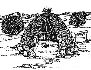
Nisipowinan Village, also spelled Nisenan Village was a major Nisenan Native American tribe Village that is a historical site in Sacramento, California. The Nisipowinan Village in Sacramento is a California Historical Landmark No. 900 listed on June 16, 1976.

PG&E Powerhouse
Historic building in California, United States
Distance: Approx. 2867 meters
Latitude and longitude: 38.59344444,-121.50561111
PG&E Powerhouse, also known as Sacramento River Station B is a historic building located in Sacramento, California, constructed in 1912 by notable architect Willis Polk. Originally used by Pacific Gas and Electric PG&E as an auxiliary power plant and transformer substation, it played a key role in transforming voltage for distribution. In 1924, PG&E upgraded the facility, making it the largest steam turbine power plant in the region.
Weather in this IP's area
clear sky
13 Celsius
12 Celsius
13 Celsius
14 Celsius
1025 hPa
51 %
1025 hPa
1024 hPa
10000 meters
5.66 m/s
310 degree