199.44.166.75 - IP Lookup: Free IP Address Lookup, Postal Code Lookup, IP Location Lookup, IP ASN, Public IP
Country:
Region:
City:
Location:
Time Zone:
Postal Code:
ISP:
ASN:
language:
User-Agent:
Proxy IP:
Blacklist:
IP information under different IP Channel
ip-api
Country
Region
City
ASN
Time Zone
ISP
Blacklist
Proxy
Latitude
Longitude
Postal
Route
db-ip
Country
Region
City
ASN
Time Zone
ISP
Blacklist
Proxy
Latitude
Longitude
Postal
Route
IPinfo
Country
Region
City
ASN
Time Zone
ISP
Blacklist
Proxy
Latitude
Longitude
Postal
Route
IP2Location
199.44.166.75Country
Region
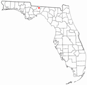
florida
City
tallahassee
Time Zone
America/New_York
ISP
Language
User-Agent
Latitude
Longitude
Postal
ipdata
Country
Region
City
ASN
Time Zone
ISP
Blacklist
Proxy
Latitude
Longitude
Postal
Route
Popular places and events near this IP address

Bradley's Country Store Complex
United States historic place
Distance: Approx. 3287 meters
Latitude and longitude: 30.59694444,-84.11777778
Bradley's Country Store Complex is located 12 miles (19 km) north of Tallahassee, Florida, United States on Centerville Road (County Road 151) in the community of Felkel, Florida. Bradley's Country Store complex has 17 buildings, most frame vernacular, on 31 acres (130,000 m2) of land.

Felkel, Florida
Unincorporated community in Florida, U.S.
Distance: Approx. 3423 meters
Latitude and longitude: 30.59833333,-84.11527778
Felkel is an unincorporated community in Leon County, Florida, United States.

W. G. Ponder Plantation
Cotton plantation in Florida, USA
Distance: Approx. 6925 meters
Latitude and longitude: 30.6181,-84.0718
The William G. Ponder Plantation was a large forced-labor farm growing cotton on over 5,756 acres (2,329 ha) in northeastern Leon County, Florida, United States. It was named after the planter who established it.

House Place Plantation
Distance: Approx. 4784 meters
Latitude and longitude: 30.5322,-84.1423
The House Place Plantation was a small forced-labor farm of 1,800 acres (730 ha) located in central Leon County, Florida, United States established by R.A. Whitfield.

Welaunee Plantation, Florida
Distance: Approx. 4588 meters
Latitude and longitude: 30.533137,-84.140253
Welaunee Plantation was a large quail hunting plantation located in central Leon County, Florida, United States established by Udo M. Fleischmann.

Roberts Farm Historic and Archeological District
Historic district in Florida, United States
Distance: Approx. 5652 meters
Latitude and longitude: 30.53333333,-84.1575
The Roberts Farm Historic and Archeological District (also known as the Theus-Roberts Farm) is a U.S. historic district (designated as such on November 2, 1995) located in Tallahassee, Florida. The district is on Roberts Road, 1-mile (2 km) east of Centerville Road.

Pisgah United Methodist Church
Historic church in Florida, United States
Distance: Approx. 5086 meters
Latitude and longitude: 30.55138889,-84.16361111
The Pisgah United Methodist Church (also known as the Old Pisgah Church) is a historic church north of Tallahassee, Leon County, Florida, United States. It is located southeast of State Road 151 at the end of Pisgah Church Road. On May 3, 1974, it was added to the U.S. National Register of Historic Places.

Strickland-Herold House
Historic house in Florida, United States
Distance: Approx. 7098 meters
Latitude and longitude: 30.59416667,-84.04666667
The Strickland-Herold House is a historic home in Miccosukee, Florida, United States. It is located at Main Street, northwest of junction of Moccasin Gap Road and State Road 59. On January 9, 1997, it was added to the U.S. National Register of Historic Places.
Miccosukee Land Co-op
Community in Florida
Distance: Approx. 5330 meters
Latitude and longitude: 30.52,-84.12
The Miccosukee Land Cooperative (MLC) is a cohousing community (a kind of intentional community). It is located near Tallahassee, in northeastern Leon County, Florida.

Billingsley Farm
United States historic place
Distance: Approx. 6814 meters
Latitude and longitude: 30.51658333,-84.07472222
The Billingsley Farm is a historic place in Wadesboro, Florida, United States. It is located at 3640 Oakhurst Lane. On September 5, 2007, it was added to the U.S. National Register of Historic Places.

Woodfield Springs Plantation
Distance: Approx. 1911 meters
Latitude and longitude: 30.5785,-84.0986
Woodfield Spring Plantation was a large quail hunting plantation in northern Leon County, Florida, United States. Woodfield Springs was owned by Gilbert W. Humphrey, an executive with the M.A. Hanna Company of Cleveland, Ohio serving as president of the company in 1960 and chairman of the board in 1961. Humphrey's father also was an executive with Hanna and U.S. Secretary of the Tresaury.

Concord School (Miccosukee)
School in Florida, United States
Distance: Approx. 7061 meters
Latitude and longitude: 30.581361,-84.042081
Concord School was a school for African-American children built in 1897 in the hamlet of Miccosukee, in eastern Leon County, Florida.
Weather in this IP's area
overcast clouds
14 Celsius
13 Celsius
12 Celsius
15 Celsius
1024 hPa
68 %
1024 hPa
1017 hPa
10000 meters
2.77 m/s
5.25 m/s
174 degree
99 %