Country:
Region:
City:
Latitude and Longitude:
Time Zone:
Postal Code:
IP information under different IP Channel
ip-api
Country
Region
City
ASN
Time Zone
ISP
Blacklist
Proxy
Latitude
Longitude
Postal
Route
Luminati
Country
Region
or
City
portland
ASN
Time Zone
America/Los_Angeles
ISP
STERLING
Latitude
Longitude
Postal
IPinfo
Country
Region
City
ASN
Time Zone
ISP
Blacklist
Proxy
Latitude
Longitude
Postal
Route
db-ip
Country
Region
City
ASN
Time Zone
ISP
Blacklist
Proxy
Latitude
Longitude
Postal
Route
ipdata
Country
Region
City
ASN
Time Zone
ISP
Blacklist
Proxy
Latitude
Longitude
Postal
Route
Popular places and events near this IP address

Lents, Portland, Oregon
Neighborhood in Portland, Oregon, United States
Distance: Approx. 467 meters
Latitude and longitude: 45.4754,-122.56207
The Lents neighborhood in the Southeast section of Portland, Oregon is bordered by SE Powell Blvd. on the north, the Clackamas County line or City of Portland line on the south (whichever is farther south), SE 82nd Ave. to the west, and roughly SE 112th on the east.
Village Free School
School in Oregon, United States
Distance: Approx. 1509 meters
Latitude and longitude: 45.48095,-122.5736
The Village Free School (VFS) is a 501(c)(3) non-profit private primary and secondary school located in Portland, Oregon, United States. The school was founded in 2004 and enrolls students between the ages of 5 and 18.

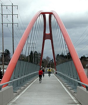
Springwater Corridor
Bicycle and pedestrian trail in the Portland, Oregon metropolitan area
Distance: Approx. 126 meters
Latitude and longitude: 45.4762309,-122.5567588
The Springwater Corridor Trail is a bicycle and pedestrian rail trail in the Portland metropolitan area in Oregon, United States. It follows a former railway line from Boring through Gresham to Portland, where it ends south of the Eastbank Esplanade. Most of the corridor, about 21 miles (34 km) long, consists of paved, off-street trail, though about 1 mile (1.6 km) overlaps city streets in Portland's Sellwood neighborhood.

Lents Town Center/Southeast Foster Road station
Distance: Approx. 1010 meters
Latitude and longitude: 45.4803,-122.566803
Lents Town Center/Southeast Foster Road is a light rail station on the MAX Green Line in Portland, Oregon. It is the 5th stop southbound on the I-205 MAX branch. The station is at the intersection of Interstate 205 and Foster Road.

Southeast Flavel Street station
Distance: Approx. 1139 meters
Latitude and longitude: 45.46807,-122.566573
Southeast Flavel Street is a light rail station on the MAX Green Line in Portland, Oregon. It is the sixth stop southbound on the I-205 MAX branch. The station is located at SE Flavel Street, adjacent to Interstate 205, and has a center platform.
Rosemont School (Portland, Oregon)
Public school in Portland, Multnomah County, Oregon, United States
Distance: Approx. 971 meters
Latitude and longitude: 45.467009,-122.56039
The former Rosemont Treatment Center and School is a secure, residential treatment facility in Portland, Oregon, United States. The facility is administered by Morrison Child and Family Services.

New Copper Penny
Defunct nightclub in Portland, Oregon, U.S.
Distance: Approx. 1099 meters
Latitude and longitude: 45.47992,-122.56846
New Copper Penny was a nightclub located at the intersection of Southeast 92nd Avenue and Foster Road in Portland's Lents neighborhood, in the U.S. state of Oregon. As of December 2016, the building has now been demolished to make way for re-development into apartments.

Bloomington Park
Public park in Portland, Oregon, U.S.
Distance: Approx. 1322 meters
Latitude and longitude: 45.48694444,-122.55861111
Bloomington Park is a 12.87-acre (5.21 ha) public park in Portland, Oregon's Lents neighborhood, in the United States. The park was acquired in 1940.

Glenwood Park (Portland, Oregon)
Public park in Portland, Oregon, U.S.
Distance: Approx. 1240 meters
Latitude and longitude: 45.473504,-122.5718
Glenwood Park is a 7.3-acre (3.0 ha) public park in Portland, Oregon's Lents neighborhood, in the United States. The park was acquired in 1941.

Beggars Tick Wildlife Refuge
Public park in Portland, Oregon, U.S.
Distance: Approx. 613 meters
Latitude and longitude: 45.47888889,-122.55027778
Beggars Tick Wildlife Refuge, also known as Beggars Tick Marsh, is a 20-acre (8.1 ha) park in Portland, Oregon's Lents neighborhood, in the United States.

Zoiglhaus Brewing Company
Brewery and restaurant in Portland, Oregon, U.S.
Distance: Approx. 1157 meters
Latitude and longitude: 45.48091667,-122.56847222
Zoiglhaus Brewing Company (sometimes simply Zoiglhaus) is a German-style brewery and restaurant in Portland, Oregon's Lents neighborhood.

Bella's Italian Bakery
Bakery in Portland, Oregon, U.S.
Distance: Approx. 1141 meters
Latitude and longitude: 45.4793,-122.5695
Bella's Italian Bakery is a bakery in Portland, Oregon.
Weather in this IP's area
light rain
11 Celsius
11 Celsius
10 Celsius
13 Celsius
1021 hPa
92 %
1021 hPa
1014 hPa
10000 meters
4.63 m/s
220 degree
75 %
06:54:40
16:52:54