199.34.1.36 - IP Lookup: Free IP Address Lookup, Postal Code Lookup, IP Location Lookup, IP ASN, Public IP
Country:
Region:
City:
Location:
Time Zone:
Postal Code:
ISP:
ASN:
language:
User-Agent:
Proxy IP:
Blacklist:
IP information under different IP Channel
ip-api
Country
Region
City
ASN
Time Zone
ISP
Blacklist
Proxy
Latitude
Longitude
Postal
Route
db-ip
Country
Region
City
ASN
Time Zone
ISP
Blacklist
Proxy
Latitude
Longitude
Postal
Route
IPinfo
Country
Region
City
ASN
Time Zone
ISP
Blacklist
Proxy
Latitude
Longitude
Postal
Route
IP2Location
199.34.1.36Country
Region
colorado
City
englewood
Time Zone
America/Denver
ISP
Language
User-Agent
Latitude
Longitude
Postal
ipdata
Country
Region
City
ASN
Time Zone
ISP
Blacklist
Proxy
Latitude
Longitude
Postal
Route
Popular places and events near this IP address
Centennial Airport
Airport in Dove Valley, Colorado, United States
Distance: Approx. 1139 meters
Latitude and longitude: 39.57,-104.84944444
Centennial Airport (IATA: APA, ICAO: KAPA, FAA LID: APA) is a public use airport owned by the Arapahoe County Public Airport Authority in the Denver-Aurora metropolitan area, 15 nautical miles (17 mi, 28 km) southeast of downtown Denver, Colorado, United States. Located in Dove Valley, a census designated place in Arapahoe County, the airport's runways extend into Douglas County.
American Institute of Mining, Metallurgical, and Petroleum Engineers
Professional organization
Distance: Approx. 2109 meters
Latitude and longitude: 39.577653,-104.836782
The American Institute of Mining, Metallurgical, and Petroleum Engineers (AIME) is a professional association for mining and metallurgy, with over 145,000 members. The association was founded in 1871 by 22 mining engineers in Wilkes-Barre, Pennsylvania, and was one of the first national engineering societies in the country. The association's charter is to "advance and disseminate, through the programs of the Member Societies, knowledge of engineering and the arts and sciences involved in the production and use of minerals, metals, energy sources and materials for the benefit of humankind." It is the parent organization of four Member Societies, the Society for Mining, Metallurgy, and Exploration (SME), The Minerals, Metals & Materials Society (TMS), the Association for Iron and Steel Technology (AIST), and the Society of Petroleum Engineers (SPE).

Colorado Department of Military and Veterans Affairs
American government agency
Distance: Approx. 2512 meters
Latitude and longitude: 39.591573,-104.8413708
The Colorado Department of Military and Veterans Affairs is the principal department of the Colorado state government that supervises both the Colorado National Guard (including the Colorado Army National Guard and Colorado Air National Guard), and non-military state safety agencies. The Department consists of the Department of Military Affairs, and the Division of Veterans' Affairs, and is headed by the Adjutant General of Colorado.

Arrow Electronics
American company
Distance: Approx. 1875 meters
Latitude and longitude: 39.590568,-104.869118
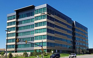
Arrow Electronics, Inc. is an American Fortune 500 company headquartered in Centennial, Colorado. A global provider of electronic components and enterprise computing products, the company specializes in distribution and value-added services for original equipment manufacturers, value-added resellers, managed service providers, contract manufacturers and other commercial customers.
National Cattlemen's Beef Association
Distance: Approx. 1885 meters
Latitude and longitude: 39.570709,-104.882381
National Cattlemen's Beef Association (NCBA) is an American trade association and lobbying group working for American beef producers.
Key Lime Air
Commuter airline based out of Englewood, Colorado
Distance: Approx. 1976 meters
Latitude and longitude: 39.574934,-104.838067
Key Lime Air is a United States airline with corporate headquarters at Denver International Airport in Denver, Colorado, within the Denver metropolitan area. Established in 1997, Key Lime Air operates scheduled air service, various types of public and private charter (under its Denver Air Connection brand), and United Parcel Service cargo feeder operations.
Dry Creek station
Light rail station in Centennial, Colorado
Distance: Approx. 1368 meters
Latitude and longitude: 39.5786,-104.8763
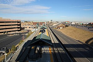
Dry Creek station is a light rail station in Centennial, Colorado, United States. It is served by the E and R Lines, operated by the Regional Transportation District (RTD), and was opened on November 17, 2006. The station features a public art installation of a series of stainless steel tubes holding hourglasses that contain pyrite entitled Fools Gold.
County Line station (RTD)
Light rail station in Lone Tree, Colorado
Distance: Approx. 1723 meters
Latitude and longitude: 39.562,-104.8722
County Line station is a light rail station in Lone Tree, Colorado, United States. It is served by the E and R Lines, operated by the Regional Transportation District (RTD), and was opened on November 17, 2006. It serves Park Meadows Mall and features a public art sculpture entitled Plow, created by Emmett Culligan and dedicated in 2006.
Arapahoe Library District
Distance: Approx. 1922 meters
Latitude and longitude: 39.577872,-104.839032
Arapahoe Library District is a public library located in Arapahoe County, Colorado with branches in Centennial, Sheridan, Deer Trail, Byers, and unincorporated Arapahoe County. Outreach services and services to the Arapahoe County Detention Facility are also provided. It was established in April 1966 by action of the Arapahoe County Board of Commissioners and the Board of School District 26J, Deer Trail, to meet the needs of Arapahoe County residents in the unincorporated areas and the smaller towns and communities that did not receive library service.
St. Mark Coptic Orthodox Church (Centennial, Colorado)
Church in Colorado , United States of America
Distance: Approx. 2212 meters
Latitude and longitude: 39.588798,-104.842671
St Mark Coptic Orthodox Church (Coptic: // transliteration: ti.eklyseya en.remenkimi en.orthodoxos ente fi.ethowab Markos) is one of the oldest Coptic Orthodox parishes to be established in North America.

Inverness, Colorado
Census Designated Place in Colorado, United States
Distance: Approx. 377 meters
Latitude and longitude: 39.5758272,-104.8653211
Inverness is an unincorporated community and a census-designated place (CDP) located in and governed by Arapahoe County, Colorado, United States. The CDP is a part of the Denver–Aurora–Lakewood, CO Metropolitan Statistical Area. The population of the Inverness CDP was 2,226 at the United States Census 2020.
Park Meadows
Shopping mall in Colorado, United States
Distance: Approx. 1893 meters
Latitude and longitude: 39.56261,-104.87634
Park Meadows is an enclosed shopping mall in Lone Tree, Colorado, that includes a gross leasable area of 1,576,618 square feet (150,000 m2). Opened on August 30, 1996, the mall features JCPenney, Macy's, Dillard's, Nordstrom, and Dick's Sporting Goods.
Weather in this IP's area
clear sky
-10 Celsius
-15 Celsius
-11 Celsius
-8 Celsius
1032 hPa
66 %
1032 hPa
828 hPa
10000 meters
3.09 m/s
190 degree


