199.30.62.217 - IP Lookup: Free IP Address Lookup, Postal Code Lookup, IP Location Lookup, IP ASN, Public IP
Country:
Region:
City:
Location:
Time Zone:
Postal Code:
IP information under different IP Channel
ip-api
Country
Region
City
ASN
Time Zone
ISP
Blacklist
Proxy
Latitude
Longitude
Postal
Route
Luminati
Country
ASN
Time Zone
America/Chicago
ISP
CLEARWAVE-COMMUNICATIONS
Latitude
Longitude
Postal
IPinfo
Country
Region
City
ASN
Time Zone
ISP
Blacklist
Proxy
Latitude
Longitude
Postal
Route
IP2Location
199.30.62.217Country
Region
illinois
City
marion
Time Zone
America/Chicago
ISP
Language
User-Agent
Latitude
Longitude
Postal
db-ip
Country
Region
City
ASN
Time Zone
ISP
Blacklist
Proxy
Latitude
Longitude
Postal
Route
ipdata
Country
Region
City
ASN
Time Zone
ISP
Blacklist
Proxy
Latitude
Longitude
Postal
Route
Popular places and events near this IP address

Williamson County, Illinois
County in Illinois, United States
Distance: Approx. 281 meters
Latitude and longitude: 37.73,-88.93
Williamson County is a county in Southern Illinois. At the 2020 census, it had a population of 67,153. The largest city and county seat is Marion.
Marion, Illinois
City in Illinois, United States
Distance: Approx. 251 meters
Latitude and longitude: 37.73027778,-88.93027778
The city of Marion is the county seat of Williamson County, Illinois, United States. The population in Marion, IL was 16,855 according to the 2020 census. It is part of a dispersed urban area that developed out of early 20th-century coal fields.
WDDD-FM
Radio station in Illinois, United States
Distance: Approx. 2610 meters
Latitude and longitude: 37.754,-88.935
WDDD-FM (107.3 FM) is an American country music formatted radio station licensed to Johnston City, Illinois. W3D has been a country station for 30+ years. On November 22, 1970, WDDD-FM first signed on.
Marion, Illinois, tornado outbreak
Natural disaster in southern Illinois, United States in 1982
Distance: Approx. 305 meters
Latitude and longitude: 37.73333333,-88.93333333
The Marion, Illinois tornado outbreak was a small, severe tornado outbreak that affected southern portions of the Midwestern United States on May 29, 1982. Tornadoes touched down in the states of Illinois, Missouri, and Indiana, with Marion, Illinois, being the hardest hit. Ten fatalities occurred there after the town took a direct hit from an F4 tornado.
Marion High School (Illinois)
Secondary high school in Marion, Williamson, Illinois, United States
Distance: Approx. 1888 meters
Latitude and longitude: 37.7156,-88.9431
Marion High School is a high school located in the growing city of Marion, Illinois, serving the Marion Unit 2 School District. The school's enrollment was approximately 1,125 students in the 2013–2014 school year. Marion Unit #2 School District built a new high school on the same property, that is completely finished.

Crab Orchard and Egyptian Railway
Shortline railroad in Illinois
Distance: Approx. 565 meters
Latitude and longitude: 37.73399,-88.92833
The Crab Orchard and Egyptian Railway (reporting mark COER) (formerly American Rail Heritage, Ltd. d/b/a Crab Orchard, and Egyptian Railroad Company) is a Class III common carrier shortline railroad that operates in the cities of Marion and Herrin in the Southern Illinois region. It is most historically recognized by the FRA for being the last U.S. railroad of any kind to use steam locomotives exclusively in regular revenue freight service up until March 1986.

Goddard Chapel
United States historic place
Distance: Approx. 1408 meters
Latitude and longitude: 37.74319444,-88.93166667
Goddard Chapel is a historic chapel located in Rose Hill Cemetery in Marion, Illinois. The chapel was constructed in 1918 through a donation from Leroy A. Goddard, who served two terms as Marion's mayor and founded the city's first bank. Chicago architect John A. Nyden designed the chapel in the Gothic Revival style.

Willis Allen House
Historic house in Illinois, United States
Distance: Approx. 659 meters
Latitude and longitude: 37.72666667,-88.9275
The Willis Allen House is a historic house located at 514 S. Market St. in Marion, Illinois. Built in 1854, the house is the oldest remaining in Marion.

Ed M. Stotlar House
Historic house in Illinois, United States
Distance: Approx. 631 meters
Latitude and longitude: 37.73277778,-88.93972222
The Ed M. Stotlar House is a historic house located at 1304 W. Main St. in Marion, Illinois. The house was built in 1914-15 for Southern Illinois lumber salesman Ed M. Stotlar and his family.

Williamson County Jail
United States historic place
Distance: Approx. 444 meters
Latitude and longitude: 37.73055556,-88.92805556
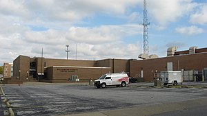
The Williamson County Jail, located at 105 S. Van Buren St. in Marion, is the former county jail serving Williamson County, Illinois. The Prairie School building served as the county jail from 1913 to 1971.

Marion Veterans Affairs Medical Center
United States historic place
Distance: Approx. 2023 meters
Latitude and longitude: 37.72444444,-88.95472222
Marion Veterans Affairs Medical Center, also known as Marion Veterans Administration Hospital, is a Veterans Affairs hospital in Marion, Illinois. The hospital is responsible for providing healthcare to U.S. military veterans in Southern Illinois and neighboring states. The hospital was built in 1939-41 following a local campaign for a veterans' hospital in Southern Illinois.

Williamson County Courthouse (Illinois)
Local government building in the United States
Distance: Approx. 406 meters
Latitude and longitude: 37.7325,-88.92916667
The Williamson County Courthouse is a government building in Marion, the county seat of Williamson County, Illinois, United States. Built in 1971, it is the fourth courthouse in Marion's history. Land was registered in today's Williamson County as early as 1814,: 442 but the county itself was formed only in 1839 from the southern half of Franklin County.
Weather in this IP's area
overcast clouds
-5 Celsius
-12 Celsius
-6 Celsius
-5 Celsius
1022 hPa
87 %
1022 hPa
1006 hPa
10000 meters
8.75 m/s
11.83 m/s
320 degree
100 %
