Country:
 USA
USARegion:
City:
Latitude and Longitude:
Time Zone:
Postal Code:
IP information under different IP Channel
ip-api
Country
Region
City
ASN
Time Zone
ISP
Blacklist
Proxy
Latitude
Longitude
Postal
Route
IPinfo
Country
Region
City
ASN
Time Zone
ISP
Blacklist
Proxy
Latitude
Longitude
Postal
Route
MaxMind
Country
Region
City
ASN
Time Zone
ISP
Blacklist
Proxy
Latitude
Longitude
Postal
Route
Luminati
Country
USASN
Time Zone
America/Chicago
ISP
TVC-AS1
Latitude
Longitude
Postal
db-ip
Country
Region
City
ASN
Time Zone
ISP
Blacklist
Proxy
Latitude
Longitude
Postal
Route
ipdata
Country
Region
City
ASN
Time Zone
ISP
Blacklist
Proxy
Latitude
Longitude
Postal
Route
Popular places and events near this IP address

Latham Circle Mall
Shopping mall in New York, United States
Distance: Approx. 2575 meters
Latitude and longitude: 42.74638889,-73.76416667
Latham Circle Mall was an enclosed shopping mall located adjacent to the Latham Circle (the intersection of US 9 and NY 2) in Latham, New York. Built in 1957 as Latham Corners Shopping Center, the mall was renovated several times in its history, most notably in 1977 when it became a fully enclosed and temperature-controlled shopping mall. Around the mid 2000s, the mall started to lose tenants, eventually becoming a dead mall.

Heritage Park (Colonie, New York)
Abandoned sport stadium in Colonie, New York
Distance: Approx. 2024 meters
Latitude and longitude: 42.740193,-73.816967
Heritage Park was a stadium in Colonie, New York, USA. It was primarily used for baseball but was also used for high school and college football games. It had a capacity of 5,500.
Christian Brothers Academy (Albany, New York)
Private, day school in Albany, New York
Distance: Approx. 2323 meters
Latitude and longitude: 42.7325,-73.82055556
Christian Brothers Academy is a private, Catholic, college preparatory, junior and senior high school for boys founded in 1859 by the De La Salle Christian Brothers (See Institute of the Brothers of the Christian Schools). Christian Brothers Academy (CBA) is located in the town of Colonie, New York near the Albany International Airport on a 126-acre (0.51 km2) campus built in 1998. Christian Brothers Academy is independently run by a board of trustees.
Latham Circle
Road junction
Distance: Approx. 2895 meters
Latitude and longitude: 42.74813889,-73.76097222
The Latham Circle or Latham Traffic Circle is the intersection of U.S. Route 9 (US 9) and New York State Route 2 (NY 2) within the town of Colonie, New York in Albany County.
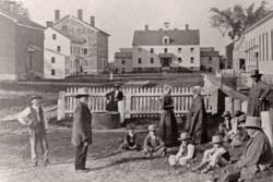
Watervliet Shaker Historic District
Historic district in New York, United States
Distance: Approx. 2124 meters
Latitude and longitude: 42.73972222,-73.81833333
Watervliet Shaker Historic District, in Colonie, New York, is the site of the first Shaker community, established in 1776. The primary Shaker community, the Mount Lebanon Shaker Society, was started a bit later. Watervliet's historic 1848 Shaker meetinghouse has been restored and is used for public events, such as concerts.

St. Francis Chapel (Colonie, New York)
Distance: Approx. 2318 meters
Latitude and longitude: 42.71763056,-73.80438611
St. Francis Chapel was a Catholic Franciscan chapel, sponsored by the Holy Name Province of the Order Friars Minor. It began in the Northway Mall in Colonie, New York, United States on December 28, 1970.
Center for Technology in Government
Distance: Approx. 1731 meters
Latitude and longitude: 42.722189,-73.800664
Center for Technology in Government is a research institution at the University at Albany in Albany, New York, that focuses on the development of innovative solutions to help government provide better public services through technology. Through applied research and partnerships (e.g. with the Major Cities of Europe IT Users Group), projects are undertaken that address the policy, management, and technology dimensions of information use in the public sector.
John Wolf Kemp House
Historic house in New York, United States
Distance: Approx. 1310 meters
Latitude and longitude: 42.72583333,-73.79916667
John Wolf Kemp House was a historic home located at Colonie in Albany County, New York. It was built about 1780 and was a 2-story, L-shaped frame farmhouse with a gable roof and five bays wide. It had a 1+1⁄2-story rear ell.

Casparus F. Pruyn House
Historic house in New York, United States
Distance: Approx. 1263 meters
Latitude and longitude: 42.73194444,-73.77861111
Casparus F. Pruyn House is a historic home located in the hamlet of Newtonville within the town of Colonie in Albany County, New York. It is a two-story, rectangular five bay wide, center entrance dwelling in a late Federal and early Greek Revival style. It was built between 1824 and 1836.

Verdoy Schoolhouse
United States historic place
Distance: Approx. 1338 meters
Latitude and longitude: 42.73269444,-73.77722222
Verdoy Schoolhouse, also known as District No. 7 Schoolhouse, is a historic one-room school building located at Newtonville in Albany County, New York. It was built in 1910 and is an asymmetrical frame building.

Transweb
Distance: Approx. 1725 meters
Latitude and longitude: 42.72225833,-73.80067778
Transweb Educational Services, founded in 2007 by Aditya Singhal and Nishant Sinha, is an online tutoring and educational website. The website provides educational resources to students from grade 4 to university level, through its five websites.
The Crossings Park
Distance: Approx. 2071 meters
Latitude and longitude: 42.718,-73.792
The Crossings Park is located in the Town of Colonie, New York, outside of Albany. Crossings Park is a 130-acre public park to which tourists come to visit every day. The park has bike and running paths that stretch and connect up to 6.5 total miles, as well as a 3-acre pond located in the center.
Weather in this IP's area
few clouds
12 Celsius
11 Celsius
10 Celsius
14 Celsius
1032 hPa
62 %
1032 hPa
1021 hPa
10000 meters
2.06 m/s
340 degree
20 %
07:12:19
18:07:47