199.253.207.31 - IP Lookup: Free IP Address Lookup, Postal Code Lookup, IP Location Lookup, IP ASN, Public IP
Country:
Region:
City:
Location:
Time Zone:
Postal Code:
IP information under different IP Channel
ip-api
Country
Region
City
ASN
Time Zone
ISP
Blacklist
Proxy
Latitude
Longitude
Postal
Route
Luminati
Country
ASN
Time Zone
America/Chicago
ISP
RMH-14
Latitude
Longitude
Postal
IPinfo
Country
Region
City
ASN
Time Zone
ISP
Blacklist
Proxy
Latitude
Longitude
Postal
Route
IP2Location
199.253.207.31Country
Region
california
City
lake forest
Time Zone
America/Los_Angeles
ISP
Language
User-Agent
Latitude
Longitude
Postal
db-ip
Country
Region
City
ASN
Time Zone
ISP
Blacklist
Proxy
Latitude
Longitude
Postal
Route
ipdata
Country
Region
City
ASN
Time Zone
ISP
Blacklist
Proxy
Latitude
Longitude
Postal
Route
Popular places and events near this IP address

Lake Forest, California
City in California, United States
Distance: Approx. 2066 meters
Latitude and longitude: 33.64166667,-117.69083333
Lake Forest is a city in Orange County, California, United States. The population was 85,858 at the 2020 census. Lake Forest incorporated as a city on December 20, 1991.
Saddleback Valley
Large valley in Orange County, California
Distance: Approx. 2437 meters
Latitude and longitude: 33.626289,-117.681028
Saddleback Valley refers to the flat and foothill areas west-southwest of the Saddleback double peak of the Santa Ana Mountains and east-northeast of the hilly Crystal Cove State Park in southern Orange County, California. The region primarily encompasses the cities of Mission Viejo, Lake Forest, and Rancho Santa Margarita, as well as the communities of Coto de Caza and Ladera Ranch. The cities of Aliso Viejo, Laguna Woods, Laguna Hills, and Laguna Niguel, as well as some of Orange County's eastern canyon communities, partially reside within the valley.
Trabuco Hills High School
Comprehensive high school in Mission Viejo, California, United States
Distance: Approx. 1887 meters
Latitude and longitude: 33.655,-117.652
Trabuco Hills High School is a high school in Mission Viejo, California, United States. It is in the Saddleback Valley Unified School District.
El Toro High School
Public high school in Lake Forest, California, United States
Distance: Approx. 2057 meters
Latitude and longitude: 33.6375221,-117.6889403
El Toro High School is a public high school in Lake Forest, California, United States. It is one of five high schools in the Saddleback Valley Unified School District (SVUSD) and serves Lake Forest and its district of Portola Hills and a small portion of east Irvine. "El Toro" was the name of the community from the 1870s until a referendum in 1991.
Lake Mission Viejo
Reservoir in Mission Viejo, California
Distance: Approx. 2888 meters
Latitude and longitude: 33.62666667,-117.64805556
Lake Mission Viejo is a reservoir created for recreation in Mission Viejo, Orange County, California, United States. The reservoir is formed by an earthfill dam across the canyon of Oso Creek, which is part of the Trabuco Creek and San Juan Creek drainage basin. The lake is not fed by urban runoff; it is maintained so as to be safe for contact.
Silverado High School (Mission Viejo)
Public school
Distance: Approx. 3105 meters
Latitude and longitude: 33.62047426,-117.68313333
Silverado High School is a continuation high school in Mission Viejo, California, United States. It is part of the Saddleback Valley Unified School District.

The Actors Workshop
Film acting training program in California
Distance: Approx. 2593 meters
Latitude and longitude: 33.62355,-117.67737
The Actors Workshop is one of southern California's oldest film acting programs and is generally associated with the Sanford Meisner and Charles Conrad techniques. The company was established by its parent company, Shannon & Company.

Jose Serrano Adobe
Historic house in California, United States
Distance: Approx. 1556 meters
Latitude and longitude: 33.64166667,-117.68513889
The José Serrano Adobe is a historic 1863 adobe house in Lake Forest, Orange County, California. The property is one of four historic buildings in the Heritage Hill Historic Park. It was listed on the National Register of Historic Places on May 24, 1976.

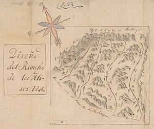
Rancho Cañada de los Alisos
Distance: Approx. 2042 meters
Latitude and longitude: 33.64,-117.69
Rancho Cañada de los Alisos was a 10,668-acre (43.17 km2) Mexican land grant in present-day Orange County, California given by Governor Juan Bautista Alvarado to Jose Antonio Fernando Serrano in 1842, and enlarged by a second grant by Pio Pico in 1846. The name means "Glen of the Alders" in Spanish, after the native White Alder (Alnus rhombifolia) trees growing there. The rancho included the present day cities of Lake Forest (formerly El Toro), and the Marine Corps Air Station El Toro—Orange County Great Park site in Irvine.
Serrano Creek
Distance: Approx. 3506 meters
Latitude and longitude: 33.65031663,-117.70654109
Serrano Creek is a roughly 7.5-mile (12.1 km) tributary of San Diego Creek in the U.S. state of California. The creek starts in the Santa Ana Mountains in a canyon in Whiting Ranch Wilderness Park, near the boundary of the Cleveland National Forest. It then flows southwest into the city of Lake Forest, running in a channelized course roughly parallel to Aliso Creek.

Etnies Skatepark of Lake Forest
Skatepark in Lake Forest, California
Distance: Approx. 2882 meters
Latitude and longitude: 33.67055556,-117.66
Etnies Skatepark of Lake Forest (stylized as etnies Skatepark) is a public skatepark located in Lake Forest, California, United States. It is the largest free skatepark in the state, with an area of over 62,000 square feet (5,800 m2). The skatepark is owned and operated by the City of Lake Forest.
El Toro station (Atchison, Topeka and Santa Fe Railway)
Former railway station in El Toro, California
Distance: Approx. 3111 meters
Latitude and longitude: 33.62746359,-117.69442471
El Toro station was a railway station in the former unincorporated community of El Toro, California, which was incorporated as Lake Forest in 1991. It was a stop on the Atchison, Topeka, and Santa Fe Railway (ATSF) Surf Line, which was served by San Diegan passenger trains. The station was located on the north side of El Toro Road.
Weather in this IP's area
fog
13 Celsius
12 Celsius
8 Celsius
16 Celsius
1017 hPa
49 %
1017 hPa
993 hPa
402 meters
0.45 m/s
1.34 m/s
60 degree
100 %

