199.248.68.128 - IP Lookup: Free IP Address Lookup, Postal Code Lookup, IP Location Lookup, IP ASN, Public IP
Country:
 USA
USARegion:
City:
Location:
Time Zone:
Postal Code:
ISP:
ASN:
language:
User-Agent:
Proxy IP:
Blacklist:
IP information under different IP Channel
ip-api
Country
Region
City
ASN
Time Zone
ISP
Blacklist
Proxy
Latitude
Longitude
Postal
Route
db-ip
Country
Region
City
ASN
Time Zone
ISP
Blacklist
Proxy
Latitude
Longitude
Postal
Route
IPinfo
Country
Region
City
ASN
Time Zone
ISP
Blacklist
Proxy
Latitude
Longitude
Postal
Route
IP2Location
199.248.68.128Country
usRegion
california
City
manhattan beach
Time Zone
America/Los_Angeles
ISP
Language
User-Agent
Latitude
Longitude
Postal
ipdata
Country
Region
City
ASN
Time Zone
ISP
Blacklist
Proxy
Latitude
Longitude
Postal
Route
Popular places and events near this IP address

Manhattan Beach, California
City in California, United States
Distance: Approx. 349 meters
Latitude and longitude: 33.88888889,-118.40527778
Manhattan Beach is a city in southwestern Los Angeles County, California, United States, on the Pacific coast south of El Segundo, west of Hawthorne and Redondo Beach, and north of Hermosa Beach. As of the 2020 census, the population was 35,506. Together with Hermosa Beach and Redondo Beach, it forms the three Beach Cities within the South Bay region of Los Angeles County.

Beach Cities
Place in Los Angeles County, California
Distance: Approx. 1135 meters
Latitude and longitude: 33.9,-118.4
The Beach Cities are a collection of three independently incorporated oceanfront cities in Los Angeles County south of El Segundo and north of the Palos Verdes Peninsula, comprising the cities of Manhattan Beach, Hermosa Beach, and Redondo Beach. They occupy the majority of the south end of Santa Monica Bay. Neighboring Torrance also shares a strip of beach property in the neighborhood of Torrance Beach, but the city of Torrance itself is generally excluded from the group.
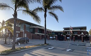
Mira Costa High School
Public high school in Manhattan Beach, California
Distance: Approx. 2116 meters
Latitude and longitude: 33.87368,-118.38976
Mira Costa High School (MCHS, "Costa") is a four-year public high school located in Manhattan Beach, California that first opened 1950. It is the only high school in the Manhattan Beach Unified School District. The school's athletic teams are known as the Mustangs and the school colors are green and gold.

Aviation High School (California)
Public school in Redondo Beach, California
Distance: Approx. 2162 meters
Latitude and longitude: 33.8874,-118.3785
Aviation High School (Aviation, AHS, Avi-Hi) was a high school located in Redondo Beach, California that was in operation from 1957 to 1982. The school occupied 40 acres at the northeast corner of Manhattan Beach Boulevard and Aviation Boulevard (which runs north to the Los Angeles International Airport). Their athletic teams were known as the Falcons and the school colors were black and orange.

Manhattan Beach Pier
Historic site in Manhattan Beach, California, United States
Distance: Approx. 1297 meters
Latitude and longitude: 33.88374,-118.41361
The Manhattan Beach Pier is a pier located in Manhattan Beach, California, on the coast of the Pacific Ocean. The pier is 928 feet (283 m) long and located at the end of Manhattan Beach Boulevard. An octagonal Mediterranean-style building sits at the end of the pier and houses the Roundhouse Aquarium.
1997 Acura Classic
Tennis tournament
Distance: Approx. 1555 meters
Latitude and longitude: 33.90011111,-118.39022222
The 1997 Acura Classic was a women's tennis tournament held between August 4 through August 10, 1997 and played on outdoor hard courts at the Manhattan Country Club in Manhattan Beach, California. It was twe 24th edition of the tournament and was part of the WTA Tier II series of the 1997 WTA Tour. Second-seeded Monica Seles won the singles title for the third time after 1990 and 1993.

Bruce's Beach
Beach park owned by and operated for African Americans in Manhattan Beach, California
Distance: Approx. 1377 meters
Latitude and longitude: 33.89444444,-118.41555556
Bruce's Beach was an African-American beach resort at Manhattan Beach in Los Angeles County, California. The property, which was located at 26th Street and Highland Avenue, was owned and operated by Charles and Willa Bruce for the benefit of the black community when racial segregation prevented them from enjoying opportunities provided at other beaches in the area. After it opened in 1912, it became a successful and popular visitor destination for African Americans.
Peck's Pier and Pavilion
Former pier in Manhattan Beach, California, USA
Distance: Approx. 1965 meters
Latitude and longitude: 33.89805556,-118.42055556
Peck's Pier was a wooden pier in Manhattan Beach, California, constructed in 1908 by George H. Peck, for whom it was named. Peck was a wealthy real estate developer who owned a lot of property in the area. The pier was located in the area of 33rd and 34th Street and was the only pier in the area open to African Americans.
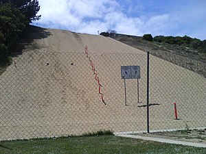
Sand Dune Park
Recreation area in Manhattan Beach, California
Distance: Approx. 1439 meters
Latitude and longitude: 33.89886,-118.41293
Sand Dune Park is an area of public sand dunes partly on a steep slope that is used for exercise in Manhattan Beach, California. The area has been used by amateur and professional athletes and has been featured in fitness magazines and newspaper accounts as a great workout spot. The park around the dune was built on a converted dump site by local residents in 1964.
Manhattan Village
Neighborhood in Manhattan Beach, California
Distance: Approx. 1794 meters
Latitude and longitude: 33.9018,-118.3886
Manhattan Village is a neighborhood in Manhattan Beach, California, founded in 1985. It was the "last major parcel available for development" in the city Its construction was said to signify "the passing of an era – the removal of oil tanks and the beginning of development of more than 100 acres of formerly bare ground." At that time the city had a population of 30,245. Early concepts had included "a graveyard, a regional wilderness park and a lake that could accommodate paddle boating and sailboating." West of the 405 Freeway and east of Sepulveda Boulevard, the neighborhood adjoins Marine Avenue to the north and is south of Rosecrans Avenue.

Manhattan Beach Botanical Garden
Botanical garden at Polliwog Park in Manhattan Beach, California
Distance: Approx. 1358 meters
Latitude and longitude: 33.8885,-118.3871
The Manhattan Beach Botanical Garden (.66 acres (0.27 ha)) is a botanical garden located within Polliwog Park in Manhattan Beach, California. It is open daily with free admission. The garden was first envisioned in 1992, with garden construction starting in 1994.

Beach Cities Greenway
Rail trail in Manhattan Beach and Hermosa Beach, California
Distance: Approx. 1247 meters
Latitude and longitude: 33.9002,-118.3964
The Beach Cities Greenway in Manhattan Beach and Hermosa Beach, California is a 3.9-mile (6.3 km) rail trail. The greenway is a linear park on the median between Valley Drive running along the west side and Ardmore Avenue on the east. Northern trailhead of the Beach Cities greenway is Sepulveda Blvd.
Weather in this IP's area
broken clouds
16 Celsius
15 Celsius
14 Celsius
18 Celsius
1016 hPa
71 %
1016 hPa
1014 hPa
10000 meters
5.14 m/s
260 degree
75 %