Country:
Region:
City:
Latitude and Longitude:
Time Zone:
Postal Code:
IP information under different IP Channel
ip-api
Country
Region
City
ASN
Time Zone
ISP
Blacklist
Proxy
Latitude
Longitude
Postal
Route
Luminati
Country
Region
mn
City
minneapolis
ASN
Time Zone
America/Chicago
ISP
LOGIS-AS-1
Latitude
Longitude
Postal
IPinfo
Country
Region
City
ASN
Time Zone
ISP
Blacklist
Proxy
Latitude
Longitude
Postal
Route
db-ip
Country
Region
City
ASN
Time Zone
ISP
Blacklist
Proxy
Latitude
Longitude
Postal
Route
ipdata
Country
Region
City
ASN
Time Zone
ISP
Blacklist
Proxy
Latitude
Longitude
Postal
Route
Popular places and events near this IP address

Brooklyn Park, Minnesota
City in Minnesota, United States
Distance: Approx. 2816 meters
Latitude and longitude: 45.09416667,-93.35638889
Brooklyn Park is a suburban city on the west bank of the Mississippi River, upstream from (north of) downtown Minneapolis in northern Hennepin County. It is the sixth-largest city in the U.S. state of Minnesota. The population was 86,478 at the 2020 census.

Osseo, Minnesota
Town in Minnesota, United States
Distance: Approx. 4192 meters
Latitude and longitude: 45.11722222,-93.39944444
Osseo ( OSS-ee-oh) is a small city in Hennepin County, Minnesota, United States. As of the 2020 United States Census, it has a population of 2,688.

North Hennepin Community College
Public college in Brooklyn Park, Minnesota, US
Distance: Approx. 2650 meters
Latitude and longitude: 45.10529,-93.37425
North Hennepin Community College (NHCC) is a public community college in Brooklyn Park, Minnesota. It was founded in 1966 and is a member of the Minnesota State Colleges and Universities system.

Richard P. Braun Bridge
Bridge in Minnesota-Coon Rapids, Minnesota
Distance: Approx. 3894 meters
Latitude and longitude: 45.129151,-93.298918
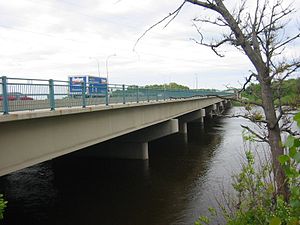
Richard P. Braun Bridge is a pair of 10-span concrete girder bridges spanning the Mississippi River between Brooklyn Park, Minnesota and Coon Rapids, Minnesota. The eastbound span was built in 1985 to connect Minnesota State Highway 252 with Minnesota State Highway 610 in Coon Rapids. The westbound span was built in 1999 as part of the continued construction of Highway 610 through Brooklyn Park.
KMNQ
Radio station in Brooklyn Park, Minnesota
Distance: Approx. 4454 meters
Latitude and longitude: 45.08805556,-93.38305556
KMNQ (1470 AM) is a commercial radio station licensed to Brooklyn Park, Minnesota, and serving the Twin Cities radio market. The station broadcasts a Spanish AC format. The station previously was a simulcast of sister station KMNV, playing traditional Regional Mexican music.
Champlin Park High School
Public school in Champlin, Minnesota, United States
Distance: Approx. 3600 meters
Latitude and longitude: 45.1501415,-93.354898
Champlin Park High School is a four-year public high school in Champlin, Minnesota, United States. The school's name comes from the combination of Brooklyn Park and Champlin. Champlin Park's first graduating class was in 1993.
Osseo Senior High School
Public school in Minnesota, United States
Distance: Approx. 4751 meters
Latitude and longitude: 45.1201621,-93.4065254
Osseo Senior High School is a four-year public high school located in Osseo, Minnesota, United States on 317 2nd Ave. NW. The principal is Sara Vernig. Osseo Senior High School is a part of the Osseo Area School District 279 and is one of three four-year high schools in the district.

Park Center Senior High School
Public school in Minnesota, United States
Distance: Approx. 3382 meters
Latitude and longitude: 45.08805556,-93.34388889
Park Center Senior High School (PCSH) is a four-year public high school located in Brooklyn Park, Minnesota, United States, on 7300 Brooklyn Blvd. PCSH is located near the border of two northwest twin cities suburbs, Brooklyn Park and Brooklyn Center, thus the school name "Park Center" is a combination of these city names. The principal is Antwan Harris.

Coon Rapids Dam
Dam on the Mississippi River
Distance: Approx. 3935 meters
Latitude and longitude: 45.14388889,-93.31138889
The Coon Rapids Dam is a concrete gravity dam on the Mississippi River located in Brooklyn Park and Coon Rapids, Minnesota. It is approximately 12 miles (19 km) north of downtown Minneapolis. Between 1914 and 1966, it provided hydroelectric power generation for northern Twin Cities suburbs.
Osseo Marching Band Festival
Annual street marching competition
Distance: Approx. 4518 meters
Latitude and longitude: 45.11916667,-93.40361111
The Osseo Marching Band Festival is an annual street marching competition in Osseo, Minnesota, featuring some of the finest high school bands in the northern midwestern United States. The competition, which begins at noon, and the post-competition awards ceremony are free for the public to attend.

Brooklyn Park Library
Building in Brooklyn Park, Minnesota
Distance: Approx. 2525 meters
Latitude and longitude: 45.11027778,-93.37611111
Brooklyn Park Library is a branch of Hennepin County Library serving Brooklyn Park, Minnesota, United States. The current facility opened in June 2016, replacing an earlier library building at 8600 Zane Avenue North that opened in 1976. Prior to that the area was served by Hennepin County Library's bookmobile.

Osseo Water Tower
United States historic place
Distance: Approx. 4463 meters
Latitude and longitude: 45.12055556,-93.40283333
The Osseo Water Tower in Osseo, Minnesota, is an historic water tower listed in the National Register of Historic Places in June 5, 2017. It was listed for its historical significance to community planning and development in Osseo, because it promoted better fire fighting, provided fresh water to homes and businesses, and supported the growth of the community. It is also architecturally significant because hemispherical-bottom water towers, built from about the 1890s to about 1940, are rapidly being replaced by larger-capacity towers.: 11 Osseo residents and the Village Council had been discussing the establishment of a water works since about 1900.
Weather in this IP's area
fog
1 Celsius
1 Celsius
-1 Celsius
3 Celsius
1019 hPa
96 %
1019 hPa
986 hPa
402 meters
100 %
06:59:43
16:54:23