199.223.222.248 - IP Lookup: Free IP Address Lookup, Postal Code Lookup, IP Location Lookup, IP ASN, Public IP
Country:
Region:
City:
Location:
Time Zone:
Postal Code:
IP information under different IP Channel
ip-api
Country
Region
City
ASN
Time Zone
ISP
Blacklist
Proxy
Latitude
Longitude
Postal
Route
Luminati
Country
Region
mn
City
glenwood
ASN
Time Zone
America/Chicago
ISP
HCAS-3
Latitude
Longitude
Postal
IPinfo
Country
Region
City
ASN
Time Zone
ISP
Blacklist
Proxy
Latitude
Longitude
Postal
Route
IP2Location
199.223.222.248Country
Region
minnesota
City
starbuck
Time Zone
America/Chicago
ISP
Language
User-Agent
Latitude
Longitude
Postal
db-ip
Country
Region
City
ASN
Time Zone
ISP
Blacklist
Proxy
Latitude
Longitude
Postal
Route
ipdata
Country
Region
City
ASN
Time Zone
ISP
Blacklist
Proxy
Latitude
Longitude
Postal
Route
Popular places and events near this IP address

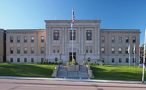
Pope County, Minnesota
County in Minnesota, United States
Distance: Approx. 6763 meters
Latitude and longitude: 45.59,-95.45
Pope County is a county in the U.S. state of Minnesota. As of the 2020 census, the population was 11,308. Its county seat is Glenwood.
Blue Mounds Township, Pope County, Minnesota
Township in Minnesota, United States
Distance: Approx. 7815 meters
Latitude and longitude: 45.54638889,-95.56055556
Blue Mounds Township is a township in Pope County, Minnesota, United States. The population was 207 at the 2000 census. The township derives its name from Blue Mounds, Wisconsin.
Minnewaska Township, Pope County, Minnesota
Township in Minnesota, United States
Distance: Approx. 6909 meters
Latitude and longitude: 45.6525,-95.46138889
Minnewaska Township is a township in Pope County, Minnesota, United States. The population was 504 at the 2000 census. The township took its name from Lake Minnewaska.
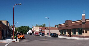
Starbuck, Minnesota
City in Minnesota, United States
Distance: Approx. 241 meters
Latitude and longitude: 45.61166667,-95.53222222
Starbuck is a city in Pope County, Minnesota, United States. The population was 1,365 at the 2020 census. The city is on the western shore of Lake Minnewaska.
White Bear Lake Township, Pope County, Minnesota
Township in Minnesota, United States
Distance: Approx. 3732 meters
Latitude and longitude: 45.63138889,-95.57055556
White Bear Lake Township is a township in Pope County, Minnesota, United States. The population was 440 at the 2000 census. The township was named for White Bear, an Ojibwe chief, who is buried there near a lake shore.
Minnewaska Area High School
Public high school in the United States
Distance: Approx. 5981 meters
Latitude and longitude: 45.6249,-95.4552
Minnewaska Area High School is a public school for grades 9–12 located between Starbuck and Glenwood Minnesota. The school mascot is the Lakers. Minnewaska is a member of the West Central Conference.

Little Falls and Dakota Depot
United States historic place
Distance: Approx. 186 meters
Latitude and longitude: 45.61166667,-95.53069444
The Little Falls and Dakota Depot, also called the Starbuck Depot, is a former railway station in Starbuck, Minnesota. It was in service from 1882 to 1982. The depot was listed on the National Register of Historic Places in 2006 for having local significance under the themes of commerce, exploration/settlement, and transportation.

Lake Minnewaska (Minnesota)
Lake in the state of Minnesota, United States
Distance: Approx. 6529 meters
Latitude and longitude: 45.61166667,-95.44638889
Lake Minnewaska is a lake in Pope County, in the U.S. state of Minnesota. It is approximately 8,050 sq acres (33 km2) in size with 20 miles (32 km) of shoreline. The lake has a maximum depth of 32 feet (10 m) and an average depth of 17 feet (5 m).
Signalness Lake
Lake in the state of Minnesota, United States
Distance: Approx. 8093 meters
Latitude and longitude: 45.54083333,-95.52194444
Signalness Lake is a lake in Pope County, in the U.S. state of Minnesota. Signalness Lake was named for Olaus Signalness, a Norwegian settler.
Signalness Creek
Stream in Pope County, Minnesota, U.S.
Distance: Approx. 8016 meters
Latitude and longitude: 45.54611111,-95.56722222
Signalness Creek is a stream in Pope County, in the U.S. state of Minnesota. Signalness Creek was named for Olaus Signalness, a Norwegian settler.
Malmedal Lake
Lake in the state of Minnesota, United States
Distance: Approx. 6469 meters
Latitude and longitude: 45.67138889,-95.5325
Malmedal Lake is a lake in Pope County, in the U.S. state of Minnesota. Malmedal Lake was named for Christian Malmedard, a Norwegian settler.

Minnewaska Hospital
United States historic place
Distance: Approx. 217 meters
Latitude and longitude: 45.61236111,-95.53263889
Minnewaska Hospital was a building in Starbuck, Minnesota on the National Register of Historic Places. When it was built in 1899–1900 for Dr. C. R. Christenson, it was the only hospital between Minneapolis and Fargo, North Dakota.
Weather in this IP's area
overcast clouds
-3 Celsius
-7 Celsius
-3 Celsius
-3 Celsius
1019 hPa
93 %
1019 hPa
970 hPa
10000 meters
3.6 m/s
270 degree
100 %
