199.216.35.229 - IP Lookup: Free IP Address Lookup, Postal Code Lookup, IP Location Lookup, IP ASN, Public IP
Country:
Region:
City:
Location:
Time Zone:
Postal Code:
ISP:
ASN:
language:
User-Agent:
Proxy IP:
Blacklist:
IP information under different IP Channel
ip-api
Country
Region
City
ASN
Time Zone
ISP
Blacklist
Proxy
Latitude
Longitude
Postal
Route
db-ip
Country
Region
City
ASN
Time Zone
ISP
Blacklist
Proxy
Latitude
Longitude
Postal
Route
IPinfo
Country
Region
City
ASN
Time Zone
ISP
Blacklist
Proxy
Latitude
Longitude
Postal
Route
IP2Location
199.216.35.229Country
Region
alberta
City
edmonton
Time Zone
America/Edmonton
ISP
Language
User-Agent
Latitude
Longitude
Postal
ipdata
Country
Region
City
ASN
Time Zone
ISP
Blacklist
Proxy
Latitude
Longitude
Postal
Route
Popular places and events near this IP address
Strathcona High School
10-12 school in Edmonton, Alberta (est. 1908)
Distance: Approx. 1641 meters
Latitude and longitude: 53.50888889,-113.49916667
Strathcona High School, colloquially referred to as Scona and SCHS, is a public high school located in Edmonton, Alberta. The school was referred to as Strathcona Composite High School until 2014. A $6.1 million modernization project was completed in 2015 and the school now enrolls approximately 1700 students.

Northern Alberta Jubilee Auditorium
Performing arts venue and cultural facility in Edmonton, Canada
Distance: Approx. 1716 meters
Latitude and longitude: 53.5219,-113.5289
The Northern Alberta Jubilee Auditorium is a 4-million-cubic-foot (110,000 m3) performing arts, culture and community facility, located in Edmonton, Alberta, Canada.

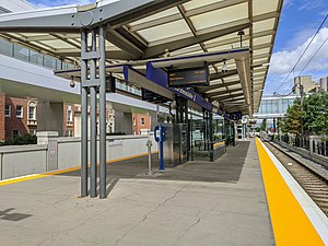
Health Sciences/Jubilee station
Light rail station in Edmonton, Alberta, Canada
Distance: Approx. 1507 meters
Latitude and longitude: 53.52027778,-113.52583333
Health Sciences/Jubilee station is an Edmonton LRT station in Edmonton, Alberta, Canada. It serves both the Capital Line and the Metro Line. As of 2021, it is the southern terminus of the Metro Line.

McKernan/Belgravia station
Light rail station in Edmonton, Alberta, Canada
Distance: Approx. 714 meters
Latitude and longitude: 53.51305556,-113.52611111
McKernan/Belgravia station is an Edmonton LRT station in Edmonton, Alberta. It is served by the Capital Line, and is the least used station on the LRT system with a typical weekday traffic averaging 4,138 riders as of 2019. It is a ground-level station located on 114 Street at 76 Avenue.

South Campus/Fort Edmonton Park station
Light rail station in Edmonton, Alberta
Distance: Approx. 553 meters
Latitude and longitude: 53.50277778,-113.52861111
South Campus/Fort Edmonton Park station is an Edmonton LRT station in Edmonton, Alberta. It is served by the Capital Line. It is a ground-level station located on the University of Alberta's South Campus approximately two blocks to the west of the site originally proposed for the station on 113 Street.

University of Alberta Hospital
Hospital in Edmonton, Alberta
Distance: Approx. 1533 meters
Latitude and longitude: 53.520556,-113.524722
The University of Alberta Hospital (UAH) is a research and teaching hospital in Edmonton, Alberta, Canada. The hospital is affiliated with the University of Alberta and run by Alberta Health Services, the health authority for Alberta. It is one of Canada's leading health sciences centres, providing a comprehensive range of diagnostic and treatment services to inpatients and outpatients.

Foote Field
Sports facility in Edmonton, Alberta
Distance: Approx. 604 meters
Latitude and longitude: 53.5038,-113.5313
Foote Field is a multi-purpose sports facility on the University of Alberta South Campus in Edmonton, Alberta, Canada, built as a legacy facility for the 2001 World Championships in Athletics. It was named for University of Alberta alumnus, former varsity track athlete, and philanthropist Eldon Foote, who donated $2 million toward the construction costs.

Stollery Children's Hospital
Hospital in Edmonton, Alberta
Distance: Approx. 1533 meters
Latitude and longitude: 53.520556,-113.524722
The Stollery Children's Hospital is a 218 bed children's hospital that opened in October 2001. It is a "hospital within a hospital," being situated within the University of Alberta Hospital and co-located with Mazankowski Alberta Heart Institute in the Walter C. Mackenzie Health Sciences Centre in Edmonton, Alberta, Canada. The hospital, which was run by Capital Health before being merged in 2008 into Alberta Health Services, is named for Bob and Shirley Stollery, who provided the original donation which helped with the creation of the hospital.
Cross Cancer Institute
Hospital in Edmonton, Alberta, Canada
Distance: Approx. 1324 meters
Latitude and longitude: 53.51777778,-113.53138889
Cross Cancer Institute is the comprehensive cancer centre for northern Alberta. The institute, named for Wallace Warren Cross, is located in Edmonton near the southwest corner of the University of Alberta, and is one of two tertiary cancer centres in the province. The Cross Cancer Institute is a lead centre for the province-wide prevention, research and treatment program.
Alberta School for the Deaf
K-12 school in Edmonton, Alberta (est. 1956)
Distance: Approx. 757 meters
Latitude and longitude: 53.5,-113.524
The Alberta School for the Deaf is a provincial school in Edmonton, Alberta with elementary and secondary residential and day programs serving deaf and hard-of-hearing students. Teachers are both deaf and hearing. Alberta School for the Deaf is modeled on a bilingual-bicultural approach.
Saville Community Sports Centre
Distance: Approx. 761 meters
Latitude and longitude: 53.5022,-113.5322
The Saville Community Sports Centre is a sports facility operated by the University of Alberta's Faculty of Physical Education and Recreation in Edmonton, Alberta . It features a curling rink, tennis courts and a gymnasium. Opened in 2003, the centre currently serves as the national training centre for curling in Canada.
Edmonton-Parkallen
Defunct provincial electoral district in Alberta, Canada
Distance: Approx. 662 meters
Latitude and longitude: 53.503,-113.516
Edmonton-Parkallen was a provincial electoral district in Alberta, Canada, mandated to return a single member to the Legislative Assembly of Alberta using the first past the post method of voting from 1971 to 1993.
Weather in this IP's area
overcast clouds
5 Celsius
3 Celsius
4 Celsius
5 Celsius
1015 hPa
48 %
1015 hPa
933 hPa
10000 meters
2.57 m/s
290 degree
100 %