199.216.209.122 - IP Lookup: Free IP Address Lookup, Postal Code Lookup, IP Location Lookup, IP ASN, Public IP
Country:
 Canada
Region:
City:
Location:
Time Zone:
Postal Code:
ISP:
ASN:
language:
User-Agent:
Proxy IP:
Blacklist:
IP information under different IP Channel
ip-api
Country
Region
City
ASN
Time Zone
ISP
Blacklist
Proxy
Latitude
Longitude
Postal
Route
db-ip
Country
Region
City
ASN
Time Zone
ISP
Blacklist
Proxy
Latitude
Longitude
Postal
Route
IPinfo
Country
Region
City
ASN
Time Zone
ISP
Blacklist
Proxy
Latitude
Longitude
Postal
Route
IP2Location
199.216.209.122Country
caRegion
alberta
City
peace river
Time Zone
America/Edmonton
ISP
Language
User-Agent
Latitude
Longitude
Postal
ipdata
Country
Region
City
ASN
Time Zone
ISP
Blacklist
Proxy
Latitude
Longitude
Postal
Route
Popular places and events near this IP address

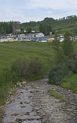
Peace River, Alberta
Town in Alberta, Canada
Distance: Approx. 1769 meters
Latitude and longitude: 56.23583333,-117.29861111
Peace River (originally named Peace River Crossing and known as Rivière-la-Paix in French) is a town in northwest Alberta, Canada. It is along the banks of the Peace River at its confluence with the Smoky River, the Heart River and Pat's Creek. It is approximately 486 kilometres (302 mi) northwest of Edmonton and 198 kilometres (123 mi) northeast of Grande Prairie on Highway 2.

Smoky River
River in Alberta, Canada
Distance: Approx. 7751 meters
Latitude and longitude: 56.18583333,-117.33416667
The Smoky River is a river in western Alberta, Canada. It is a major tributary of the Peace River. The name refers to the presence of "smouldering beds of coal in the riverbank" noted by the Cree people, an Indigenous people of the area.

CKKX-FM
Radio station in Peace River, Alberta
Distance: Approx. 2049 meters
Latitude and longitude: 56.23638889,-117.26388889
CKKX-FM is a Canadian radio station that broadcasts a CHR/Top 40 format at 106.1 FM in Peace River, Alberta and has rebroadcasters in High Level, Fairview, High Prairie, and Manning. The station is branded as Kix FM and is owned by Peace River Broadcasting. The station received approval by the Canadian Radio-television and Telecommunications Commission (CRTC) in 1997.
Diocese of Athabasca
Diocese of the Anglican Church in Canada
Distance: Approx. 1771 meters
Latitude and longitude: 56.235,-117.295
The Anglican Diocese of Athabasca is a diocese of the Northern Lights of the Anglican Church of Canada, in the northern half of the civil province of Alberta. It was created in 1874 by the division into four parts of the original Diocese of Rupert's Land. The Synod of the Diocese of Athabasca was organized in 1876.
Peace River Formation
Distance: Approx. 6300 meters
Latitude and longitude: 56.2,-117.33333333
The Peace River Formation is a stratigraphical unit of middle Albian age in the Western Canadian Sedimentary Basin. It takes the name from the Peace River, and was first described on the banks of the river, downstream from the Smoky River confluence to the mouth of the Notikewin River by McConnell in 1893.

Heart River (Alberta)
River in Alberta, Canada
Distance: Approx. 2213 meters
Latitude and longitude: 56.23047,-117.29169
The Heart River is a river in northern Alberta, Canada. It is a major tributary of the Peace River. The motto of the village of Nampa, Alberta is A Place close to the Heart, a reference to the river flowing through the community.
Pat's Creek (Alberta)
Creek in Canada
Distance: Approx. 1982 meters
Latitude and longitude: 56.23339,-117.297084
Pat's Creek is a tributary of the Peace River in northern Alberta, Canada whose mouth is located within the Town of Peace River. It is named after Patrick Wesley, a Métis man who lived in a cabin adjacent to the creek on his property. He deeded to the Anglican Church 5 acres of his land, including the creek, as tokens of his appreciation for care given to him during his final days in the battle with smallpox.
St. James' Cathedral (Peace River)
Distance: Approx. 1766 meters
Latitude and longitude: 56.2351,-117.2953
St. James's Cathedral, is the Anglican cathedral of the Diocese of Athabasca: it is in Peace River, Alberta, and celebrated its centenary in 2012.
Weather in this IP's area
light snow
-15 Celsius
-21 Celsius
-15 Celsius
-15 Celsius
1033 hPa
78 %
1033 hPa
982 hPa
10000 meters
3.09 m/s
10 degree
75 %