Country:
Region:
City:
Latitude and Longitude:
Time Zone:
Postal Code:
IP information under different IP Channel
ip-api
Country
Region
City
ASN
Time Zone
ISP
Blacklist
Proxy
Latitude
Longitude
Postal
Route
Luminati
Country
Region
mn
City
duluth
ASN
Time Zone
America/Chicago
ISP
COMPISP
Latitude
Longitude
Postal
IPinfo
Country
Region
City
ASN
Time Zone
ISP
Blacklist
Proxy
Latitude
Longitude
Postal
Route
db-ip
Country
Region
City
ASN
Time Zone
ISP
Blacklist
Proxy
Latitude
Longitude
Postal
Route
ipdata
Country
Region
City
ASN
Time Zone
ISP
Blacklist
Proxy
Latitude
Longitude
Postal
Route
Popular places and events near this IP address
Carlton, Minnesota
City in Minnesota, United States
Distance: Approx. 6873 meters
Latitude and longitude: 46.66388889,-92.425
Carlton is a city and the county seat of Carlton County, Minnesota, United States. The population was 948 at the 2020 census. The town sits on the northwestern edge of Jay Cooke State Park.

Cloquet, Minnesota
City in Minnesota, United States
Distance: Approx. 311 meters
Latitude and longitude: 46.72166667,-92.45944444
Cloquet ( kloh-KAY) is a city in Carlton County, Minnesota, United States, at the junction of Interstate 35 and Minnesota State Highway 33. Part of the city lies within the Fond du Lac Indian Reservation and serves as one of the reservation's three administrative centers. The population was 12,568 at the 2020 census.

Scanlon, Minnesota
City in Minnesota, United States
Distance: Approx. 2680 meters
Latitude and longitude: 46.70666667,-92.42833333
Scanlon is a city in Carlton County, Minnesota, United States. The population was 987 at the 2020 census. Interstate 35 and Carlton County Highway 45 (CR 45) are two of the main routes in Scanlon.
Thomson Township, Carlton County, Minnesota
Township in Minnesota, United States
Distance: Approx. 7122 meters
Latitude and longitude: 46.71277778,-92.36305556
Thomson Township is a township in Carlton County, Minnesota, United States. The population was 5,003 as of the 2010 census. Thomson Township took its name from the city of Thomson.

Carlton High School
Public high school in Minnesota, United States
Distance: Approx. 6788 meters
Latitude and longitude: 46.6652778,-92.4227778
Carlton High School is a public high school located in Carlton, Minnesota, United States. The school operates under the Carlton Public School District, housing grades 6 through 12. It serves a population of approximately 350 students.
Cloquet High School
School in Cloquet, Minnesota, United States
Distance: Approx. 1735 meters
Latitude and longitude: 46.7097222,-92.4413889
Cloquet High School (CHS) is a high school in Cloquet in the U.S. state of Minnesota. Operated by Cloquet Public Schools, it serves approximately 700 students in grades 9-12; a typical graduating class has 160 to 200 members. It has existed for over 100 years.
Carlton County Courthouse
United States historic place
Distance: Approx. 6775 meters
Latitude and longitude: 46.66499722,-92.42432778
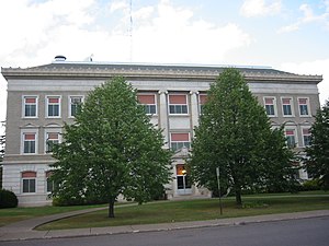
The Carlton County Courthouse in Carlton, Minnesota, United States, is the county seat of Carlton County, Minnesota. The county seat was originally located in Cloquet, with a jail located at the town of Northern Pacific Junction. In 1890, residents of Northern Pacific Junction raised funds to build a courthouse, which was a two-story brick building with a high-pitched gable roof.

Cloquet City Hall
United States historic place
Distance: Approx. 728 meters
Latitude and longitude: 46.72314722,-92.46479722
The Cloquet City Hall, also known as the Spafford Building, is located at Avenue B and Arch Street in Cloquet in the U.S. state of Minnesota. The red brick Colonial Revival building was built in 1920 and features quoins, keystones, and an entablature with a high parapet. Tall stone pilasters extend to the high cornice.
Fond du Lac Tribal and Community College
Public tribal college in Cloquet, Minnesota, US
Distance: Approx. 3560 meters
Latitude and longitude: 46.6903,-92.4492
Fond du Lac Tribal and Community College (FDLTCC) is a public tribal land-grant community college in Cloquet, Minnesota. FDLTCC is located within the Twin Ports area of Duluth, Minnesota and Superior, Wisconsin in northeastern Minnesota. The college is a member of Minnesota State, the American Indian Higher Education Consortium, and the World Indigenous Nations Higher Education Consortium.
Midway River
River in Minnesota, United States
Distance: Approx. 7139 meters
Latitude and longitude: 46.67194444,-92.39694444
The Midway River is an 18.8-mile-long (30.3 km) river located in southern Saint Louis County and northeast Carlton County, Minnesota, United States. It is a tributary of the Saint Louis River and flows northeast to southwest. The Midway River rises in the central part of Hermantown, then flows through Midway Township and Thomson Township, before flowing into the Saint Louis River southeast of Cloquet.

R. W. Lindholm Service Station
United States historic place
Distance: Approx. 420 meters
Latitude and longitude: 46.72138889,-92.46083333
The R. W. Lindholm Service Station is a service station designed by Frank Lloyd Wright and located in Cloquet, Minnesota, United States. Built in 1958 and still in use, it is the only station built to a Wright design during his lifetime. It was originally part of Wright's utopian Broadacre City plan and is one of the few designs from that plan that was actually implemented.
Fond du Lac Ojibwe School
Tribal school in Cloquet, Minnesota
Distance: Approx. 4584 meters
Latitude and longitude: 46.7108,-92.5132
Fond du Lac Ojibwe School is a K–12 tribal school in Cloquet, Minnesota. The Fond du Lac Band of Lake Superior Chippewa operates the school and owns the facilities. It is affiliated with the Bureau of Indian Education (BIE).
Weather in this IP's area
overcast clouds
6 Celsius
3 Celsius
5 Celsius
7 Celsius
1004 hPa
73 %
1004 hPa
960 hPa
10000 meters
4.12 m/s
90 degree
100 %
07:17:32
16:33:01
