199.21.159.79 - IP Lookup: Free IP Address Lookup, Postal Code Lookup, IP Location Lookup, IP ASN, Public IP
Country:
Region:
City:
Location:
Time Zone:
Postal Code:
IP information under different IP Channel
ip-api
Country
Region
City
ASN
Time Zone
ISP
Blacklist
Proxy
Latitude
Longitude
Postal
Route
Luminati
Country
Region
ca
City
fullerton
ASN
Time Zone
America/Los_Angeles
ISP
NETBLK-DMRCOM
Latitude
Longitude
Postal
IPinfo
Country
Region
City
ASN
Time Zone
ISP
Blacklist
Proxy
Latitude
Longitude
Postal
Route
IP2Location
199.21.159.79Country
Region
california
City
paramount
Time Zone
America/Los_Angeles
ISP
Language
User-Agent
Latitude
Longitude
Postal
db-ip
Country
Region
City
ASN
Time Zone
ISP
Blacklist
Proxy
Latitude
Longitude
Postal
Route
ipdata
Country
Region
City
ASN
Time Zone
ISP
Blacklist
Proxy
Latitude
Longitude
Postal
Route
Popular places and events near this IP address

East Rancho Dominguez, California
Unincorporated community in California, United States
Distance: Approx. 3083 meters
Latitude and longitude: 33.89777778,-118.19416667
East Rancho Dominguez, () also known as East Compton, is an unincorporated community and census-designated place (CDP) located in southern Los Angeles County, California. The population was 15,135 at the 2010 census, up from 9,286 at the 2000 census. East Rancho Dominguez is an accepted city name according to the USPS, and shares the 90221 ZIP Code with Compton.

Paramount, California
City in California, United States
Distance: Approx. 586 meters
Latitude and longitude: 33.9,-118.16666667
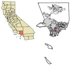
Paramount is a city in Los Angeles County, California, United States. According to the 2010 census, the city had a total population of 54,098, down from 55,266 at the 2000 census. Paramount is part of the Greater Los Angeles Area and is bordered by Compton and Lynwood to the west, South Gate and Downey to the north, Bellflower to the east and south, and Long Beach to the south.
Manuel Dominguez High School
Public high school in Compton, California, United States
Distance: Approx. 2039 meters
Latitude and longitude: 33.893893,-118.18231
Manuel Dominguez High School is a four-year public high school located in Compton, California. It is part of the Compton Unified School District.
Toyota Auto Body California
Automotive parts plant in Long Beach, California, US
Distance: Approx. 2951 meters
Latitude and longitude: 33.8715,-118.1615
Toyota Auto Body California (TABC) is a manufacturing plant in Long Beach, California. Established in 1972, TABC was the first Toyota plant in North America. A subsidiary of Toyota Motor North America, the plant occupies 30 acres (12 ha).
Somerset High School (Bellflower, California)
Public High School in Bellflower, California
Distance: Approx. 2839 meters
Latitude and longitude: 33.88222222,-118.13666667
Somerset High School is a continuation school located in Bellflower, California, as part of the Bellflower Unified School District (BUSD). As of 2004, Somerset had 17 regular educations teachers and 16 classrooms serving 353 students from the communities of Lakewood and Bellflower. Average class size is 12.7 students.
KLTX
Radio station in Long Beach, California, United States
Distance: Approx. 2271 meters
Latitude and longitude: 33.89166667,-118.18416667
KLTX is a radio station licensed to Long Beach, California, serving the greater Los Angeles area, broadcasting at a frequency of 1390 kHz AM. The station airs a Spanish Christian format, and is branded "Radio Inspiración".
Lakewood Boulevard station
Los Angeles Metro Rail station
Distance: Approx. 2519 meters
Latitude and longitude: 33.9131,-118.1405
Lakewood Boulevard station is a below-grade light rail station on the C Line of the Los Angeles Metro Rail system. It is situated in the median of Interstate 105 (Century Freeway), below Lakewood Boulevard, after which the station is named. The station serves the city of Downey, California and opened as part of the Green Line on August 12, 1995.
St. Pius X - St. Matthias Academy
Private school in Downey, California, United States
Distance: Approx. 2357 meters
Latitude and longitude: 33.91916667,-118.16
St. Pius X - St. Matthias Academy is a coeducational private, Catholic high school for grades 9–12 located in Downey, California.

Los Angeles Airways Flight 841
1968 helicopter accident
Distance: Approx. 1178 meters
Latitude and longitude: 33.8888,-118.1671
Los Angeles Airways Flight 841 was a Sikorsky S-61 helicopter that crashed at 5:50 p.m. on Wednesday, May 22, 1968, in the city of Paramount, California. All twenty passengers and three crew members were killed.
Pius X High School (Downey, California)
Private school in Downey, Los Angeles, California, United States
Distance: Approx. 2398 meters
Latitude and longitude: 33.919496,-118.159056
Pius X High School (Pius X) is a co-educational, private, four year (grade levels 9-12) high school located at 7851 Gardendale Street, in the city of Downey, California. The school was founded in 1953, and named for St.

Rosecrans Avenue
Street in Los Angeles
Distance: Approx. 2182 meters
Latitude and longitude: 33.903643,-118.183414
Rosecrans Avenue is a major west-east thoroughfare in Los Angeles and Orange Counties, California, USA. It has a total length of 27.5 miles (44.3 km). The street is named after U.S. Union General William S. Rosecrans, who purchased 13,000 acres (5,300 ha) of Rancho Sausal Redondo southwest of Los Angeles in 1869. Rosecrans Avenue was originally named Drexel Avenue, and ran through the Rosecrans Rancho which is part of modern-day Gardena.

Hay Tree
Historic site in Paramount, California
Distance: Approx. 1536 meters
Latitude and longitude: 33.8842,-118.16060556
Hay Tree is a historic camphor tree in what is now downtown Paramount, California, United States. The Hay Tree was designated a California Historic Landmark (No. 1038) on August 8, 2003.
Weather in this IP's area
clear sky
15 Celsius
13 Celsius
12 Celsius
17 Celsius
1024 hPa
31 %
1024 hPa
1028 hPa
10000 meters
0.65 m/s
1.31 m/s
347 degree
