199.21.159.201 - IP Lookup: Free IP Address Lookup, Postal Code Lookup, IP Location Lookup, IP ASN, Public IP
Country:
Region:
City:
Location:
Time Zone:
Postal Code:
ISP:
ASN:
language:
User-Agent:
Proxy IP:
Blacklist:
IP information under different IP Channel
ip-api
Country
Region
City
ASN
Time Zone
ISP
Blacklist
Proxy
Latitude
Longitude
Postal
Route
db-ip
Country
Region
City
ASN
Time Zone
ISP
Blacklist
Proxy
Latitude
Longitude
Postal
Route
IPinfo
Country
Region
City
ASN
Time Zone
ISP
Blacklist
Proxy
Latitude
Longitude
Postal
Route
IP2Location
199.21.159.201Country
Region
california
City
gardena
Time Zone
America/Los_Angeles
ISP
Language
User-Agent
Latitude
Longitude
Postal
ipdata
Country
Region
City
ASN
Time Zone
ISP
Blacklist
Proxy
Latitude
Longitude
Postal
Route
Popular places and events near this IP address

Alondra Park, California
Place in California, United States
Distance: Approx. 1726 meters
Latitude and longitude: 33.89083333,-118.33416667
Alondra Park (), also known as El Camino Village, is an unincorporated community and census designated place (CDP) in the South Bay region of Los Angeles County, California, United States. It is the unincorporated area north of Alondra Community Regional Park and El Camino College. It is east of Lawndale, south of Hawthorne, west of Gardena, and north of Torrance.

Gardena, California
City in California, United States
Distance: Approx. 1190 meters
Latitude and longitude: 33.89361111,-118.30777778
Gardena is a city located in the South Bay region of Los Angeles County, California, United States. The population was 61,027 at the 2020 census, up from 58,829 at the 2010 census. Until 2014, the U.S. census cited the City of Gardena as the place with the highest percentage of Japanese Americans in California.
El Camino College
Community college in Alondra Park, California, US
Distance: Approx. 1862 meters
Latitude and longitude: 33.885881,-118.330457
El Camino College (Elco or ECC) is a public community college in Los Angeles County, California. Most of it is in Alondra Park, while a section is in the city limits of Torrance. It consists of 37 buildings spanning an area of roughly 26 acres (11 ha).

California's 43rd congressional district
U.S. House district for California
Distance: Approx. 1693 meters
Latitude and longitude: 33.90305556,-118.33638889
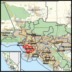
California's 43rd congressional district is a congressional district in the U.S. state of California that is currently represented by Democrat Maxine Waters. The district is centered in the southern part of Los Angeles County, and includes portions of the cities of Los Angeles (including LAX) and Torrance. It includes the entirety of the cities of Hawthorne, Lawndale, Gardena, Inglewood, and Lomita.
Eldon (toy company)
American Toy Company
Distance: Approx. 2083 meters
Latitude and longitude: 33.9179,-118.322
Eldon Industries, Inc. was a toy company located in Hawthorne, California (the hometown of the Mattel toy company), that also in its heyday operated factories in Canada, Spain, England, Japan, and the Netherlands. The company is best known for items and brands that repackaged Japanese toys and distributed them worldwide - an example is the Billy Blastoff astronaut toy produced by Tomy.
Junípero Serra High School (Gardena, California)
Private school in Gardena, California, United States
Distance: Approx. 321 meters
Latitude and longitude: 33.89666667,-118.3175
Established in 1950, Junípero Serra High School is a four-year, private, Roman Catholic, coeducational, college preparatory school in Gardena, California, with an alumni body of more than 6,000 located throughout the United States and abroad. Honored as a California State School of the Year, Serra is operated by the Roman Catholic Archdiocese of Los Angeles.
Gardena Police Department
Law enforcement agency in California, US
Distance: Approx. 2062 meters
Latitude and longitude: 33.88333333,-118.3075
The Gardena Police Department is the principal law enforcement agency responsible for the city of Gardena, California, in the United States. The current Chief of Police is Michael Saffell, appointed in 2019. Chief Saffell is a 30 year veteran of the Gardena Police Department.
Gardena Office of Economic Development
Distance: Approx. 2070 meters
Latitude and longitude: 33.8837,-118.3066
The Gardena Office of Economic Development's purpose is to attract new business, and to stimulate job creation by providing services to businesses and industries relocating to or expanding within Gardena, California.

Larry Flynt's Lucky Lady Casino
Casino in Gardena, California, United States
Distance: Approx. 2362 meters
Latitude and longitude: 33.90238,-118.29329
Larry Flynt's Lucky Lady Casino is a cardroom located in Gardena, California. It replaced Normandie Casino. In 1940, the Western Club opened on Western Avenue.
All Olympia Gymnastics Center
Gymnastics gym in Calabasas, California
Distance: Approx. 1997 meters
Latitude and longitude: 33.913086,-118.332569
The All Olympia Gymnastics Center or AOGC is a one-facility gymnastics gym in Calabasas. A previous location in Hawthorne, California, was closed down. The head coaches are 1983 World Vault Champion Artur Akopyan and 1980 Olympian Galina Marinova.
Featherstone Field
College sports stadium in California, U.S
Distance: Approx. 2087 meters
Latitude and longitude: 33.88444444,-118.33222222
Featherstone Field, previously known as Murdock Stadium is a stadium on the campus of El Camino College in Torrance, California. Built in 1958 the stadium seats around 12,127 on wood-backed bleacher seats. It was home to the North American Soccer League's Los Angeles Aztecs for two years (1975–1976), the American Soccer League's Southern California Lazers for a single season in 1978, as well as several United States men's national soccer team FIFA World Cup qualification matches.
Gardena Cinema
Movie theater in Gardena, California
Distance: Approx. 803 meters
Latitude and longitude: 33.89597222,-118.32625
Gardena Cinema is an 800-seat, single-screen movie theater located on Crenshaw Boulevard, Gardena, California in the US. It was built in the 1940s.
Weather in this IP's area
clear sky
10 Celsius
9 Celsius
9 Celsius
11 Celsius
1011 hPa
66 %
1011 hPa
1010 hPa
10000 meters
2.57 m/s
70 degree