199.21.130.187 - IP Lookup: Free IP Address Lookup, Postal Code Lookup, IP Location Lookup, IP ASN, Public IP
Country:
Region:
City:
Location:
Time Zone:
Postal Code:
IP information under different IP Channel
ip-api
Country
Region
City
ASN
Time Zone
ISP
Blacklist
Proxy
Latitude
Longitude
Postal
Route
Luminati
Country
ASN
Time Zone
America/Chicago
ISP
ITRIG-ASN1
Latitude
Longitude
Postal
IPinfo
Country
Region
City
ASN
Time Zone
ISP
Blacklist
Proxy
Latitude
Longitude
Postal
Route
IP2Location
199.21.130.187Country
Region
michigan
City
bath
Time Zone
America/Detroit
ISP
Language
User-Agent
Latitude
Longitude
Postal
db-ip
Country
Region
City
ASN
Time Zone
ISP
Blacklist
Proxy
Latitude
Longitude
Postal
Route
ipdata
Country
Region
City
ASN
Time Zone
ISP
Blacklist
Proxy
Latitude
Longitude
Postal
Route
Popular places and events near this IP address

Bath Charter Township, Michigan
Local government area in Michigan, United States
Distance: Approx. 3613 meters
Latitude and longitude: 42.80583333,-84.41833333
Bath Charter Township is a charter township of Clinton County in the state of Michigan in the U.S.. As of the 2020 census, the township population was 13,292, an increase from 11,598 at the 2010 census. It is situated directly north of the city of East Lansing.

DeWitt Charter Township, Michigan
Charter township in Michigan, United States
Distance: Approx. 6587 meters
Latitude and longitude: 42.81138889,-84.53944444
DeWitt Charter Township is a charter township of Clinton County in the U.S. state of Michigan. The population was 15,073 at the 2020 census, which was an increase from 14,321 at the 2010 census. The original survey township now includes portions of the cities of DeWitt, East Lansing, and Lansing, but all are administered autonomously or through 425 Agreements.

East Lansing, Michigan
City in Michigan, United States
Distance: Approx. 8046 meters
Latitude and longitude: 42.74805556,-84.48361111
East Lansing is a city in the U.S. state of Michigan. Most of the city lies within Ingham County with a smaller portion extending north into Clinton County. At the 2020 census the population was 47,741.

Bath, Michigan
Census-designated place & unincorporated community in Michigan, United States
Distance: Approx. 449 meters
Latitude and longitude: 42.82,-84.45444444
Bath is an unincorporated community and census-designated place (CDP) in Clinton County in the U.S. state of Michigan. It is located in Bath Charter Township. As of the 2010 census, the CDP had a population of 2,083.

Bath School disaster
1927 bombing attacks in Bath Township, Michigan
Distance: Approx. 843 meters
Latitude and longitude: 42.81666667,-84.44916667
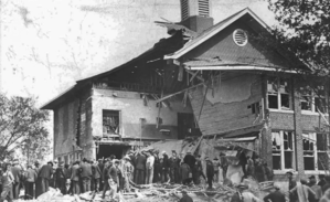
The Bath School disaster, also known as the Bath School massacre, was a series of violent attacks perpetrated by Andrew Kehoe upon the Bath Consolidated School in Bath Charter Township, Michigan, United States, on May 18, 1927. The attacks killed 38 children and 6 adults, and injured at least 58 other people. Prior to the explosions at the school, Kehoe had murdered his wife, Nellie Price Kehoe, and firebombed his farm.
University Airpark
Airport in Bath Township, Michigan
Distance: Approx. 2956 meters
Latitude and longitude: 42.84031111,-84.47914444
University Airpark (ICAO: K41G, FAA LID: 41G) is a privately-owned, public use general aviation airport located 2 miles (3 km) west-northwest of Bath, Michigan in Clinton County, Michigan, United States. Lansing Capital Region International Airport is located 6 miles (10 km) southwest.

Eastwood Towne Center
Shopping mall in Michigan, United States
Distance: Approx. 7727 meters
Latitude and longitude: 42.76239,-84.51572
Eastwood Towne Center is an open-air shopping mall and lifestyle center located in Lansing Charter Township, Michigan, United States at the northwest corner of the intersection of Lake Lansing Road and U.S. 127. Its anchor stores include NCG Cinemas, Dick's Sporting Goods, DSW Shoe Warehouse, and Pottery Barn. The center is owned, managed, and leased by Kite Realty Group Trust.

Michigan Wetland Management District
Distance: Approx. 7056 meters
Latitude and longitude: 42.76444444,-84.50527778
The Michigan Wetland Management District consists of a 14-county area and includes three waterfowl production areas (WPAs): the 160-acre (0.65 km2) Schlee WPA and the 138-acre (0.56 km2) Mahan WPA in Jackson County and the 77-acre (310,000 m2) Kinney WPA in Van Buren County. The Michigan Department of Natural Resources, Wildlife Division, oversees day-to-day management of these three areas through a partnership with the U.S. Fish and Wildlife Service. Michigan has a fourth WPA, the 95-acre (380,000 m2) Schoonover WPA, in Lenawee County.
Michigan State Medical Society
Distance: Approx. 8133 meters
Latitude and longitude: 42.7474,-84.4844
The Michigan State Medical Society (MSMS) is a professional association representing more than 15,000 physicians in Michigan. Incorporated on June 5, 1866, MSMS is a non-profit, membership organization of physicians, graduates completing residency programs, and medical school students. MSMS is the state affiliate of the American Medical Association.
Lake Lansing Park North
Park in Haslett, Ingham County, United States of America
Distance: Approx. 7759 meters
Latitude and longitude: 42.76874,-84.39223
Lake Lansing Park North is a public park in Haslett, Michigan covering over 530 acres (0.83 sq mi). The park covers a variety of ecosystems, including mature oak and maple woodlands, marshlands, pine plantations and transitional field areas. The park entrance is located at 6260 East Lake Drive across from the Lake Lansing boat launch.
Archer Stadium
Stadium in Clinton County, Michigan, USA
Distance: Approx. 5625 meters
Latitude and longitude: 42.771806,-84.486906
Archer Stadium is a 1,500 seat soccer stadium located in East Lansing, Michigan. Its primary tenants are East Lansing High School and Lansing United Women of United Women's Soccer.
Lake Lansing Park South
Park in Haslett, Ingham County, United States of America
Distance: Approx. 8181 meters
Latitude and longitude: 42.75542,-84.40702
Lake Lansing Park South is a public park in Haslett, Michigan covering 30 acres (0.047 sq mi). The entrance to the park is located at 1621 Pike Street. Lake Lansing Park South offers a beach, bathhouse, multi-purpose dock, snack bar (open in the summer), a playground near the beach, and covered picnic tables.
Weather in this IP's area
overcast clouds
-1 Celsius
-3 Celsius
-2 Celsius
0 Celsius
1029 hPa
87 %
1029 hPa
997 hPa
10000 meters
1.54 m/s
240 degree
100 %