199.204.17.220 - IP Lookup: Free IP Address Lookup, Postal Code Lookup, IP Location Lookup, IP ASN, Public IP
Country:
Region:
City:
Location:
Time Zone:
Postal Code:
IP information under different IP Channel
ip-api
Country
Region
City
ASN
Time Zone
ISP
Blacklist
Proxy
Latitude
Longitude
Postal
Route
Luminati
Country
Region
az
City
phoenix
ASN
Time Zone
America/Phoenix
ISP
SSASN2
Latitude
Longitude
Postal
IPinfo
Country
Region
City
ASN
Time Zone
ISP
Blacklist
Proxy
Latitude
Longitude
Postal
Route
IP2Location
199.204.17.220Country
Region
arizona
City
phoenix
Time Zone
America/Phoenix
ISP
Language
User-Agent
Latitude
Longitude
Postal
db-ip
Country
Region
City
ASN
Time Zone
ISP
Blacklist
Proxy
Latitude
Longitude
Postal
Route
ipdata
Country
Region
City
ASN
Time Zone
ISP
Blacklist
Proxy
Latitude
Longitude
Postal
Route
Popular places and events near this IP address

Phoenix Sky Harbor International Airport
Airport in Arizona, United States
Distance: Approx. 1479 meters
Latitude and longitude: 33.43416667,-112.01166667
Phoenix Sky Harbor International Airport (IATA: PHX, ICAO: KPHX, FAA LID: PHX) is a civil-military public international airport 3 mi (2.6 nmi; 4.8 km) east of downtown Phoenix, in Maricopa County, Arizona, United States. It is Arizona's largest and busiest airport; among the largest commercial airports in the United States, PHX was the 8th-busiest airport in the United States and 22nd-busiest in the world in 2021. The airport serves as a hub for American Airlines and a base for Frontier Airlines and Southwest Airlines.
Arizona State Prison Complex – Phoenix
Prison facility operated by the Arizona Department of Corrections
Distance: Approx. 1492 meters
Latitude and longitude: 33.453,-112.026
Arizona State Prison Complex – Phoenix is one of 13 prison facilities operated by the Arizona Department of Corrections (ADC). ASPC-Phoenix is located in Phoenix, Maricopa County, Arizona, which includes a minimum security unit near Globe, the Arizona Correctional Facility for Woman (ACW), and ASPC-Aspen.

Golden Gate Barrio
Former neighborhood in Phoenix, Arizona
Distance: Approx. 1755 meters
Latitude and longitude: 33.438,-112.045
Golden Gate Barrio was a historic Mexican-American neighborhood in the Eastside of Phoenix, Arizona. The neighborhood was razed due to eminent domain for the expansion of Phoenix Sky Harbor International Airport in the 1970s and 1990s through the West Approach Land Acquisition Project. In 1953 Father Albert Braun helped found Sacred Heart Church in neighborhood.

Mini Stack
Freeway interchange in Phoenix, Arizona
Distance: Approx. 2728 meters
Latitude and longitude: 33.46222222,-112.0375
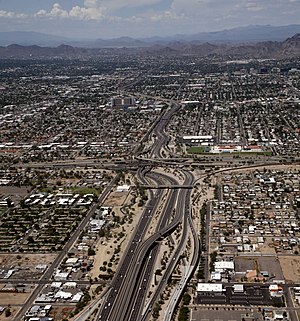
The Mini Stack is the freeway interchange among Interstate 10, State Route 51, and Loop 202 in Phoenix, Arizona, United States, located northeast of downtown. Reconstructed in 2004 to its current setup, the interchange, which is the busiest in the state of Arizona with over 300,000 vehicles per day, provides full directional access between the three freeways, as well as HOV lane connections for southbound SR 51 to eastbound I-10, westbound I-10 to northbound SR 51, westbound Loop 202 to westbound I-10, and eastbound I-10 to eastbound Loop 202.

24th Street/Jefferson and 24th Street/Washington stations
Valley Metro light rail stops in Phoenix, Arizona
Distance: Approx. 959 meters
Latitude and longitude: 33.44777778,-112.02944444
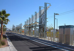
24th Street/Jefferson station and 24th Street/Washington station are a pair of light rail stations on the Valley Metro Rail in Phoenix, Arizona, United States. They are the thirteenth stop westbound and the sixteenth stop eastbound on the initial 20-mile (32 km) starter line. This station is split between two platforms, the westbound platform which is located on Washington Street at 24th Street and the eastbound platform located on Jefferson Street at 24th Street, approximately 400 feet (120 m) apart from one another.

38th Street/Washington station
Valley Metro Rail station in Phoenix, Arizona
Distance: Approx. 2609 meters
Latitude and longitude: 33.44805556,-112
38th Street/Washington (also known as GateWay Community College) is a light rail station on Valley Metro Rail in Phoenix, Arizona, United States. It is the twelfth stop westbound and the seventeenth stop eastbound on the initial 20-mile (32 km) starter line. This station is a park and ride station.
Celebrity Theatre
Theatre in Phoenix, Arizona
Distance: Approx. 1964 meters
Latitude and longitude: 33.4544,-112.0147
Celebrity Theatre is a theater in the round located in Phoenix, Arizona.
Vicki A. Romero High School
Defunct school in Arizona, United States
Distance: Approx. 1915 meters
Latitude and longitude: 33.455,-112.017
Vicki A. Romero High School was a public charter high school in Phoenix, Arizona. It operated from 1998 until 2012, when renewal of its charter was declined. The site is now home to Wilson College Prep (opened 2017) of the Phoenix Union High School District.
Bethlehem Baptist Church (Phoenix, Arizona)
Historic church in Arizona, United States
Distance: Approx. 1166 meters
Latitude and longitude: 33.44972222,-112.02944444
Bethlehem Baptist Church is a historic National Baptist church located at 1402 E. Adams Street in Phoenix, Arizona. The church was built circa 1920 and has been active continuously since its opening. The church was designed in the Colonial Revival style.

Goldwater Air National Guard Base
ANG facility at Phoenix Sky Harbor International Airport host facility of 161st Air Refueling Wing
Distance: Approx. 2057 meters
Latitude and longitude: 33.42499444,-112.01263056
Goldwater Air National Guard Base, formerly Sky Harbor Air National Guard Base, is a facility of the United States Air National Guard that exists adjacent to Phoenix Sky Harbor International Airport. It was built as the result of a 99-year lease in 1949, and was rebuilt in the 1990s to accommodate the creation of a third runway at the airport. On December 9, 2016, the Phoenix Sky Harbor Air National Guard Base was renamed Goldwater Air National Guard Base in honor of former United States Senator from Arizona and former Arizona Air National Guard member, Barry Goldwater.
Phoenix Rising Soccer Stadium
Soccer stadium in Phoenix, Arizona
Distance: Approx. 2340 meters
Latitude and longitude: 33.44527778,-112.00194444
Phoenix Rising Soccer Stadium is a soccer-specific stadium in Phoenix, Arizona. It is the home of Phoenix Rising FC of the USL Championship. The stadium was completed on April 1, 2023.
Calderon Ballroom
Distance: Approx. 1974 meters
Latitude and longitude: 33.4369,-112.0472
The Calderon Ballroom was a music venue at 1610 E. Buckeye Road in Phoenix, Arizona, United States. It was one of the most popular dance halls in the state in the 1950s and 1960s, hosting the region's top Mexican and Latin bands. During its heyday, some of the top R&B acts performed at the Calderon Ballroom.
Weather in this IP's area
overcast clouds
13 Celsius
12 Celsius
11 Celsius
15 Celsius
1018 hPa
42 %
1018 hPa
979 hPa
10000 meters
0.3 m/s
0.43 m/s
38 degree
100 %

