Country:
Region:
City:
Latitude and Longitude:
Time Zone:
Postal Code:
IP information under different IP Channel
ip-api
Country
Region
City
ASN
Time Zone
ISP
Blacklist
Proxy
Latitude
Longitude
Postal
Route
Luminati
Country
Region
qc
City
montreal
ASN
Time Zone
America/Toronto
ISP
RISQ-AS
Latitude
Longitude
Postal
IPinfo
Country
Region
City
ASN
Time Zone
ISP
Blacklist
Proxy
Latitude
Longitude
Postal
Route
db-ip
Country
Region
City
ASN
Time Zone
ISP
Blacklist
Proxy
Latitude
Longitude
Postal
Route
ipdata
Country
Region
City
ASN
Time Zone
ISP
Blacklist
Proxy
Latitude
Longitude
Postal
Route
Popular places and events near this IP address

Laval, Quebec
City in Quebec, Canada
Distance: Approx. 4170 meters
Latitude and longitude: 45.58333333,-73.75
Laval ( lə-VAL, French: [laval] ) is a city in Quebec, Canada. It is in the southwest of the province, north of Montreal. It is the largest suburb of Montreal, the third-largest city in the province after Montreal and Quebec City, and the thirteenth largest city in Canada, with a population of 443,192 in 2021.
Île Jésus
Large river island in Quebec, Canada
Distance: Approx. 4170 meters
Latitude and longitude: 45.58333333,-73.75
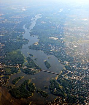
Île Jésus (French: [il ʒezy], Jesus Island) is a river island in southwestern Quebec, separated from the mainland to the north by the Rivière des Mille Îles, and from the Island of Montreal to the south by the Rivière des Prairies. It is the second-largest (242 km2 (93 sq mi)) island in the Hochelaga Archipelago (after the Island of Montreal), and the fourth most populous island in Canada, with more than 420,000 residents as of 2016. Île Jésus is the major component of the City of Laval, along with the Îles Laval and several other islands.
Rivière des Mille Îles
River in Quebec, Canada
Distance: Approx. 3731 meters
Latitude and longitude: 45.642848,-73.771133
The Rivière des Mille Îles (French: [ʁivjɛʁ de mil il], "Thousand Islands River") is a channel of the Ottawa River in southwestern Quebec, Canada and runs into the Rivière des Prairies. It is 42 kilometres (26 mi) long. It divides Île Jésus (the city of Laval) from the North Shore, the northern mainland suburbs of Montreal, such as Deux-Montagnes, Saint-Eustache, Boisbriand, Rosemère, Lorraine, Bois-des-Filion, Sainte-Thérèse, and Terrebonne.

Marc-Aurèle-Fortin (electoral district)
Federal electoral district in Quebec, Canada
Distance: Approx. 4128 meters
Latitude and longitude: 45.592,-73.772
Sainte-Rose (electoral district) re-directs here. For the provincial electoral district, see Sainte-Rose (provincial electoral district) Marc-Aurèle-Fortin is a federal electoral district in Quebec, Canada, that has been represented in the House of Commons of Canada since 2004.
Montréal/Marina Venise Water Airport
Airport in Montreal
Distance: Approx. 3914 meters
Latitude and longitude: 45.63305556,-73.78305556
Montréal/Marina Venise Water Airport, formerly TC LID: CST8, was located on the Rivière des Mille Îles near Montreal, Quebec, Canada and was open from May until the middle of November. It was classified as an airport by Nav Canada and subject to regular inspections by Transport Canada.

Sainte-Rose, Quebec
Distance: Approx. 3653 meters
Latitude and longitude: 45.61666667,-73.78333333
Sainte-Rose is a district in Laval, Quebec. It was incorporated as a village in 1850, and was a separate town until the municipal mergers on August 6, 1965 which amalgamated all the municipalities on Île Jésus into a single City of Laval. Ste-Rose is best known for the parish church, erected 1740, which contains a Casavant Frères organ and hosts numerous concerts every year, and for "Vieux Ste-Rose", an area known for its old houses and its restaurants.
Vimont, Quebec
Distance: Approx. 2367 meters
Latitude and longitude: 45.59988889,-73.72519444
Vimont is a district in the centre of Laval, Quebec. It was a separate city until the municipal mergers on August 6, 1965. Until 1960 the name was Saint-Elzéar.

Vimont (electoral district)
Provincial electoral district in Quebec, Canada
Distance: Approx. 1188 meters
Latitude and longitude: 45.63,-73.74
Vimont is a provincial electoral district in the Laval region of Quebec, Canada, that elects members to the National Assembly of Quebec. It consists of part of the city of Laval. It was created for the 1981 election from parts of Fabre and Mille-Îles electoral districts.

Vimont station
Railway station in Quebec, Canada
Distance: Approx. 1760 meters
Latitude and longitude: 45.60444444,-73.74305556
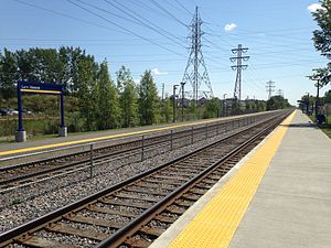
Vimont station is a commuter rail station operated by Exo in Laval, Quebec, Canada. It is served by the Saint-Jérôme line. The station is in ARTM fare zone B, and currently has 200 parking spaces.

Sainte-Rose station
Railway station in Quebec, Canada
Distance: Approx. 2379 meters
Latitude and longitude: 45.62583333,-73.76583333
Sainte-Rose station is a commuter rail station operated by Exo in Laval, Quebec, Canada. It is served by the Saint-Jérôme line. The station is located in ARTM fare zone B, and currently has 713 parking spaces and a bus loop.

Laval Regional County Municipality
Regional county municipality in Quebec, Canada
Distance: Approx. 4170 meters
Latitude and longitude: 45.58333333,-73.75
Laval was a former regional county municipality whose territory coincided with the city of Laval, Quebec. It was established in 1979, whereas the city itself had been constituted in 1965. While it existed, it was the most populous regional county municipality in Quebec.
Académie Sainte-Thérèse
Distance: Approx. 4194 meters
Latitude and longitude: 45.6461,-73.7749
Académie Sainte-Thérèse is a French-language private school in the Laurentides region of Quebec with its headquarters in Sainte-Thérèse and two campuses: Campus Rose-DeAngelis in Rosemère serves preschool (5 years old) through the fifth year of elementary school, while Campus Jacques-About in Sainte-Thérèse serves the 6th year of elementary school through the 5th (final) year of secondary school.
Weather in this IP's area
broken clouds
16 Celsius
16 Celsius
15 Celsius
18 Celsius
1006 hPa
81 %
1006 hPa
1001 hPa
10000 meters
2.57 m/s
190 degree
75 %
06:42:23
16:34:50

