199.201.95.99 - IP Lookup: Free IP Address Lookup, Postal Code Lookup, IP Location Lookup, IP ASN, Public IP
Country:
Region:
City:
Location:
Time Zone:
Postal Code:
IP information under different IP Channel
ip-api
Country
Region
City
ASN
Time Zone
ISP
Blacklist
Proxy
Latitude
Longitude
Postal
Route
Luminati
Country
Region
or
City
boardman
ASN
Time Zone
America/Los_Angeles
ISP
WINDWAVE-COMMUNICATIONS
Latitude
Longitude
Postal
IPinfo
Country
Region
City
ASN
Time Zone
ISP
Blacklist
Proxy
Latitude
Longitude
Postal
Route
IP2Location
199.201.95.99Country
Region
oregon
City
boardman
Time Zone
America/Los_Angeles
ISP
Language
User-Agent
Latitude
Longitude
Postal
db-ip
Country
Region
City
ASN
Time Zone
ISP
Blacklist
Proxy
Latitude
Longitude
Postal
Route
ipdata
Country
Region
City
ASN
Time Zone
ISP
Blacklist
Proxy
Latitude
Longitude
Postal
Route
Popular places and events near this IP address

Boardman, Oregon
City in Oregon, United States
Distance: Approx. 3286 meters
Latitude and longitude: 45.83972222,-119.70055556
Boardman is a city in Morrow County, Oregon, United States on the Columbia River and Interstate 84. As of the 2020 census the population was 3,828. It is currently the largest town in Morrow County, Oregon.
Boardman Airport
Airport in Oregon
Distance: Approx. 9696 meters
Latitude and longitude: 45.814825,-119.8205
Boardman Airport (FAA LID: M50) is a public airport 4 miles (6.4 km) southwest of the city of Boardman in Morrow County, in the U.S. state of Oregon.

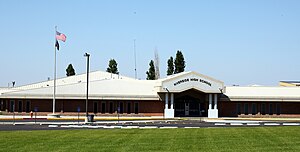
Riverside Junior/Senior High School (Boardman, Oregon)
Public school in Boardman, , Oregon, United States
Distance: Approx. 3449 meters
Latitude and longitude: 45.841341,-119.697901
Riverside Junior/Senior High School is a public high school in Boardman, Oregon, United States.
Port of Morrow
Port authority of Boardman, Oregon, United States
Distance: Approx. 5049 meters
Latitude and longitude: 45.852633,-119.671972
The Port of Morrow is the port authority in Boardman, a city in Morrow County, Oregon, United States, on the Columbia River.
Clarke, Oregon
Unincorporated community in the state of Oregon, United States
Distance: Approx. 7965 meters
Latitude and longitude: 45.83777778,-119.60083333
Clarke is an unincorporated community in Morrow County, Oregon, United States. It lies east of Boardman between Interstate 84 to the south and U.S. Route 730 to the north.
Weather in this IP's area
clear sky
10 Celsius
7 Celsius
8 Celsius
11 Celsius
1008 hPa
65 %
1008 hPa
993 hPa
10000 meters
7.15 m/s
12.57 m/s
226 degree
6 %