199.198.158.112 - IP Lookup: Free IP Address Lookup, Postal Code Lookup, IP Location Lookup, IP ASN, Public IP
Country:
 Canada
Region:
City:
Location:
Time Zone:
Postal Code:
ISP:
ASN:
language:
User-Agent:
Proxy IP:
Blacklist:
IP information under different IP Channel
ip-api
Country
Region
City
ASN
Time Zone
ISP
Blacklist
Proxy
Latitude
Longitude
Postal
Route
db-ip
Country
Region
City
ASN
Time Zone
ISP
Blacklist
Proxy
Latitude
Longitude
Postal
Route
IPinfo
Country
Region
City
ASN
Time Zone
ISP
Blacklist
Proxy
Latitude
Longitude
Postal
Route
IP2Location
199.198.158.112Country
caRegion
ontario
City
toronto
Time Zone
America/Toronto
ISP
Language
User-Agent
Latitude
Longitude
Postal
ipdata
Country
Region
City
ASN
Time Zone
ISP
Blacklist
Proxy
Latitude
Longitude
Postal
Route
Popular places and events near this IP address

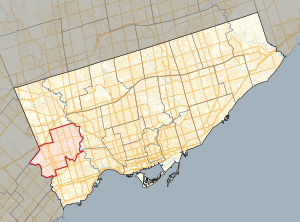
Etobicoke Centre (federal electoral district)
Federal electoral district in Ontario, Canada
Distance: Approx. 849 meters
Latitude and longitude: 43.6481,-79.5577
Etobicoke Centre (French: Etobicoke-Centre) is a federal electoral district in Ontario, Canada, that has been represented in the House of Commons of Canada since 1979.

Rob Ford Stadium
Stadium in Toronto, Canada
Distance: Approx. 1700 meters
Latitude and longitude: 43.65361111,-79.58444444
Rob Ford Stadium (formerly Centennial Park Stadium) is a 2,200-seat stadium in Toronto, Ontario, Canada. It is primarily used for soccer, track and field, football and occasionally for kabaddi. It is located within Centennial Park in Etobicoke, just south of Toronto Pearson International Airport and near the intersection of Rathburn Road and Renforth Drive.

Trader Corporation
Canadian technology company
Distance: Approx. 116 meters
Latitude and longitude: 43.645628,-79.566323
Trader Corporation is a Canadian technology company based in Toronto specializing in classified automotive advertising. The company's flagship product is AutoTrader, an online marketplace for buying and selling new and used vehicles. The company is owned by private equity firm Thoma Bravo.

Etobicoke Civic Centre
Civic building in Toronto, Canada
Distance: Approx. 167 meters
Latitude and longitude: 43.64388889,-79.56555556
The Etobicoke Civic Centre in the Eatonville neighbourhood of Toronto, Ontario, Canada, once housed the municipal government of the former City of Etobicoke. The building was built in 1958 by the firm Shore and Moffat to replace the single storey brick Township of Etobicoke Municipal Hall at 4946 Dundas Street (now Fox and a Fiddle pub). The building exterior is clad in Queenston limestone and framed by glass and aluminum.

Eatonville, Toronto
Neighbourhood in Toronto, Ontario, Canada
Distance: Approx. 1697 meters
Latitude and longitude: 43.63888889,-79.54777778
Eatonville is a neighbourhood in Toronto, Ontario, Canada. It is located west of the central core, in the former suburb of Etobicoke. Eatonville is bisected by Highway 427, with the community generally located north of Dundas Street West and south of Rathburn Road.

Markland Wood
Neighbourhood in Toronto, Ontario, Canada
Distance: Approx. 1535 meters
Latitude and longitude: 43.63222222,-79.575
Markland Wood is a residential neighbourhood in Toronto, Ontario, Canada. It is located west of the central core, in the former suburb of Etobicoke and is the westernmost residential community in Toronto along Bloor Street West. It's located on the border of Mississauga and bounded by Etobicoke Creek to the west, Elmcrest Creek to the east, Burnhamthorpe to the North, and surrounded by the Markland Wood Golf Club; approximately 2/3 is north of Bloor Street, and 1/3 south.

Silverthorn Collegiate Institute
Public high school in Toronto, Ontario, Canada
Distance: Approx. 1287 meters
Latitude and longitude: 43.63808,-79.580197
Silverthorn Collegiate Institute is a public high school in Toronto, Ontario, Canada. It is located in the neighbourhood of Markland Wood in the former suburb of Etobicoke. It is under the sanction of the Toronto District School Board (the successor to the former Etobicoke Board of Education).
Etobicoke Centre (provincial electoral district)
Provincial electoral district in Ontario, Canada
Distance: Approx. 844 meters
Latitude and longitude: 43.648,-79.5577
Etobicoke Centre is a provincial electoral district in Toronto, Ontario, Canada. It elects one member to the Legislative Assembly of Ontario. It was created in 1999 from parts of Etobicoke West and Etobicoke—Humber.

Burnhamthorpe Collegiate Institute
Alternative high school in Toronto, Ontario, Canada
Distance: Approx. 690 meters
Latitude and longitude: 43.64963,-79.56184
Burnhamthorpe Collegiate Institute and Adult Learning Centre (Burnhamthorpe CI, BCI, Burnhamthorpe ALC, BCALC, or Burnhamthorpe) is an adult and alternative high school in Toronto, Ontario, Canada. It is located in the Eatonville neighbourhood of the former suburb of Etobicoke. It has operated since 1956, currently by the Toronto District School Board, originally part of the Etobicoke Board of Education.

1975 World Association of Veteran Athletes Championships
International athletics championship event
Distance: Approx. 1700 meters
Latitude and longitude: 43.653611,-79.584444
1975 World Association of Veteran Athletes Championships is the first in a series of World Outdoor Championships (also called World Masters Track and Field Championships). The first international athletics (track and field) competitions for older athletes had taken place in 1972, when the United States Masters International Track Team (USMITT) and the Canadian Masters International Track Team (CMITT) organized a tour of Europe along with Australian and European athletes. : 18 : 45 : 62 The minimum age limit for this tour was 40 years, all men, with athletes divided into 10-year age groups called Veterans (now called Masters).
Etobicoke Hall of Fame
Distance: Approx. 195 meters
Latitude and longitude: 43.64365,-79.56537
Etobicoke Hall of Fame is a civic hall of fame in Toronto, Ontario, Canada. It began as a project of Etobicoke, a borough of Metropolitan Toronto. Etobicoke is now part of the larger city of Toronto.
Eatonville Care Centre
Distance: Approx. 604 meters
Latitude and longitude: 43.64752778,-79.56072222
Eatonville Care Centre is a privately owned long-term care facility in the Eatonville area of Etobicoke, Toronto, Ontario, Canada. As of 2020, it is owned by Rykka Care Centres. During the COVID-19 pandemic, it was particularly hard-hit, with 142 resident cases and 40 resident deaths.
Weather in this IP's area
broken clouds
-3 Celsius
-10 Celsius
-4 Celsius
-3 Celsius
1023 hPa
60 %
1023 hPa
1005 hPa
10000 meters
10.29 m/s
13.38 m/s
270 degree
75 %