199.195.55.143 - IP Lookup: Free IP Address Lookup, Postal Code Lookup, IP Location Lookup, IP ASN, Public IP
Country:
Region:
City:
Location:
Time Zone:
Postal Code:
ISP:
ASN:
language:
User-Agent:
Proxy IP:
Blacklist:
IP information under different IP Channel
ip-api
Country
Region
City
ASN
Time Zone
ISP
Blacklist
Proxy
Latitude
Longitude
Postal
Route
db-ip
Country
Region
City
ASN
Time Zone
ISP
Blacklist
Proxy
Latitude
Longitude
Postal
Route
IPinfo
Country
Region
City
ASN
Time Zone
ISP
Blacklist
Proxy
Latitude
Longitude
Postal
Route
IP2Location
199.195.55.143Country
Region
kansas
City
marysville
Time Zone
America/Chicago
ISP
Language
User-Agent
Latitude
Longitude
Postal
ipdata
Country
Region
City
ASN
Time Zone
ISP
Blacklist
Proxy
Latitude
Longitude
Postal
Route
Popular places and events near this IP address
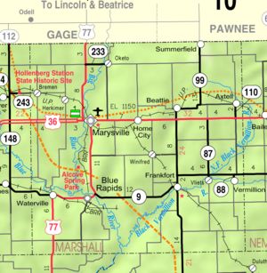
Marshall County, Kansas
County in Kansas, United States
Distance: Approx. 9487 meters
Latitude and longitude: 39.8,-96.55
Marshall County is a county located in the U.S. state of Kansas. Its county seat and largest city is Marysville. As of the 2020 census, the county population was 10,038.

Marysville, Kansas
City in Marshall County, Kansas
Distance: Approx. 766 meters
Latitude and longitude: 39.84305556,-96.63861111
Marysville is a city in and the county seat of Marshall County, Kansas, United States. As of the 2020 census, the population of the city was 3,447.
KNDY (AM)
Radio station in Marysville, Kansas
Distance: Approx. 1054 meters
Latitude and longitude: 39.85055556,-96.64777778
KNDY (1570 kHz) is a commercial AM radio station in Marysville, Kansas that plays classic country music as well as local news, weather, and sports coverage. The station signed on the air July 10, 1956 and celebrated 50 year s of broadcasting in July 2006 by moving into a new broadcast studio with sister-station KNDY-FM 95.5. On May 2, 2011, the station signed on Translator K231AX on 94.1 MHz operating at 250 watts.

Herkimer, Kansas
Unincorporated community in Marshall County, Kansas
Distance: Approx. 7798 meters
Latitude and longitude: 39.89111111,-96.71111111
Herkimer is a census-designated place (CDP) in Marshall County, Kansas, United States. As of the 2020 census, the population was 54.

Koester Block Historic District
Historic district in Kansas, United States
Distance: Approx. 144 meters
Latitude and longitude: 39.84138889,-96.64555556
The Koester Block Historic District is a historic district which was listed on the National Register of Historic Places in 1980. The 1.5 acres (0.61 ha) listed area included five contributing buildings. It includes the Charles Koester House, which is separately listed on the National Register, and was the home of Charles F. Koester.
Charles Koester House
Historic house in Kansas, United States
Distance: Approx. 144 meters
Latitude and longitude: 39.84138889,-96.64555556
The Charles Koester House at 919 Broadway in Marysville, Kansas was built in 1873. It was listed on the National Register of Historic Places in 1975. It was the home of Charles F. Koester.
Marshall County Courthouse (Kansas)
United States historic place
Distance: Approx. 466 meters
Latitude and longitude: 39.84222222,-96.64194444
The Marshall County Courthouse in Marysville, Kansas, located at 1207 Broadway, is a historic courthouse built in 1891–92. It was listed on the National Register of Historic Places in 1974. It was designed by Milwaukee architect H.C. Koch and the building contractor was Groves & Hackett.

Marysville station (Kansas)
United States historic place
Distance: Approx. 381 meters
Latitude and longitude: 39.84416667,-96.64916667
The Marysville station, nominated as the Marysville Union Pacific Depot, is a historic railroad depot building at 400 Hedrix Ave in Marysville, Kansas. The depot was at the junction of multiple lines of the Union Pacific Railroad with connections to St. Joseph, Topeka, Manahattan, Grand Island and other cities.
Weather in this IP's area
clear sky
-11 Celsius
-16 Celsius
-11 Celsius
-11 Celsius
1035 hPa
53 %
1035 hPa
983 hPa
10000 meters
2.05 m/s
2.95 m/s
310 degree

