199.193.208.244 - IP Lookup: Free IP Address Lookup, Postal Code Lookup, IP Location Lookup, IP ASN, Public IP
Country:
Region:
City:
Location:
Time Zone:
Postal Code:
IP information under different IP Channel
ip-api
Country
Region
City
ASN
Time Zone
ISP
Blacklist
Proxy
Latitude
Longitude
Postal
Route
Luminati
Country
ASN
Time Zone
America/Chicago
ISP
ONEIRIC
Latitude
Longitude
Postal
IPinfo
Country
Region
City
ASN
Time Zone
ISP
Blacklist
Proxy
Latitude
Longitude
Postal
Route
IP2Location
199.193.208.244Country
Region
california
City
la canada flintridge
Time Zone
America/Los_Angeles
ISP
Language
User-Agent
Latitude
Longitude
Postal
db-ip
Country
Region
City
ASN
Time Zone
ISP
Blacklist
Proxy
Latitude
Longitude
Postal
Route
ipdata
Country
Region
City
ASN
Time Zone
ISP
Blacklist
Proxy
Latitude
Longitude
Postal
Route
Popular places and events near this IP address

Jet Propulsion Laboratory
Research and development center and NASA field center in California, United States
Distance: Approx. 2990 meters
Latitude and longitude: 34.2,-118.17166667
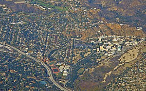
The Jet Propulsion Laboratory (JPL) is a federally funded research and development center (FFRDC) in La Cañada Flintridge, California, Crescenta Valley, United States. Founded in 1936 by California Institute of Technology (Caltech) researchers, the laboratory is now owned and sponsored by NASA and administered and managed by Caltech. The primary function of the laboratory is the construction and operation of planetary robotic spacecraft, though it also conducts Earth-orbit and astronomy missions.

La Cañada Flintridge, California
City in Los Angeles County, California, United States
Distance: Approx. 522 meters
Latitude and longitude: 34.207721,-118.206979
La Cañada Flintridge, commonly known as just La Cañada (Spanish for 'The Canyon'), is a city in the foothills of the Verdugo Mountains in Los Angeles County, California, United States. Located in the Crescenta Valley, in the western edge of the San Gabriel Valley, it is the location of NASA's Jet Propulsion Laboratory. Before the city's incorporation on November 30, 1976, it consisted of the two distinct communities of La Cañada and Flintridge.

Descanso Gardens
Botanical garden in La Cañada Flintridge, California
Distance: Approx. 1178 meters
Latitude and longitude: 34.201475,-118.2098
Descanso Gardens is a 150-acre (61 ha) botanical garden located in La Cañada Flintridge, Los Angeles County, California. It sits on the northern edge of the San Rafael Hills. Descanso Gardens features a wide area, mostly forested, with artificial streams, ponds, and lawns.
Flintridge Preparatory School
Private school in La Cañada Flintridge, California, United States
Distance: Approx. 2055 meters
Latitude and longitude: 34.198743,-118.184032
Flintridge Preparatory School, familiarly known as Flintridge Prep, or simply Prep, is a highly ranked coeducational day school for grades 7-12. Founded in 1933, it is located in La Cañada Flintridge, California, United States.
La Cañada High School
Public school in La Cañada Flintridge, California, United States
Distance: Approx. 2785 meters
Latitude and longitude: 34.1929,-118.1796
La Cañada High School is a combined junior-senior high school located in La Cañada Flintridge, California, US. It sits at the base of the San Gabriel Mountains, below the Angeles National Forest, in the City of La Cañada Flintridge. The school is adjacent to the Interstate 210 Freeway north of Pasadena's Rose Bowl and south of NASA's Jet Propulsion Laboratory.
Rancho La Cañada
Mexican land grant in present-day Los Angeles County, California, USA
Distance: Approx. 1321 meters
Latitude and longitude: 34.2,-118.21
Rancho La Cañada was a 5,832-acre (23.60 km2) Mexican land grant in the San Rafael Hills and Crescenta Valley, of present-day Los Angeles County, California given in 1843 by Governor Manuel Micheltorena to a Mexican schoolteacher from Los Angeles, Ygnacio Coronel. The name means "ranch of the canyon". The rancho included the current day city of La Cañada Flintridge and community of La Crescenta-Montrose.

Space Flight Operations Facility
United States historic place
Distance: Approx. 2779 meters
Latitude and longitude: 34.20108611,-118.17361389
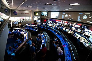
The Space Flight Operations Facility (SFOF) is a building containing a control room and related computing and communications equipment areas at the Jet Propulsion Laboratory in Pasadena, California. NASA's Deep Space Network is operated from this facility. The SFOF has monitored and controlled all interplanetary and deep space exploration for NASA and other international space agencies since 1964.

Twenty-Five-Foot Space Simulator
United States historic place
Distance: Approx. 2785 meters
Latitude and longitude: 34.20272222,-118.17288889
The Twenty-Five-Foot Space Simulator is a chamber for testing spacecraft in space-like conditions, including extreme cold, high radiation, and near-vacuum pressure. Built in 1961, it is located at the Jet Propulsion Laboratory in Pasadena, California. It has been used to prepare many American space probes for their launches, including the Ranger, Surveyor, Mariner, and Voyager spacecraft.
St. Monica Academy (Montrose, California)
Catholic school in California, United States
Distance: Approx. 2646 meters
Latitude and longitude: 34.21166667,-118.23055556
St. Monica Academy is a private, independent Roman Catholic high school in Montrose, California. It is operated independently of the Roman Catholic Archdiocese of Los Angeles.

JPL Science Division
Distance: Approx. 2926 meters
Latitude and longitude: 34.20169444,-118.17166667
The Jet Propulsion Laboratory Science Division investigates physical and chemical processes on the Earth, in the Solar System, and throughout the universe. Explorations of space and terrestrial processes lead to understanding of the universe. Methods for accomplishing scientific work pertaining to the nature of the Earth, the Solar System, the galaxy, etc., are addressed in the JPL Science Division.

History of the Deep Space Network
Observatory
Distance: Approx. 2957 meters
Latitude and longitude: 34.20083333,-118.17166667
The forerunner of the Deep Space Network was established in January 1958, when JPL, then under contract to the U.S. Army, deployed portable radio tracking stations in Nigeria, Singapore, and California to receive telemetry and plot the orbit of the Army-launched Explorer 1, the first successful U.S. satellite. NASA (and the DSN by extension) was officially established on October 1, 1958, to consolidate the separately developing space-exploration programs of the U.S. Army, U.S. Navy, and U.S. Air Force into one civilian organization.

Lanterman House
Historic house in California, United States
Distance: Approx. 685 meters
Latitude and longitude: 34.20444444,-118.20555556
Lanterman House is a bungalow-style historic house museum in La Cañada Flintridge, California on the National Register of Historic Places. The house was commissioned by Dr. Roy Lanterman in 1915 and was built by A. L. Haley (b.
Weather in this IP's area
clear sky
11 Celsius
10 Celsius
6 Celsius
14 Celsius
1020 hPa
36 %
1020 hPa
970 hPa
10000 meters
2.06 m/s
260 degree