199.19.236.195 - IP Lookup: Free IP Address Lookup, Postal Code Lookup, IP Location Lookup, IP ASN, Public IP
Country:
Region:
City:
Location:
Time Zone:
Postal Code:
ISP:
ASN:
language:
User-Agent:
Proxy IP:
Blacklist:
IP information under different IP Channel
ip-api
Country
Region
City
ASN
Time Zone
ISP
Blacklist
Proxy
Latitude
Longitude
Postal
Route
db-ip
Country
Region
City
ASN
Time Zone
ISP
Blacklist
Proxy
Latitude
Longitude
Postal
Route
IPinfo
Country
Region
City
ASN
Time Zone
ISP
Blacklist
Proxy
Latitude
Longitude
Postal
Route
IP2Location
199.19.236.195Country
Region
louisiana
City
collinston
Time Zone
America/Chicago
ISP
Language
User-Agent
Latitude
Longitude
Postal
ipdata
Country
Region
City
ASN
Time Zone
ISP
Blacklist
Proxy
Latitude
Longitude
Postal
Route
Popular places and events near this IP address

Bastrop, Louisiana
City in Louisiana, United States
Distance: Approx. 9340 meters
Latitude and longitude: 32.75611111,-91.87222222
Bastrop is a city in Morehouse Parish, Louisiana, United States. It is the parish seat of Morehouse Parish. The population was 9,691 at the 2020 census, down from 11,365 in 2010.

Collinston, Louisiana
Village in Louisiana, United States
Distance: Approx. 5148 meters
Latitude and longitude: 32.69,-91.87166667
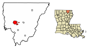
Collinston is a village in Morehouse Parish, Louisiana, United States. The population was 274 at the 2020 census.

Oak Ridge, Louisiana
Village in Louisiana, United States
Distance: Approx. 8033 meters
Latitude and longitude: 32.62361111,-91.77444444
Oak Ridge is a village in Morehouse Parish, Louisiana, United States. The population was 124 at the 2020 census.
KJMG
Radio station in Louisiana, United States
Distance: Approx. 9606 meters
Latitude and longitude: 32.672,-91.918
KJMG (97.3 MHz, "Majic 97") is an American radio station licensed to Bastrop, Louisiana. The station broadcasting an urban adult contemporary radio format in the Greater Monroe. KJMG is owned by Todd Fowler, through licensee Skyline Media, LLC. The studios are located in Monroe, and its transmitter is located east of Sterlington, Louisiana.
Morehouse Memorial Airport
Airport
Distance: Approx. 9795 meters
Latitude and longitude: 32.75611111,-91.88055556
Morehouse Memorial Airport (ICAO: KBQP, FAA LID: BQP, formerly 2F8) is a public use airport in Morehouse Parish, Louisiana, United States. It is owned by the City of Bastrop and located two nautical miles (4 km) southeast of its central business district. This airport is included in the National Plan of Integrated Airport Systems for 2011–2015, which categorized it as a general aviation facility.
Excelsior (Oak Ridge, Louisiana)
Historic house in Louisiana, United States
Distance: Approx. 7796 meters
Latitude and longitude: 32.62688,-91.77287
Excelsior, at 317 North Oak Street (LA 133), Oak Ridge, Louisiana in Morehouse Parish in northern Louisiana, was built in 1869. The building was listed on the National Register of Historic Places on September 7, 1989. The listing included five contributing buildings.
Walnut Grove (Mer Rouge, Louisiana)
Historic house in Louisiana, United States
Distance: Approx. 8372 meters
Latitude and longitude: 32.7571,-91.78674
Walnut Grove, in the vicinity of Mer Rouge in Morehouse Parish in northern Louisiana, was listed on the National Register of Historic Places in 2007. It has also been known as White Haven and as White House. The house was originally built in about 1830 and was developed into more or less full form by the 1880s.
Mer Rouge High School
United States historic place
Distance: Approx. 9757 meters
Latitude and longitude: 32.7721,-91.79564
The Mer Rouge High School, at 500 South 14th Street in Mer Rouge, Morehouse Parish in northern Louisiana, was built in 1925. It was listed on the National Register of Historic Places on March 4, 2004. It is a two-story, brick veneer building.
Cedars Plantation
United States historic place
Distance: Approx. 8024 meters
Latitude and longitude: 32.61424,-91.81483
Cedars Plantation, located along Lake Irwin Road, about 2.4 miles (3.9 km) southwest of Oak Ridge in Morehouse Parish in Louisiana, was built in c.1840 and is believed to be the oldest surviving house in the parish. It has also been known as Williams Home Place. It was listed on the National Register of Historic Places on May 19, 1976.
Weather in this IP's area
overcast clouds
11 Celsius
10 Celsius
11 Celsius
11 Celsius
1018 hPa
54 %
1018 hPa
1015 hPa
10000 meters
5.55 m/s
9.34 m/s
186 degree
100 %