199.189.190.50 - IP Lookup: Free IP Address Lookup, Postal Code Lookup, IP Location Lookup, IP ASN, Public IP
Country:
Region:
City:
Location:
Time Zone:
Postal Code:
IP information under different IP Channel
ip-api
Country
Region
City
ASN
Time Zone
ISP
Blacklist
Proxy
Latitude
Longitude
Postal
Route
Luminati
Country
Region
pa
City
arendtsville
ASN
Time Zone
America/New_York
ISP
AS-NSI-GLOBAL
Latitude
Longitude
Postal
IPinfo
Country
Region
City
ASN
Time Zone
ISP
Blacklist
Proxy
Latitude
Longitude
Postal
Route
IP2Location
199.189.190.50Country
Region
virginia
City
ashburn
Time Zone
America/New_York
ISP
Language
User-Agent
Latitude
Longitude
Postal
db-ip
Country
Region
City
ASN
Time Zone
ISP
Blacklist
Proxy
Latitude
Longitude
Postal
Route
ipdata
Country
Region
City
ASN
Time Zone
ISP
Blacklist
Proxy
Latitude
Longitude
Postal
Route
Popular places and events near this IP address

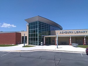
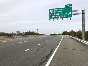
Ashburn, Virginia
Census-designated place in Virginia, United States
Distance: Approx. 1571 meters
Latitude and longitude: 39.03,-77.47111111
Ashburn is a rapidly growing census-designated place (CDP) in Loudoun County, Virginia, United States. At the 2010 United States census, its population was 43,511, up from 3,393 in 1990. It is 30 miles (48 km) northwest of Washington, D.C., and part of the Washington metropolitan area.

Ashburn station (Washington Metro)
Washington Metro station
Distance: Approx. 3290 meters
Latitude and longitude: 39.0046,-77.4909
Ashburn station is a Washington Metro station in Loudoun County, Virginia, United States, that serves as the western terminus of the Silver Line. Originally planned to begin operation in 2016, the station opened on November 15, 2022. Ashburn station is located at the median of the Dulles Greenway (SR 267) east of Old Ryan Road (SR 772).
Broad Run High School
Public school in Ashburn, Loudoun County, Virginia
Distance: Approx. 1320 meters
Latitude and longitude: 39.0225,-77.49166667
Broad Run High School is a public secondary school in Ashburn, an unincorporated area in Loudoun County, Virginia, United States. Broad Run is part of the Loudoun County Public Schools system (LCPS). It was ranked as the #1 Best Public High School in Loudoun County and the #9 Best Public High School in Virginia by U.S. News in 2020.

Loudoun County Public Schools
Public school division serving Loudoun County, Virginia, United States
Distance: Approx. 2492 meters
Latitude and longitude: 39.033609,-77.517316
Loudoun County Public Schools (LCPS) is a branch of the Loudoun County, Virginia, United States government, and administers public schools in the county. LCPS's headquarters is located at 21000 Education Court in Ashburn, an unincorporated section of the county. Due to rapid growth in the region, LCPS is one of the fastest-growing school divisions in Virginia and the third largest school division in the state.
Waxpool, Virginia
Unincorporated community in Virginia, United States
Distance: Approx. 3799 meters
Latitude and longitude: 39.01388889,-77.52388889
Waxpool is an unincorporated community in Loudoun County, Virginia. Waxpool is centered on Waxpool Road (Virginia Secondary Route 625) in the vicinity of Beaver Dam Reservoir and is part of the Broadlands census-designated place. Waxpool once contained a general store and post office in one building near the intersection of Waxpool Road (Rte.

Broadlands, Virginia
Census-designated place in Virginia
Distance: Approx. 3278 meters
Latitude and longitude: 39.01805556,-77.52027778
Broadlands is a census-designated place (CDP) in Loudoun County, Virginia, United States. It is a 1,500-acre (610 ha) master-planned community started and developed by Van Metre Homes in the 1990s. It is built on wetlands and is certified as a Community Wildlife Habitat by the National Wildlife Federation.

Ryan, Virginia
Unincorporated community in Virginia, United States
Distance: Approx. 2162 meters
Latitude and longitude: 39.015,-77.49305556
Ryan is an unincorporated community in Loudoun County, Virginia, United States. The community was once at the corner of Shellhorn, Ryan, and Waxpool roads. It is now a part of the Ashburn communities.
Loudoun School for Advanced Studies
Private school in Ashburn, Virginia, United States
Distance: Approx. 3420 meters
Latitude and longitude: 39.0174,-77.4553
Loudoun School for Advanced Studies (LSAS) is a private school in Ashburn, Virginia, United States and is designed to inspire and challenge advanced students in grades 6-12. Students from LSAS worked to rehabilitate the historic Ashburn Colored School, which is located on the same property where LSAS has built its new campus.

Ashburn Presbyterian Church
Presbyterian church in Virginia, USA
Distance: Approx. 585 meters
Latitude and longitude: 39.03867,-77.48515
Ashburn Presbyterian Church is a historic Presbyterian church located in Ashburn, Loudoun County, Virginia. It was built in 1878, and is a one-story, rectangular wood-frame building in the Carpenter Gothic style. The church measures 33 feet wide by 50 feet long, and is topped by a steep gable roof.
One Loudoun, Virginia
Census-designated place in Virginia
Distance: Approx. 3507 meters
Latitude and longitude: 39.05277778,-77.45583333
One Loudoun is a census-designated place (CDP) in Loudoun County, Virginia, United States. It is a mixed-use development just south of Virginia State Route 7, 29 miles (47 km) northwest of Washington, D.C., and 7 miles (11 km) southeast of Leesburg. One Loudoun was developed since the 2010 census, so it was not recognized as a census-designated place until the 2020 census.

Ashburn Colored School
School in Ashburn, Virginia
Distance: Approx. 1529 meters
Latitude and longitude: 39.047737,-77.486348
The Ashburn Colored School is a former one-room schoolhouse for black students located at 20593 Ashburn Road in Ashburn, Virginia. Constructed in the late 19th century, it was in use until 1958. In the 21st century it has been restored after being dilapidated and vandalized.
Goose Creek Village, Virginia
Census-designated place in Virginia, United States
Distance: Approx. 3157 meters
Latitude and longitude: 39.04444444,-77.5225
Goose Creek Village is a census-designated place (CDP) in Loudoun County, Virginia, United States. It was first drawn as a CDP prior to the 2020 census.
Weather in this IP's area
overcast clouds
3 Celsius
-2 Celsius
2 Celsius
4 Celsius
1023 hPa
47 %
1023 hPa
1014 hPa
10000 meters
7.72 m/s
12.35 m/s
300 degree
100 %
