199.176.230.37 - IP Lookup: Free IP Address Lookup, Postal Code Lookup, IP Location Lookup, IP ASN, Public IP
Country:
Region:
City:
Location:
Time Zone:
Postal Code:
IP information under different IP Channel
ip-api
Country
Region
City
ASN
Time Zone
ISP
Blacklist
Proxy
Latitude
Longitude
Postal
Route
Luminati
Country
Region
mi
City
fremont
ASN
Time Zone
America/Detroit
ISP
NCATS
Latitude
Longitude
Postal
IPinfo
Country
Region
City
ASN
Time Zone
ISP
Blacklist
Proxy
Latitude
Longitude
Postal
Route
IP2Location
199.176.230.37Country
Region
michigan
City
muskegon
Time Zone
America/Detroit
ISP
Language
User-Agent
Latitude
Longitude
Postal
db-ip
Country
Region
City
ASN
Time Zone
ISP
Blacklist
Proxy
Latitude
Longitude
Postal
Route
ipdata
Country
Region
City
ASN
Time Zone
ISP
Blacklist
Proxy
Latitude
Longitude
Postal
Route
Popular places and events near this IP address

Muskegon, Michigan
City in Michigan, United States
Distance: Approx. 22 meters
Latitude and longitude: 43.23416667,-86.24833333
Muskegon ( mə-SKEE-gən) is a city in and the county seat of Muskegon County, Michigan, United States. Situated around a harbor of Lake Michigan, Muskegon is known for fishing, sailing regattas, and boating. It is the most populous city along Lake Michigan's eastern shore.
Trinity Health Arena
Arena in Muskegon, Michigan, United States
Distance: Approx. 565 meters
Latitude and longitude: 43.23444444,-86.25555556
The Trinity Health Arena (formerly the L.C. Walker Arena) is a 3,000-seat multi-purpose arena in Muskegon, Michigan, United States. It was built in 1960 in partnership with philanthropist and industrialist Louis Carlisle Walker at a cost of $2 million, and on October 27, 1960, was formally gifted to the City of Muskegon. Mr.

Frauenthal Center for the Performing Arts
Performing arts center in Muskegon, Michigan, United States
Distance: Approx. 377 meters
Latitude and longitude: 43.23486,-86.25316
The Frauenthal Center for Performing Arts is located in downtown Muskegon in the U.S. state of Michigan. It consists of the Frauenthal Theater, formerly the Michigan Theater, and additional performance, exhibition, and support spaces in the Hilt Building. The Frauenthal Theater opened as the Michigan Theater in 1930 and was one of 17 theaters in downtown Muskegon.
Unity Christian Music Festival
Music festival
Distance: Approx. 22 meters
Latitude and longitude: 43.23416667,-86.24833333
Unity Christian Music Festival (Unity) is a four-day Christian music festival held annually during the month of August at Heritage Landing in Muskegon, Michigan. Unity was started in 2001 to bring Christians together for public praise, worship and fellowship; to provide a wholesome, family valued entertainment alternative and to raise funds and recruit volunteers for area Christian ministries. The Festival is presented by Alive on the Lakeshore, an all volunteer group of local Christians who want to present wholesome, Christ centered, family valued entertainment options in West Michigan.

Muskegon Mall
Shopping mall in Michigan, United States
Distance: Approx. 345 meters
Latitude and longitude: 43.23666389,-86.25117222
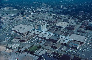
Muskegon Mall was an enclosed shopping mall in downtown Muskegon, Michigan. Opened in 1976, it closed in 2001 and was torn down for redevelopment.

Muskegon Historic District
Historic district in Michigan, United States
Distance: Approx. 462 meters
Latitude and longitude: 43.23333333,-86.25416667
The Muskegon Historic District is a public and residential historic district in Muskegon, Michigan, consisting of the four blocks between Clay Avenue, Webster Avenue, Second Street, and Sixth Street, and the two blocks between Webster Avenue, Muskegon Avenue, Second Street and Fourth Street. The district was placed on the National Register of Historic Places in 1972.

Amazon Hosiery Mill
United States historic place
Distance: Approx. 680 meters
Latitude and longitude: 43.23361111,-86.25694444
The Amazon Hosiery Mill, also known as the Amazon Knitting Mill, is a former industrial building located at 530-550 West Western Avenue in Muskegon, Michigan. It now houses the Amazon Apartments. The building was listed on the National Register of Historic Places in 1982.
Central Fire Station (Muskegon, Michigan)
United States historic place
Distance: Approx. 248 meters
Latitude and longitude: 43.23444444,-86.24555556
The Muskegon Central Fire Station is a building originally constructed to house a fire station, located at 75 W. Walton Avenue in Muskegon, Michigan. It was added to the National Register of Historic Places in 1999. The building has been renovated into office space, and is known as the Firehouse Professional Building.

Muskegon YMCA Building
United States historic place
Distance: Approx. 199 meters
Latitude and longitude: 43.23527778,-86.25055556
The Muskegon YMCA Building is a YMCA building located at 297 West Clay Avenue in Muskegon, Michigan. It was listed on the National Register of Historic Places in 1982. It has been renovated, and currently houses 297 Clay Condominiums.

Horatio N. Hovey House
United States historic place
Distance: Approx. 386 meters
Latitude and longitude: 43.23138889,-86.25138889
The Horatio N. Hovey House is a private house located at 318 Houston Avenue in Muskegon, Michigan. It was listed on the National Register of Historic Places in 1983.

Hackley Library
United States historic place
Distance: Approx. 226 meters
Latitude and longitude: 43.23416667,-86.25138889
The Hackley Library is a historic library in Muskegon, Michigan. It was a gift to the school board from lumber baron Charles Hackley to the City of Muskegon Public Schools and opened in 1890. It is listed on the Michigan Register of Historic Places.

Hackley Park
Park in Muskegon, Michigan
Distance: Approx. 318 meters
Latitude and longitude: 43.23389,-86.2525
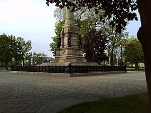
Hackley Park is a municipal park in Muskegon, Michigan. In 1890, it was built on land donated by Charles H. Hackley to honor the memory of soldiers who fought in the Civil War. It is bounded by Clay & Webster, and Third & Fourth in the Muskegon Historic District near Muskegon Lake.
Weather in this IP's area
broken clouds
1 Celsius
-2 Celsius
-0 Celsius
1 Celsius
1009 hPa
73 %
1009 hPa
985 hPa
10000 meters
3.13 m/s
7.15 m/s
360 degree
52 %
