Country:
 USA
USARegion:
City:
Latitude and Longitude:
Time Zone:
Postal Code:
IP information under different IP Channel
ip-api
Country
Region
City
ASN
Time Zone
ISP
Blacklist
Proxy
Latitude
Longitude
Postal
Route
IPinfo
Country
Region
City
ASN
Time Zone
ISP
Blacklist
Proxy
Latitude
Longitude
Postal
Route
MaxMind
Country
Region
City
ASN
Time Zone
ISP
Blacklist
Proxy
Latitude
Longitude
Postal
Route
Luminati
Country
USRegion
ca
City
fremont
ASN
Time Zone
America/Los_Angeles
ISP
PAN0001
Latitude
Longitude
Postal
db-ip
Country
Region
City
ASN
Time Zone
ISP
Blacklist
Proxy
Latitude
Longitude
Postal
Route
ipdata
Country
Region
City
ASN
Time Zone
ISP
Blacklist
Proxy
Latitude
Longitude
Postal
Route
Popular places and events near this IP address

Fremont, California
City in California, United States
Distance: Approx. 1667 meters
Latitude and longitude: 37.55,-121.99
Fremont () is a city in Alameda County, California, United States. Located in the East Bay region of the Bay Area, Fremont has a population of 230,504 as of 2020, making it the fourth most populous city in the Bay Area, behind San Jose, San Francisco, and Oakland. It is the closest East Bay city to the high-tech Silicon Valley network of businesses, and has a strong tech industry presence.

Fremont station (BART)
Metro station in Fremont, California, US
Distance: Approx. 2171 meters
Latitude and longitude: 37.557489,-121.97662
Fremont station is a Bay Area Rapid Transit (BART) station in the central district of Fremont, California. The station is served by the Orange and Green lines. It was the southern terminus of both lines from September 11, 1972, until March 25, 2017, when Warm Springs/South Fremont station opened.

Washington High School (Fremont, California)
Public high school in the United States
Distance: Approx. 1225 meters
Latitude and longitude: 37.55277778,-121.99388889
Washington High School (WHS) is the oldest of the five comprehensive public high schools in Fremont, California, United States. It was established in 1893. It is a part of the Fremont Unified School District.
American High School (California)
Public high school in Fremont, California, United States
Distance: Approx. 1391 meters
Latitude and longitude: 37.5645917,-122.015947
American High School (AHS) is a public secondary school located in Fremont, California, United States. It is one of five public high schools within the Fremont Unified School District. The school receives its students through the American High School attendance area boundary set by the district.

Centerville Pioneer Cemetery
State cemetery in Fremont, California, United States
Distance: Approx. 765 meters
Latitude and longitude: 37.55972222,-122.00833333
The Centerville Pioneer Cemetery, also known as the Centerville Presbyterian Cemetery or Alameda Presbyterian Cemetery, is located at the corner of Post Street and Bonde Way in Fremont, California. It was officially designated as a state cemetery in 1858 or 1859, depending upon the source, and was listed in the California Register of Historic Resources in 1976.
Wat Buddhanusorn
Thai Buddhist temple in California
Distance: Approx. 2154 meters
Latitude and longitude: 37.581475,-121.995591
Wat Buddhanusorn is a Buddhist temple of the Theravadan tradition in Fremont, California, United States. The name, Wat Buddhanusorn, means “temple for the dedication of the Buddha,” in the Thai language. It was founded in 1983 and, in Buddhist tradition, relies on donations and volunteer work for support.
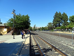
Fremont station
Train station in Fremont, California
Distance: Approx. 708 meters
Latitude and longitude: 37.559097,-122.007176
Fremont station (also known as Fremont–Centerville station) is a train station located in the Centerville area of Fremont, California, United States. The station is served by Amtrak Capitol Corridor commuter rail/intercity rail service and the Altamont Corridor Express (ACE) commuter rail service. The station has two platforms serving the two tracks of the Niles Subdivision.

Quarry Lakes Regional Recreation Area
Distance: Approx. 1693 meters
Latitude and longitude: 37.57694444,-122.00638889
Quarry Lakes Regional Recreation Area is a regional park located in Fremont, California that is part of the East Bay Regional Parks system. Before being converted into a park, the site was used as a gravel quarry. When water purchased by the public for groundwater recharge of the Niles Cone flooded the gravel pits, the gravel harvesters began to daily pump the seeping water down Alameda Creek into San Francisco Bay.

Fremont Christian School
Private school in Fremont, California, United States
Distance: Approx. 2124 meters
Latitude and longitude: 37.55055556,-122.01916667
Fremont Christian School (FCS), is a private Christian school located in Fremont, California, U.S. It was founded in 1968.
Niles Cone
Groundwater basin and aquifer
Distance: Approx. 876 meters
Latitude and longitude: 37.56988889,-121.99699444
The Niles Cone is a groundwater basin in Alameda County, California, United States which is the source of drinking water for a sizeable human urban population in the East Bay. The land area corresponding to this groundwater basin is approximately 103 square miles; (California, 1998) the Niles Cone Basin is bounded on the east by the Diablo Range and on the west by San Francisco Bay. Surface runoff in the Alameda Creek catchment basin accounts for much of the recharge of the Niles Cone.
Pabrico, Union City, California
Neighborhood in Newark, California
Distance: Approx. 2318 meters
Latitude and longitude: 37.58277778,-122.00638889
Pabrico (formerly, Pabrico Siding) is a neighborhood of Union City in Alameda County, California. It lies at an elevation of 52 feet (16 m). It was formerly an unincorporated community.
Shinn, Fremont, California
Distance: Approx. 1576 meters
Latitude and longitude: 37.56666667,-121.98333333
Shinn (formerly, Shinn Station) was a former unincorporated community around the Western Pacific Railroad station, constructed 1909 on the south bank of Alameda Creek at the end of Shinn Street. It was named after James Shinn, a native of Ohio who settled there in 1856. Later, Western Pacific upgraded the station to be its Niles station (Niles is across the creek on its north bank).
Weather in this IP's area
clear sky
16 Celsius
15 Celsius
14 Celsius
19 Celsius
1018 hPa
49 %
1018 hPa
1016 hPa
10000 meters
1.54 m/s
230 degree
07:19:25
18:26:19